Category:River name signs in Georgia (U.S. state)
Jump to navigation
Jump to search
States of the United States: Alabama · Alaska · Arizona · Arkansas · Colorado · Delaware · Florida · Georgia · Idaho · Illinois · Indiana · Maryland · Massachusetts · Michigan · Mississippi · Nebraska · Nevada · New York · North Carolina · Ohio · Oklahoma · Oregon · Pennsylvania · South Carolina · Tennessee · Texas · Utah · Virginia · Washington · Wyoming
Subcategories
This category has only the following subcategory.
Media in category "River name signs in Georgia (U.S. state)"
The following 68 files are in this category, out of 68 total.
-
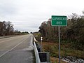 Alapahoochee River sign and bridge, Echols County.JPG 5,152 × 3,864; 8.01 MB
-
 Atkinson County border, GA135NB.JPG 4,320 × 3,240; 4.51 MB
-
 Berrien County border, GA135SB.JPG 4,320 × 3,240; 4.53 MB
-
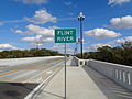 Broad Avenue Memorial Bridge, Flint River sign.JPG 5,152 × 3,864; 7.82 MB
-
 Brooks County Line marker, GA SR 122 WB.JPG 4,320 × 3,240; 4.49 MB
-
 Brooks County line, GA31SB.jpg 5,184 × 3,456; 6.49 MB
-
 Brooks County line, SR133 NW.JPG 4,320 × 3,240; 4.44 MB
-
 Coffee County border, Ocmulgee River bridge, US319SB.JPG 4,608 × 3,456; 4.74 MB
-
 Cook County border, GA37EB.jpg 5,184 × 3,456; 4.66 MB
-
 Dodge County border, US280eb.JPG 4,608 × 3,456; 4.73 MB
-
 Early County line, Georgia State border, US84EB.JPG 4,608 × 3,456; 5.45 MB
-
 Flint River Bridge, GA 32.JPG 4,320 × 3,240; 4.42 MB
-
 Flint River sign, GA37 EB, Baker County.jpg 5,184 × 3,456; 4.39 MB
-
 Flint River sign, US280 EB.jpg 5,184 × 3,456; 4.12 MB
-
 Florida I75sb Alapaha River 2019.jpg 5,184 × 3,456; 4.49 MB
-
 GA135 SB Alapaha River Berrien County.jpg 5,184 × 3,456; 5.19 MB
-
 GA520 EB Jekyll River.jpg 5,184 × 3,456; 4.94 MB
-
 GA64 bridge over Satilla River c.JPG 5,152 × 3,864; 7.93 MB
-
 GA75 street crosses Chattahoochee River, White County.jpg 5,184 × 3,456; 6.16 MB
-
 GA94 EB, Echols County, Statenville Unincorporated Alapaha River.jpg 5,184 × 3,456; 4.24 MB
-
 GA94 EB, Fargo, Suwannee River bridge.jpg 5,184 × 3,456; 4.96 MB
-
 Georgia I75sb Withlacoochee River.jpg 5,184 × 3,456; 4.29 MB
-
 Georgia I95nb Altamaha River.jpg 5,184 × 3,456; 4.32 MB
-
 Georgia I95nb Butler River.jpg 5,184 × 3,456; 4.9 MB
-
 Georgia I95nb Champney River.jpg 5,184 × 3,456; 4.83 MB
-
 Georgia I95nb Jerico River, Bryan County.jpg 5,184 × 3,456; 5.45 MB
-
 Georgia I95nb Liberty County border.jpg 5,184 × 3,456; 4.98 MB
-
 Georgia I95nb MM112 Savannah River.jpg 5,184 × 3,456; 4.53 MB
-
 Georgia I95nb Ogeechee River.jpg 5,184 × 3,456; 5.05 MB
-
 Georgia I95nb Turtle River.JPG 4,608 × 3,456; 3.5 MB
-
 Georgia I95sb Butler River.jpg 5,184 × 3,456; 4.36 MB
-
 Georgia I95sb Glynn County Altamaha River.jpg 5,184 × 3,456; 4.47 MB
-
 Georgia I95sb Liberty County.jpg 5,184 × 3,456; 4.19 MB
-
 Georgia I95sb McIntosh County.jpg 5,184 × 3,456; 3.86 MB
-
 Georgia I95sb Ogeechee River.jpg 5,184 × 3,456; 4.66 MB
-
 Georgia State Line, GA 31 NB.JPG 4,320 × 3,240; 4.53 MB
-
 Georgia State Line, US82 EB.JPG 4,320 × 3,240; 4.5 MB
-
 Georgia State Route 56 Ohoopee River bridge, Tattnall County.jpg 5,184 × 3,456; 5.75 MB
-
 Jeff Davis County border and bridge over Altamaha River, US221SB.JPG 5,152 × 3,864; 8.02 MB
-
 Jeff Davis County limit US341SB.jpg 5,184 × 3,456; 6.01 MB
-
 Joseph Simmons Alexander, Sr. Memorial Bridge.jpg 5,184 × 3,456; 7.67 MB
-
 Lanier County border, US84 EB.JPG 4,608 × 3,456; 4.04 MB
-
 Long County Altamaha River US84 EB.jpg 5,184 × 3,456; 4.8 MB
-
 Long County border US84EB.jpg 5,184 × 3,456; 6.93 MB
-
 Lowndes County Border sign on GA SR 94.JPG 3,072 × 2,304; 2.93 MB
-
 Lowndes County line, US84EB.JPG 4,608 × 3,456; 5.82 MB
-
 Montgomery County border and bridge over Altamaha River US221NB.JPG 5,152 × 3,864; 7.81 MB
-
 Montgomery County limit US280EB.jpg 5,184 × 3,456; 4.98 MB
-
 NB I-95 over Turtle River Bridge.JPG 4,000 × 3,000; 6.13 MB
-
 Newton city limit, Baker County border, Flint River, GA37 WB.jpg 5,184 × 3,456; 4.59 MB
-
 Pierce County border US84WB.jpg 5,184 × 3,456; 4.32 MB
-
 Pierce County, Little Satilla River, US84 WB.jpg 5,184 × 3,456; 9.07 MB
-
 Reed Bingham State Park Bridge and Colquitt County border.JPG 4,320 × 3,240; 4.44 MB
-
 Satilla River bridge, US82WB, Brantley County.JPG 4,608 × 3,456; 3.89 MB
-
 Scotland City limit, Telfair County border, GA149SB.JPG 4,608 × 3,456; 4.73 MB
-
 Statenville limit, US94 EB.JPG 4,320 × 3,240; 4.43 MB
-
 Telfair County limit US341NB.jpg 5,184 × 3,456; 7.78 MB
-
 Telfair County US319NB.jpg 5,184 × 3,456; 6.98 MB
-
 US Highway 17 - Georgia - 8574695428.jpg 3,072 × 2,304; 444 KB
-
 US Highway 17 - Georgia - 8574696196.jpg 3,072 × 2,304; 531 KB
-
 US280 WB Telfair County.jpg 5,184 × 3,456; 4.87 MB
-
 US280EB, Flint River.jpg 5,184 × 3,456; 4.33 MB
-
 Wayne County border US84EB.jpg 5,184 × 3,456; 6.02 MB
-
 Wayne County border US84WB.jpg 5,184 × 3,456; 6.05 MB
-
 Wheeler County, GA149NB.JPG 4,608 × 3,456; 4.98 MB
-
 Wheeler County, US280NB.jpg 5,184 × 3,456; 5.75 MB
-
 Wilcox County border, US280WB.JPG 4,608 × 3,456; 5.3 MB
-
 Withlacoochee River sign, GA 122, Lowndes County.JPG 4,320 × 3,240; 4.58 MB


