Category:River Wear
Jump to navigation
Jump to search
river in North East England | |||||
| Upload media | |||||
| Instance of | |||||
|---|---|---|---|---|---|
| Location |
| ||||
| Length |
| ||||
| Origin of the watercourse | |||||
| Mouth of the watercourse | |||||
| Basin country | |||||
| Tributary | |||||
 | |||||
Subcategories
This category has the following 11 subcategories, out of 11 total.
Media in category "River Wear"
The following 200 files are in this category, out of 218 total.
(previous page) (next page)-
'Aghios Nicolaos' is launched by William Doxford and Sons (14577535593).jpg 1,594 × 1,080; 250 KB
-
'Chinese Prince' on the River Wear (16261267512).jpg 1,580 × 904; 681 KB
-
'City of Manchester' on the River Wear (14108627593).jpg 993 × 760; 415 KB
-
'Eastern Glory' on the River Wear.jpg 972 × 738; 172 KB
-
'G.M. Livanos' afloat after launch (16371597238).jpg 945 × 720; 223 KB
-
'Gomphina' and 'Hemsefjell' at Manor Quay, Sunderland (16275783301).jpg 811 × 583; 274 KB
-
'Iron Endeavour' afloat after launch (16192865119).jpg 955 × 748; 411 KB
-
'Melete' ready for launch (14248965159).jpg 964 × 788; 246 KB
-
'Naess Crusader' a few days before her launch (24285787393).jpg 1,041 × 674; 117 KB
-
'Naess Crusader' being fitted out at Manor Quay (24676440769).jpg 1,021 × 787; 177 KB
-
'Naess Crusader' during the early stages of construction (24278004679).jpg 1,010 × 818; 429 KB
-
'Naess Crusader' near completion (25276895551).jpg 1,050 × 801; 150 KB
-
'Naess Crusader' on sea trials (25316294942).jpg 829 × 1,019; 131 KB
-
'Nicola' getting a coat of paint (15989685122).jpg 837 × 589; 293 KB
-
'Nicola's engine room (15979198186).jpg 637 × 870; 239 KB
-
'Nicola's stern frame in place (15759623507).jpg 1,653 × 1,080; 740 KB
-
'Sheaf Mount' under tow on the River Wear (19713937206).jpg 890 × 627; 280 KB
-
A Winter scene on the River Wear.jpg 999 × 658; 166 KB
-
Aerial view of 'Naess Crusader' at Manor Quay (24965003922).jpg 1,027 × 815; 217 KB
-
Aerial view of 'Nicola' under construction (15944603665).jpg 819 × 708; 391 KB
-
Aerial view of the North Sands shipyard (16050245420).jpg 987 × 757; 521 KB
-
Aerial view of the North Sands shipyard (26587716231).jpg 950 × 746; 595 KB
-
Aerial view of the North Sands shipyard, 1964 (15878210854).jpg 900 × 692; 458 KB
-
Aerial view of the North Sands shipyard, 1973 (24643920203).jpg 1,017 × 802; 444 KB
-
Aerial view of the River Wear, 1973 (25112794292).jpg 1,038 × 818; 542 KB
-
Aerial view of the Southwick shipyard, Sunderland (15944603535).jpg 1,401 × 1,080; 827 KB
-
An engine room debate on 'Galeomma' (15969039707).jpg 1,043 × 1,080; 186 KB
-
Bishop Auckland - geograph.org.uk - 482065.jpg 640 × 426; 182 KB
-
Boats in the River Wear, Durham (29444948766).jpg 2,568 × 3,852; 9.6 MB
-
Bottom shell of 'Nicola' (15944603525).jpg 1,712 × 1,080; 964 KB
-
Bow quarter view of 'Nicola' on sea trials (16003263925).jpg 909 × 640; 340 KB
-
Browney meets Wear - geograph.org.uk - 1208364.jpg 640 × 480; 89 KB
-
Bulkhead in position on 'Nicola' (15759623397).jpg 1,713 × 1,080; 776 KB
-
Bulkheads in place on 'Naess Crusader' (24350422650).jpg 1,012 × 806; 372 KB
-
Cargo ship 'Miss Chandris' ready for launch (14377193839).jpg 843 × 1,041; 253 KB
-
Chester-le-Street Rowing Club - geograph.org.uk - 176717.jpg 640 × 480; 49 KB
-
Colour aerial view of 'Naess Crusader' on sea trials (24978393094).jpg 1,055 × 797; 158 KB
-
Corporation Quay, Sunderland (19873625372).jpg 831 × 638; 401 KB
-
Cox Green, Washington (15265238126).jpg 923 × 703; 217 KB
-
Cretehauser HDR.jpg 4,000 × 3,000; 7.07 MB
-
Dandelions - Crook, England3.jpg 3,872 × 2,592; 2.08 MB
-
Deck view of 'Naess Crusader' at the fitting out quay (24607718539).jpg 1,024 × 805; 180 KB
-
Deck view on 'Nicola' (15381666044).jpg 659 × 880; 380 KB
-
Deck view on the tanker 'Aluco' (16104487308).jpg 796 × 579; 267 KB
-
Double bottoms near completion (15944603785).jpg 683 × 913; 403 KB
-
Double bottoms of the first SD14 (15944603685).jpg 919 × 610; 289 KB
-
Durham at night (2011.10.19).jpg 4,256 × 2,577; 8.34 MB
-
Durham Cathedral (3610695341).jpg 1,159 × 1,536; 317 KB
-
Durham March 1972.jpg 1,083 × 906; 261 KB
-
Durham, England.jpg 3,968 × 2,976; 3.34 MB
-
Erosion on the River Wear - geograph.org.uk - 1574399.jpg 640 × 480; 125 KB
-
Fish Quay, Strand Quay and Manor Quay (19873625432).jpg 889 × 685; 456 KB
-
Footbridge over the River Wear - geograph.org.uk - 1311212.jpg 640 × 480; 101 KB
-
George Clark’s Engine Works, Southwick (19693845090).jpg 804 × 681; 361 KB
-
Greenwell's Dry Docks, Sunderland (19859844096).jpg 976 × 703; 420 KB
-
January trees by river Wear - geograph.org.uk - 1111093.jpg 480 × 640; 126 KB
-
Jobling Glassworks, Sunderland (19887792931).jpg 955 × 727; 486 KB
-
Jock's Bridge Bishop Auckland - geograph.org.uk - 138903.jpg 640 × 413; 66 KB
-
Launch of 'G.M. Livanos' at the North Sands shipyard (15868730178).jpg 606 × 793; 254 KB
-
Launch of the 'Eidanger' (13901976538).jpg 1,200 × 979; 232 KB
-
Launch of the cargo ship 'Houston City'.jpg 868 × 617; 419 KB
-
Launch of the cargo ship 'Ternefjell' (22992108721).jpg 1,096 × 852; 198 KB
-
Launch of the ferry ‘Superflex Bravo’ (13901976548).jpg 1,200 × 850; 169 KB
-
Launch of the SD14 'Degedo' (14181936172).jpg 1,000 × 656; 90 KB
-
Launch party of the cargo ship 'Eastern Rover' (16049060958).jpg 794 × 598; 357 KB
-
Ledge drops on the Upper Wear - geograph.org.uk - 1586745.jpg 640 × 480; 142 KB
-
Lonely ship and the Wear River mouth - panoramio.jpg 685 × 1,024; 180 KB
-
Looking down River from Pallion to the Sea (19260603163).jpg 682 × 880; 445 KB
-
Looking down the River Wear (19873625442).jpg 685 × 895; 452 KB
-
Looking up River to Pallion and beyond (19260603203).jpg 858 × 668; 364 KB
-
Looking up the River Wear (19873625412).jpg 890 × 682; 453 KB
-
Mooring the tanker 'Spinanger' after launch (20373410868).jpg 954 × 698; 361 KB
-
Moving 'Nicola's stern frame into position (15759623497).jpg 1,560 × 1,080; 675 KB
-
MPIAdventureSunderland.jpg 2,542 × 2,818; 4.34 MB
-
Naming ceremony of the 'Naess Crusader' (14381563722).jpg 760 × 953; 262 KB
-
New recreation and old industry on the Wear River - panoramio.jpg 2,777 × 1,717; 3.4 MB
-
Newall's Insulation and Chemical Company, Washington (15266586945).jpg 895 × 651; 166 KB
-
North Dock, Sunderland (19873625392).jpg 848 × 658; 389 KB
-
North Sands Shipyard and Corporation Quay, Sunderland (19859844066).jpg 991 × 762; 503 KB
-
North Sands shipyard, Sunderland, 1950 (16048829295).jpg 885 × 684; 278 KB
-
On the bridge of 'Naess Crusader' (25184068666).jpg 1,057 × 816; 109 KB
-
Ordnance Survey One-Inch Sheet 78 Newcastle upon Tyne, Published 1947.jpg 10,948 × 12,799; 58.81 MB
-
Ordnance Survey One-Inch Sheet 78 Newcastle upon Tyne, Published 1971.jpg 11,066 × 13,205; 44.27 MB
-
Ordnance Survey One-Inch Sheet 78 Newcastle, Published 1965.jpg 8,346 × 9,961; 10.63 MB
-
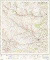
Ordnance Survey One-Inch Sheet 84 Teesdale, Published 1947.jpg 10,936 × 12,785; 16.06 MB
-
Ordnance Survey One-Inch Sheet 84 Teesdale, Published 1964.jpg 8,230 × 9,875; 11.42 MB
-
Painting the bow of 'Naess Crusader' (24864979676).jpg 1,026 × 813; 137 KB
-
Pallion Trading Estate, Sunderland (19887792891).jpg 987 × 762; 554 KB
-
Path along the River Wear - geograph.org.uk - 1719451.jpg 1,024 × 768; 421 KB
-
Pool on the River Wear - geograph.org.uk - 452400.jpg 640 × 480; 87 KB
-
Preparing Inishowen Head for launch (15717112262).jpg 926 × 666; 172 KB
-
Progress shot of 'Naess Crusader' at North Sands, Sunderland (24162492953).jpg 1,028 × 800; 393 KB
-
Progress shot of 'Naess Crusader' at the North Sands shipyard (24063073543).jpg 1,048 × 823; 391 KB
-
Progress with the double bottoms of 'Naess Crusader' (24036361214).jpg 1,053 × 797; 381 KB
-
Public footpath between Penshaw and Cox Green.jpg 1,920 × 2,560; 1.54 MB
-
Raintonpark Wood rapid - geograph.org.uk - 1195580.jpg 640 × 480; 69 KB
-
Refurbishing tug boats at Bill Quay (23498125242).jpg 1,199 × 764; 266 KB
-
River bank footpath - geograph.org.uk - 1388580.jpg 640 × 480; 98 KB
-
River downstream from Silver Street - geograph.org.uk - 1400496.jpg 640 × 426; 64 KB
-
River Wear - geograph.org.uk - 1018589.jpg 600 × 450; 95 KB
-
River Wear - geograph.org.uk - 1018590.jpg 600 × 450; 77 KB
-
River Wear - geograph.org.uk - 1035452.jpg 640 × 480; 105 KB
-
River Wear - geograph.org.uk - 123330.jpg 640 × 480; 78 KB
-
River Wear - geograph.org.uk - 1333798.jpg 640 × 480; 104 KB
-
River Wear - geograph.org.uk - 1704373.jpg 640 × 480; 93 KB
-
River Wear - geograph.org.uk - 208155.jpg 640 × 480; 131 KB
-
River Wear - geograph.org.uk - 299090.jpg 640 × 384; 95 KB
-
River Wear - geograph.org.uk - 452406.jpg 640 × 480; 111 KB
-
River Wear - geograph.org.uk - 769023.jpg 640 × 480; 77 KB
-
River Wear - geograph.org.uk - 872620.jpg 640 × 480; 136 KB
-
River Wear - geograph.org.uk - 952701.jpg 640 × 480; 108 KB
-
River Wear 2nd March 1967.jpg 1,073 × 907; 220 KB
-
River Wear and riverside offices - geograph.org.uk - 172025.jpg 640 × 480; 42 KB
-
River Wear approaching Kemp Lawers - geograph.org.uk - 2198301.jpg 4,160 × 2,860; 1.92 MB
-
River Wear at Eastgate - panoramio - Keith Ruffles.jpg 1,632 × 1,224; 423 KB
-
River Wear at Eastgate - panoramio.jpg 1,632 × 1,224; 415 KB
-
River Wear at Finchale - geograph.org.uk - 453642.jpg 640 × 480; 77 KB
-
River Wear at Frankland area of Durham - geograph.org.uk - 96464.jpg 634 × 640; 247 KB
-
River Wear below Tudhoe - geograph.org.uk - 245820.jpg 640 × 480; 103 KB
-
River Wear dock cranes - geograph.org.uk - 928195.jpg 500 × 375; 87 KB
-
River Wear near Etherley Dene - geograph.org.uk - 1733172.jpg 2,048 × 1,536; 1.56 MB
-
River Wear near Low Harperley - geograph.org.uk - 1311199.jpg 640 × 480; 117 KB
-
River Wear near Low Harperley - geograph.org.uk - 1311208.jpg 640 × 480; 86 KB
-
River Wear near Low Harperley - geograph.org.uk - 1730152.jpg 2,048 × 1,536; 1.57 MB
-
River Wear near Marston Lake - geograph.org.uk - 1731374.jpg 2,048 × 1,536; 1.96 MB
-
River Wear near Page Bank Bridge - geograph.org.uk - 1018581.jpg 600 × 450; 167 KB
-
River Wear near Stanhope - panoramio - Keith Ruffles.jpg 1,224 × 1,632; 415 KB
-
River Wear near Stanhope - panoramio.jpg 1,632 × 1,224; 447 KB
-
River Wear Weardale 20070617.jpg 1,704 × 2,272; 1.48 MB
-
River Wear, Finchale - geograph.org.uk - 1690915.jpg 1,600 × 1,200; 536 KB
-
River Wear, Washington, Newcastle, UK, KW (15539941667).jpg 5,184 × 3,456; 6.13 MB
-
River Wear.png 900 × 591; 172 KB
-
Ships on the River Wear, Sunderland (16046904251).jpg 1,014 × 803; 540 KB
-
Shipyard of Sir James Laing and Sons, Sunderland (19693845050).jpg 887 × 687; 452 KB
-
Small fishing boat on River Wear - geograph.org.uk - 518917.jpg 640 × 480; 105 KB
-
South View and the River Wear - geograph.org.uk - 375930.jpg 640 × 427; 101 KB
-
Southwick Shipyard of Austin and Pickersgill Ltd (19969057861).jpg 843 × 698; 447 KB
-
Southwick Yard of Austin and Pickersgill, Sunderland (19859844086).jpg 972 × 746; 483 KB
-
SS Manxman, Pallion - geograph.org.uk - 1223422.jpg 640 × 419; 72 KB
-
Stadium of Light, Sunderland afc.jpg 3,551 × 2,665; 7.63 MB
-
Steel and Co. Ltd and the shipyard of Short Brothers (19969057841).jpg 936 × 751; 443 KB
-
Stern quarter view of 'Nicola' on sea trials (16003263945).jpg 965 × 670; 389 KB
-
Sunderland Harbour (19859844046).jpg 920 × 680; 268 KB
-
Sunderland IMG 3972.jpg 3,024 × 4,032; 1.24 MB
-
Sunderland Power Station (19859844056).jpg 991 × 766; 592 KB
-
Swans on the River Wear - geograph.org.uk - 1633395.jpg 640 × 480; 73 KB
-
The 'Iron Ore' ready for launch.jpg 1,094 × 838; 336 KB
-
The bow of 'Naess Crusader' nears completion (24461836489).jpg 1,017 × 829; 374 KB
-
The cargo ship 'Silverlaurel' afloat after launch (16184648189).jpg 805 × 594; 269 KB
-
The Eastern Rover and the Eastern Ranger (9237704935).jpg 598 × 800; 233 KB
-
The engine room of 'Naess Crusader' (25188841905).jpg 803 × 1,019; 367 KB
-
The North Sands shipyard, 1960 (15781231933).jpg 754 × 988; 525 KB
-
The North Sands Shipyard, Sunderland (19260603273).jpg 891 × 687; 448 KB
-
The River Wear - geograph.org.uk - 247444.jpg 640 × 480; 104 KB
-
The River Wear - geograph.org.uk - 247454.jpg 640 × 480; 109 KB
-
The River Wear - geograph.org.uk - 247461.jpg 640 × 480; 96 KB
-
The River Wear at West Bridge Street - geograph.org.uk - 375898.jpg 640 × 427; 72 KB
-
The River Wear at Willington - geograph.org.uk - 75704.jpg 640 × 427; 78 KB
-
The River Wear bends at Nab End - geograph.org.uk - 81426.jpg 640 × 425; 119 KB
-
The River Wear looking down stream - geograph.org.uk - 251698.jpg 640 × 480; 124 KB
-
The River Wear near Ireshopeburn - geograph.org.uk - 77038.jpg 640 × 427; 139 KB
-
The stern of 'Naess Crusader' nears completion (24768908515).jpg 1,020 × 831; 353 KB
-
The tanker 'Daphnella' under tow on the River Wear (15868816230).jpg 820 × 569; 249 KB
-
The tanker 'Gomphina' under tow on the River Wear (15316870653).jpg 838 × 550; 297 KB
-
The tug boat 'Seaburn' towing the 'Tanea' (14569829372).jpg 1,356 × 1,054; 221 KB
-
The wheelhouse on 'Nicola' (15979198346).jpg 919 × 660; 193 KB
-
Three Sunderland-built ships on the River Wear.jpg 969 × 691; 251 KB
-
TTTV03.jpg 566 × 393; 50 KB
-
Tugboats towing 'Naess Crusader' after her launch (24565872809).jpg 1,020 × 763; 99 KB
-
Tyne-Tees tunnel, Frosterley outlet - geograph.org.uk - 2198315.jpg 4,320 × 3,240; 2.15 MB
-
Urban regeneration by River Wear - geograph.org.uk - 517022.jpg 640 × 480; 108 KB
-
View along the River Wear (19887792951).jpg 988 × 757; 557 KB
-
View From Keir Hardie Way - geograph.org.uk - 87555.jpg 640 × 480; 59 KB
-
View of 'Naess Crusader' from across the River Wear (24125647434).jpg 1,054 × 748; 141 KB
-
View of 'Nicola' after two months' work (15794659470).jpg 1,628 × 1,080; 671 KB
-
View of progress on the stern of 'Naess Crusader' (24058479734).jpg 1,052 × 866; 415 KB
-
Wear vue depuis Pont Wearmouth Sunderland 1.jpg 5,184 × 3,456; 4.94 MB
-
Wear vue depuis Pont Wearmouth Sunderland 2.jpg 5,184 × 3,456; 5.49 MB
-
Wear vue depuis Pont Wearmouth Sunderland 3.jpg 5,184 × 3,456; 5.51 MB
-
Wear vue depuis Pont Wearmouth Sunderland 4.jpg 5,184 × 3,456; 4.88 MB
-
Wear vue depuis Pont Wearmouth Sunderland 5.jpg 5,184 × 3,456; 5.64 MB
-
WeardaleRockhope.jpg 1,952 × 2,608; 1.93 MB
-
WeardaleWearhead.jpg 2,608 × 1,952; 4.21 MB
-
Wearmouth Bridge, Sunderland (19873625322).jpg 831 × 734; 468 KB


