Category:River Vyrnwy
Jump to navigation
Jump to search
river in Wales, United Kingdom  | |||||
| Upload media | |||||
| Instance of | |||||
|---|---|---|---|---|---|
| Location | Powys, Wales | ||||
| Elevation above sea level |
| ||||
| Mouth of the watercourse | |||||
| Tributary | |||||
 | |||||
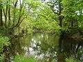
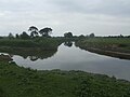
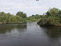
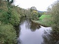
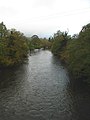
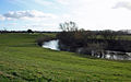
The River Vyrnwy, which flows from Lake Vyrnwy in Powys, is a tributary of the Severn.
Subcategories
This category has the following 3 subcategories, out of 3 total.
T
V
- Vyrnwy Weir Gauging Station (7 F)
Media in category "River Vyrnwy"
The following 44 files are in this category, out of 44 total.
-
 Afon Efyrnwy - geograph.org.uk - 672602.jpg 640 × 398; 80 KB
-
 Afon Efyrnwy - geograph.org.uk - 884410.jpg 640 × 457; 106 KB
-

-
 Afon Vyrnwy from Pontrobert Bridge - geograph.org.uk - 1339079.jpg 640 × 426; 121 KB
-
 Dolanog Falls - geograph.org.uk - 5686.jpg 640 × 480; 135 KB
-
 Flood Plain - geograph.org.uk - 672620.jpg 640 × 398; 75 KB
-
 Pedestrian Bridge over River Vyrnwy - geograph.org.uk - 755372.jpg 632 × 420; 109 KB
-
 Pont Llanymynech.jpg 5,988 × 3,991; 4.69 MB
-
 Pontrobert bridge - geograph.org.uk - 591879.jpg 640 × 482; 153 KB
-
 River Severn-Vyrnwy confluence - geograph.org.uk - 347928.jpg 640 × 480; 93 KB
-
 River Vyrnwy - geograph.org.uk - 1326469.jpg 640 × 480; 38 KB
-
 River Vyrnwy - geograph.org.uk - 1753681.jpg 2,816 × 2,112; 2.89 MB
-
 River Vyrnwy - geograph.org.uk - 509985.jpg 640 × 480; 145 KB
-
 River Vyrnwy below dam - geograph.org.uk - 754419.jpg 640 × 480; 128 KB
-
 River Vyrnwy below the dam - geograph.org.uk - 755345.jpg 632 × 420; 95 KB
-
 River Vyrnwy below the Lake Vyrnwy dam - geograph.org.uk - 754411.jpg 640 × 480; 121 KB
-
 River Vyrnwy meets the River Severn - geograph.org.uk - 1323404.jpg 640 × 480; 179 KB
-
 River Vyrnwy weir - geograph.org.uk - 754426.jpg 640 × 480; 102 KB
-
 River Vyrnwy, Pont Llogel - geograph.org.uk - 509584.jpg 640 × 480; 134 KB
-
 Riverside Houses - geograph.org.uk - 1339078.jpg 640 × 426; 100 KB
-
 Track down to the ford at Rhyd - geograph.org.uk - 527875.jpg 640 × 480; 154 KB
-
 Upstream from Newbridge - geograph.org.uk - 790410.jpg 640 × 426; 56 KB
-
 Vyrnwy road bridge - geograph.org.uk - 710587.jpg 636 × 436; 83 KB
-
 Waterfall below the weir, Dolanog - geograph.org.uk - 509997.jpg 480 × 640; 150 KB
-
 Weir at Dolanog - geograph.org.uk - 510065.jpg 640 × 480; 123 KB
-
 Weir on River Vyrnwy - geograph.org.uk - 755374.jpg 632 × 420; 113 KB
-

-
-
 Afon Efyrnwy - geograph.org.uk - 688747.jpg 640 × 398; 54 KB
-
 Afon Efyrnwy - geograph.org.uk - 689615.jpg 640 × 427; 83 KB
-
 Afon Efyrnwy - River Vyrnwy - geograph.org.uk - 1405550.jpg 640 × 480; 166 KB
-
 Afon Efyrnwy - River Vyrnwy - geograph.org.uk - 1405556.jpg 640 × 480; 154 KB
-
 Afon Efyrnwy at Newbridge - geograph.org.uk - 790406.jpg 640 × 426; 107 KB
-
 Afon Efyrnwy from Pont Ysgawrhyd - geograph.org.uk - 790391.jpg 640 × 426; 74 KB
-
 Afon Efyrnwy, Pontrobert - geograph.org.uk - 591837.jpg 480 × 640; 122 KB
-
-
-
 Beside The River Vyrnwy - geograph.org.uk - 315758.jpg 640 × 480; 118 KB
-
 Confluence of the Banwy and Vyrnwy rivers - geograph.org.uk - 510415.jpg 640 × 481; 124 KB
-
 Flowing South - geograph.org.uk - 672607.jpg 640 × 398; 65 KB
-
 Looking back towards the waterfall - geograph.org.uk - 509993.jpg 480 × 640; 124 KB
-
 River Vyrnwy below Dolanog - geograph.org.uk - 559093.jpg 640 × 480; 158 KB
-
 River Vyrnwy, Pontrobert - geograph.org.uk - 591864.jpg 640 × 480; 160 KB
-
 Trout Pools on the Vyrnwy - geograph.org.uk - 166548.jpg 640 × 480; 172 KB


_at_Millgate_Farm_-_geograph.org.uk_-_584998.jpg)
_turns_360_degrees_-_geograph.org.uk_-_570273.jpg)


