Category:River Oaks (VTA)
Jump to navigation
Jump to search
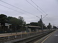
English: Media pertaining to the River Oaks (VTA) light rail and bus station on North 1st Street and River Oaks Parkway in San José, California, USA.
| Object location | | View all coordinates using: OpenStreetMap |
|---|
VTA light rail station in San Jose, California  | |||||
| Upload media | |||||
| Instance of | |||||
|---|---|---|---|---|---|
| Location | San Jose, Silicon Valley, California, Pacific States Region | ||||
| Transport network | |||||
| Owned by | |||||
| Date of official opening |
| ||||
| Connecting line |
| ||||
| Adjacent station |
| ||||
 | |||||
Media in category "River Oaks (VTA)"
The following 6 files are in this category, out of 6 total.
-
 River Oaks VTA 2190 01.JPG 2,048 × 1,536; 668 KB
-
 River Oaks VTA 2191 02.JPG 2,048 × 1,536; 649 KB
-
 River Oaks VTA 2197 03.JPG 2,048 × 1,536; 671 KB
-
 River Oaks VTA 2198 04.JPG 2,048 × 1,536; 572 KB
-
 River Oaks VTA 2200 05.JPG 2,048 × 1,536; 600 KB
-
 River Oaks VTA 2250.JPG 2,048 × 1,536; 806 KB


