Category:River Loddon
Jump to navigation
Jump to search
English: The River Loddon is a river in the English counties of Berkshire and Hampshire. It is a tributary of the River Thames, rising within the urban area of Basingstoke and flowing to meet the Thames near the village of Wargrave. The river has a total length of 28 miles (45 km) and, together with its tributaries, drains an area of 1036 km².
river in the English counties of Berkshire and Hampshire  | |||||
| Upload media | |||||
| Instance of | |||||
|---|---|---|---|---|---|
| Location | Hampshire, South East England, England | ||||
| Mouth of the watercourse | |||||
| Tributary |
| ||||
 | |||||
Subcategories
This category has the following 3 subcategories, out of 3 total.
L
- Land's End Ford (11 F)
T
Media in category "River Loddon"
The following 59 files are in this category, out of 59 total.
-
 A dry river Loddon - geograph.org.uk - 1282669.jpg 480 × 640; 231 KB
-

-
 Banks of the river Loddon - geograph.org.uk - 1334179.jpg 640 × 470; 92 KB
-
 Bridge over the Loddon - geograph.org.uk - 65901.jpg 640 × 481; 56 KB
-
 Cow - geograph.org.uk - 175446.jpg 640 × 480; 176 KB
-
 Dry course of the River Loddon - geograph.org.uk - 673771.jpg 640 × 480; 92 KB
-
 Farm bridge across stream - geograph.org.uk - 1122815.jpg 640 × 480; 115 KB
-
 Farmland in the Loddon valley - geograph.org.uk - 1240807.jpg 630 × 459; 136 KB
-
 Ford at Turgis Court - geograph.org.uk - 175436.jpg 480 × 640; 179 KB
-
 Ford opposite Hays Farm, Hartley Wespall.jpg 4,128 × 3,096; 7.7 MB
-
 Frosty field margin - geograph.org.uk - 1123167.jpg 640 × 457; 81 KB
-
 Frosty Trees - geograph.org.uk - 1123155.jpg 640 × 470; 83 KB
-
 Frozen farmland - geograph.org.uk - 1122763.jpg 640 × 480; 105 KB
-
 Great place to paddle in the summer - geograph.org.uk - 1122765.jpg 640 × 480; 113 KB
-
 I will survive^ - geograph.org.uk - 1184024.jpg 640 × 480; 113 KB
-
 Loddon Bridge - geograph.org.uk - 504337.jpg 640 × 480; 162 KB
-
 Loddon Bridge - geograph.org.uk - 8155.jpg 640 × 431; 119 KB
-
 Loddon Lilies by the Loddon (Leucojum aestivum L.).jpg 3,024 × 4,032; 4.25 MB
-
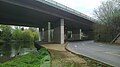 Loddon Viaduct east bank.jpg 2,048 × 1,152; 768 KB
-
 Loddon Viaduct river span.jpg 2,048 × 1,152; 743 KB
-
 Looking upstream to a small weir - geograph.org.uk - 1122778.jpg 640 × 480; 114 KB
-
 River Loddon - geograph.org.uk - 1238119.jpg 461 × 617; 175 KB
-
 River Loddon - geograph.org.uk - 175427.jpg 640 × 480; 193 KB
-
 River Loddon - geograph.org.uk - 471822.jpg 640 × 475; 127 KB
-
 River Loddon - geograph.org.uk - 743150.jpg 640 × 475; 102 KB
-
 River Loddon - geograph.org.uk - 780530.jpg 640 × 477; 112 KB
-
 River Loddon - Victory Park - geograph.org.uk - 673779.jpg 640 × 480; 115 KB
-
 River Loddon at Lillymill Farm (geograph 5422010).jpg 2,736 × 3,648; 3.08 MB
-
 River Loddon at Stanford End Mill (geograph 1783679).jpg 640 × 427; 199 KB
-
 Sandford Lane, Hurst - geograph.org.uk - 504191.jpg 640 × 480; 175 KB
-
 Sandford Lane, Hurst - geograph.org.uk - 504347.jpg 640 × 480; 170 KB
-
 Sindlesham - geograph.org.uk - 8162.jpg 431 × 640; 121 KB
-
 Still flowing - geograph.org.uk - 1122752.jpg 640 × 480; 115 KB
-
 Stream and woods - geograph.org.uk - 1122871.jpg 640 × 477; 109 KB
-
 The River Loddon - geograph.org.uk - 1164378.jpg 480 × 640; 125 KB
-
 The River Loddon - geograph.org.uk - 1178578.jpg 490 × 640; 105 KB
-
 The River Loddon - geograph.org.uk - 278921.jpg 640 × 480; 139 KB
-
 The River Loddon - geograph.org.uk - 278976.jpg 480 × 640; 121 KB
-
 The River Loddon - geograph.org.uk - 278986.jpg 640 × 478; 152 KB
-
 The River Loddon - geograph.org.uk - 287727.jpg 640 × 480; 196 KB
-
 The River Loddon - geograph.org.uk - 287742.jpg 640 × 480; 150 KB
-
 The River Loddon - geograph.org.uk - 504333.jpg 640 × 480; 143 KB
-
 The River Loddon, Charvil - geograph.org.uk - 604979.jpg 640 × 480; 94 KB
-
 The River Loddon, Charvil - geograph.org.uk - 604980.jpg 480 × 640; 82 KB
-
 The River Loddon, Sherfield - geograph.org.uk - 1240656.jpg 640 × 480; 131 KB
-
 The River Loddon, Stratfield Saye - geograph.org.uk - 1386005.jpg 640 × 480; 154 KB
-
 The River Loddon, Stratfield Saye - geograph.org.uk - 1422793.jpg 640 × 480; 111 KB
-
 The River Loddon, Stratfield Saye - geograph.org.uk - 1422927.jpg 640 × 480; 132 KB
-
 The River Loddon, Stratfield Saye - geograph.org.uk - 1423117.jpg 640 × 480; 135 KB
-
 The River Loddon, Stratfield Saye - geograph.org.uk - 1423160.jpg 640 × 480; 147 KB
-
 The weir and sluice - geograph.org.uk - 321069.jpg 640 × 480; 104 KB
-
 Weir and sluice - geograph.org.uk - 327289.jpg 640 × 480; 85 KB
-

-

-
 Misty dawn, River Loddon - geograph.org.uk - 82553.jpg 400 × 597; 61 KB
-
 Old Basing - geograph.org.uk - 1507.jpg 640 × 427; 67 KB
-
 River Loddon - geograph.org.uk - 175443.jpg 640 × 480; 186 KB
-
 River Loddon, Swallowfield - geograph.org.uk - 65890.jpg 640 × 481; 91 KB
-
 The River Loddon, Old Basing - geograph.org.uk - 147395.jpg 640 × 480; 140 KB


.jpg)


.jpg)
.jpg)


