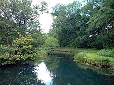
Category:River Dun, Hampshire
Jump to navigation
Jump to search
The River Dun is a river that flows through the counties of Wiltshire and Hampshire in England. The River Dun rises in Wiltshire to the south-east of Salisbury near West Grimstead, and flows east into Hampshire before joining the River Test at Kimbridge.
river in Hampshire, United Kingdom, a tributary of the River Test | |||||
| Upload media | |||||
| Instance of | |||||
|---|---|---|---|---|---|
| Location | |||||
| Mouth of the watercourse | |||||
 | |||||
Media in category "River Dun, Hampshire"
The following 15 files are in this category, out of 15 total.
-
Electricity pylon by the river Dun - geograph.org.uk - 617067.jpg 640 × 480; 86 KB
-
River Dun at Dunbridge - geograph.org.uk - 422768.jpg 480 × 640; 104 KB
-
River Dun in Lockerley - geograph.org.uk - 669108.jpg 640 × 480; 86 KB
-
River Dun, Lockerley - geograph.org.uk - 138146.jpg 640 × 427; 216 KB
-
River Dun, near Dunbridge, Hampshire - geograph.org.uk - 145262.jpg 640 × 480; 216 KB
-
The River Dun - geograph.org.uk - 322615.jpg 640 × 480; 93 KB
-
West Dean - Bridge - geograph.org.uk - 996345.jpg 640 × 480; 122 KB
-
Meadow Land by the River Dun at Dunbridge - geograph.org.uk - 422770.jpg 640 × 480; 108 KB
-
River Dun at Butts Green - geograph.org.uk - 423337.jpg 480 × 640; 115 KB
-
River Dun at Butts Green - geograph.org.uk - 423338.jpg 640 × 480; 102 KB
-
River Dun at Butts Green - geograph.org.uk - 423339.jpg 640 × 480; 129 KB
-
River Dun at Butts Green - geograph.org.uk - 423341.jpg 480 × 640; 93 KB
-
River Dun at West Dean - geograph.org.uk - 349203.jpg 640 × 480; 136 KB
-
River Dun, near Dunbridge, Hampshire - geograph.org.uk - 45536.jpg 640 × 480; 48 KB
-
The River Dun at West Dean - geograph.org.uk - 349466.jpg 640 × 480; 113 KB


