Category:River Boyle
Jump to navigation
Jump to search
The River Boyle, County Roscommon, rises at Loch Garra and flows into the River Shannon at Lough Drumharlow.
river in Ireland - Geonames ID = 2966043  | |||||
| Upload media | |||||
| Instance of | |||||
|---|---|---|---|---|---|
| Location | Ireland | ||||
| Elevation above sea level |
| ||||
| Mouth of the watercourse | |||||
| Drainage basin | |||||
 | |||||
Media in category "River Boyle"
The following 10 files are in this category, out of 10 total.
-
 "Fishing" signpost at Cootehall - geograph.org.uk - 802962.jpg 480 × 640; 78 KB
-
 Boyle River - geograph.org.uk - 1635477.jpg 640 × 480; 92 KB
-
 Cootehall Bridge - geograph.org.uk - 585684.jpg 640 × 427; 104 KB
-
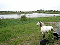 Cootehall Lough - geograph.org.uk - 1652965.jpg 640 × 480; 80 KB
-
 Jetty on Cootehall Lough - geograph.org.uk - 802973.jpg 640 × 480; 53 KB
-
 Knockvicar Bridge - geograph.org.uk - 919144.jpg 640 × 480; 87 KB
-
 New housing at Cootehall - geograph.org.uk - 1652949.jpg 640 × 480; 86 KB
-
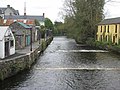
 River Boyle at Cootehall - geograph.org.uk - 1652959.jpg 640 × 480; 67 KB
-
 RiverBoyleKnockvicar.JPG 3,888 × 2,592; 2.4 MB
-
 SihnRiverBoyle.JPG 3,888 × 2,592; 2.12 MB


