Category:River Axe (Bristol Channel)
Jump to navigation
Jump to search
The River Axe flows through North Somerset from Wookey Hole caves into the Bristol Channel.

Subcategories
This category has only the following subcategory.
T
Media in category "River Axe (Bristol Channel)"
The following 18 files are in this category, out of 18 total.
-
 Admiralty Chart No 1157 Bridgewater Port, Published 1886.jpg 10,964 × 16,209; 68.04 MB
-
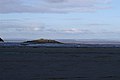 Black Rock - geograph.org.uk - 77583.jpg 640 × 426; 88 KB
-
 Bleadon levels - geograph.org.uk - 4202.jpg 640 × 480; 67 KB
-
 Brean 4.jpg 3,400 × 1,935; 1.18 MB
-
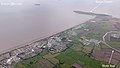
 Brean, the Axe approaches the Severn - geograph.org.uk - 854078.jpg 640 × 480; 52 KB
-
 Brean, UK - panoramio (5).jpg 4,288 × 2,848; 5.52 MB
-
 Old River Axe - geograph.org.uk - 93455.jpg 640 × 426; 161 KB
-
 River Axe - geograph.org.uk - 1414795.jpg 640 × 480; 75 KB
-
 River Axe - geograph.org.uk - 86676.jpg 640 × 426; 109 KB
-
 River Axe near Bleadon - geograph.org.uk - 1414816.jpg 640 × 480; 57 KB
-
 River Axe near Clewer - geograph.org.uk - 113152.jpg 640 × 426; 145 KB
-
 River Axe near Shiplate - geograph.org.uk - 1414805.jpg 640 × 480; 86 KB
-
 RiverAxe2.jpg 5,358 × 3,504; 14.32 MB
-
 The River Axe, Yarley - geograph.org.uk - 1671628.jpg 640 × 480; 156 KB
-
 Uphill River Axe.jpg 1,366 × 1,024; 395 KB
-
 View from Uphill, Weston-super-Mare 1.jpg 3,888 × 2,592; 2.29 MB
-
 Walborough from sea wall.jpg 1,366 × 820; 321 KB
-
 Stream and Road in Henton - geograph.org.uk - 92173.jpg 480 × 640; 87 KB


.jpg)


