Category:River Avon, (Hampshire) in Wiltshire
Jump to navigation
Jump to search
This category is for images of the Hampshire Avon as it flows through Wiltshire into Hampshire
Subcategories
This category has the following 2 subcategories, out of 2 total.
D
- Downton Bridge (6 F)
T
- TS Salisbury (2 F)
Media in category "River Avon, (Hampshire) in Wiltshire"
The following 200 files are in this category, out of 301 total.
(previous page) (next page)-
 'All great change is preceeded by chaos' - geograph.org.uk - 4257821.jpg 2,304 × 1,704; 1.54 MB
-
 A36 river bridge in Salisbury - geograph.org.uk - 3809539.jpg 800 × 717; 135 KB
-
 Amesbury - Queensbury Bridge - geograph.org.uk - 1459724.jpg 640 × 480; 126 KB
-
 Amesbury - The River Avon - geograph.org.uk - 1459730.jpg 640 × 480; 106 KB
-
 Amesbury - The River Avon - geograph.org.uk - 1459734.jpg 640 × 480; 129 KB
-
 Amesbury - Two Bridges - geograph.org.uk - 1459726.jpg 640 × 480; 89 KB
-
 An Avon footbridge in Salisbury - geograph.org.uk - 4126535.jpg 800 × 600; 179 KB
-
 Arrowhead in the Salisbury Avon.jpg 4,000 × 3,000; 4.45 MB
-
 At Salisbury 2023 189.jpg 4,032 × 3,024; 6.52 MB
-
 Audley House - geograph.org.uk - 4337348.jpg 2,304 × 1,704; 1.7 MB
-
 Avon at Stratford Bridge - geograph.org.uk - 1400556.jpg 640 × 448; 93 KB
-
 Avon between two bridges, Salisbury - geograph.org.uk - 4143989.jpg 745 × 800; 214 KB
-
 Avon bridge, Amesbury - geograph.org.uk - 1036115.jpg 640 × 480; 114 KB
-
 Avon flows past The Boathouse, Salisbury - geograph.org.uk - 3809602.jpg 800 × 527; 127 KB
-
 Avon in Salisbury.jpg 4,999 × 3,229; 4.72 MB
-
 Avon Valley Nature Reserve 10.jpg 4,000 × 2,248; 3.25 MB
-
 Avon Valley Nature Reserve 11.jpg 4,000 × 2,248; 2.67 MB
-
 Avon Valley Nature Reserve 3.jpg 4,000 × 2,248; 2.79 MB
-
 Avon Valley Nature Reserve 4.jpg 4,000 × 2,248; 2.93 MB
-
 Avon Valley Nature Reserve 5.jpg 4,000 × 2,248; 2.98 MB
-
 Avon Valley Nature Reserve 6.jpg 4,000 × 2,248; 3.03 MB
-
 Avon Valley Nature Reserve 8.jpg 4,000 × 2,248; 3.51 MB
-
 Avon Valley Nature Reserve 9.jpg 4,000 × 2,248; 3.29 MB
-
 Avon Valley Nature Reserve Information Board.jpg 4,000 × 2,248; 2.75 MB
-
 Avon Valley Path, north of Downton - geograph.org.uk - 312560.jpg 640 × 480; 104 KB
-
 Back of Cathedral Green - geograph.org.uk - 1148471.jpg 640 × 427; 112 KB
-
 Back under the road - geograph.org.uk - 2432670.jpg 800 × 600; 137 KB
-
 Bench by the river - geograph.org.uk - 355609.jpg 640 × 480; 90 KB
-
 Blick auf den Avon in Salisbury 01.jpg 1,536 × 2,204; 1.05 MB
-
 Boardwalk by River Avon - geograph.org.uk - 5629528.jpg 640 × 480; 157 KB
-
 Boardwalk by River Avon - geograph.org.uk - 5630898.jpg 640 × 480; 155 KB
-
 Bridge over River Avon - geograph.org.uk - 5629630.jpg 640 × 480; 129 KB
-
 Bridge over the River Avon, Amesbury - geograph.org.uk - 864061.jpg 640 × 480; 90 KB
-
 Bridge over the River Avon, Salisbury - geograph.org.uk - 5866640.jpg 1,024 × 768; 421 KB
-
 Bridge over the weir, River Avon - geograph.org.uk - 871184.jpg 640 × 480; 119 KB
-
 Bridge Street - geograph.org.uk - 6595323.jpg 1,200 × 803; 1.07 MB
-
 Bridge Street crossing the River Avon - geograph.org.uk - 780596.jpg 640 × 450; 71 KB
-
 Bridge Street- river, looking south - geograph.org.uk - 1910127.jpg 640 × 480; 107 KB
-
 Bridge To Market Walk, Salisbury - geograph.org.uk - 3085907.jpg 456 × 640; 65 KB
-
 Britford - footpath alongside The Moat - geograph.org.uk - 1295235.jpg 640 × 480; 119 KB
-
 Britford - Water Meadows.jpg 2,272 × 1,704; 1.28 MB
-
 Building site by River Avon, Salisbury - geograph.org.uk - 5629627.jpg 640 × 480; 124 KB
-
 Burton, River Avon - geograph.org.uk - 1216585.jpg 640 × 480; 47 KB
-
 Burton, river bank defences - geograph.org.uk - 1216601.jpg 640 × 480; 83 KB
-
 Cattle near New Court Farm - geograph.org.uk - 871430.jpg 640 × 503; 108 KB
-
 Channel, River Avon - geograph.org.uk - 871146.jpg 640 × 446; 78 KB
-
 Charlton All Saints, Avon - geograph.org.uk - 1823905.jpg 1,024 × 768; 182 KB
-
 Churchill Gardens7.jpg 1,440 × 810; 288 KB
-

-
 Confluence of Avon and Nadder - geograph.org.uk - 1400672.jpg 640 × 480; 87 KB
-
 Coot on the Avon - geograph.org.uk - 1399515.jpg 640 × 510; 131 KB
-
 Coot on the River Avon - geograph.org.uk - 2432385.jpg 800 × 661; 158 KB
-
 Crane Bridge, Salisbury - geograph.org.uk - 5468600.jpg 1,101 × 1,600; 663 KB
-
 Crane Bridge, Salisbury - geograph.org.uk - 5629776.jpg 640 × 480; 201 KB
-
 Dace in the Salisbury Avon.jpg 4,000 × 2,248; 2.75 MB
-
 Dawn's Stile near Charlton all Saints - geograph.org.uk - 871137.jpg 640 × 480; 136 KB
-
 Depth marker - geograph.org.uk - 2719596.jpg 706 × 800; 244 KB
-
 Developed banks of the Avon - geograph.org.uk - 780603.jpg 640 × 458; 68 KB
-
 Down the river - geograph.org.uk - 2719577.jpg 800 × 600; 125 KB
-
 Downstream on the Avon - geograph.org.uk - 2432306.jpg 800 × 600; 217 KB
-
 Millennium Sundial, Downton - geograph.org.uk - 355602.jpg 640 × 480; 97 KB
-
 Downton, River Avon - geograph.org.uk - 1654815.jpg 640 × 480; 60 KB
-
 Downton, river branch - geograph.org.uk - 1654803.jpg 640 × 480; 85 KB
-
 Downton, river channels - geograph.org.uk - 1823573.jpg 1,600 × 1,200; 409 KB
-
 Downton, water level board - geograph.org.uk - 1823538.jpg 1,024 × 768; 177 KB
-
 Downton, Wiltshire MOD 45158454.jpg 3,000 × 2,010; 6.56 MB
-
 Downton, Wiltshire MOD 45158455.jpg 3,000 × 2,010; 7.04 MB
-
 Downtown Downton. - geograph.org.uk - 199564.jpg 640 × 435; 153 KB
-
 Ducks on the Avon in Salisbury - geograph.org.uk - 4126550.jpg 800 × 600; 179 KB
-
 Engeland Salisbury rivier Avon 16-10-2011 12-14-50.png 4,284 × 2,410; 17.19 MB
-
 Family outing, Stratford-sub-Castle - geograph.org.uk - 1914845.jpg 480 × 640; 187 KB
-
 Fisherton Bridge, Salisbury - geograph.org.uk - 5866685.jpg 1,024 × 768; 262 KB
-
 Fisherton River Bridge xsouth.jpg 2,592 × 1,944; 1.7 MB
-
 Fisherton River Bridge.jpg 2,592 × 1,944; 1.93 MB
-
 Fishing the Wiltshire Avon - geograph.org.uk - 309663.jpg 640 × 409; 61 KB
-
 Flooded footpath - geograph.org.uk - 355596.jpg 480 × 640; 117 KB
-
 Footbridge over River Avon - geograph.org.uk - 5629620.jpg 640 × 480; 193 KB
-
 Footbridge over River Avon, Salisbury - geograph.org.uk - 363440.jpg 640 × 427; 108 KB
-
 Footbridge over the Avon - geograph.org.uk - 780602.jpg 640 × 458; 107 KB
-
 Footbridge over the River Avon in Salisbury - geograph.org.uk - 3409898.jpg 3,648 × 2,736; 2.37 MB
-
 Footbridge over the River Avon, Salisbury - geograph.org.uk - 5866645.jpg 1,024 × 768; 317 KB
-
 From Cranebridge - geograph.org.uk - 3057121.jpg 2,304 × 1,704; 1.77 MB
-
 From under the Railway Bridge - geograph.org.uk - 672436.jpg 640 × 458; 73 KB
-
 Harnham Bridge from the Rose ^ Crown - geograph.org.uk - 2485858.jpg 640 × 480; 94 KB
-
-
 Island buildings, Salisbury - geograph.org.uk - 5630238.jpg 640 × 480; 143 KB
-
 Keeping an eye on the water level - geograph.org.uk - 355889.jpg 480 × 640; 119 KB
-
 Keeping the waters back - geograph.org.uk - 4257839.jpg 1,704 × 2,304; 1.78 MB
-
 Limpley Stoke Station. - panoramio.jpg 2,112 × 2,816; 2.36 MB
-
 Lord's Walk 3.jpg 4,096 × 3,072; 7.37 MB
-
 Lord's Walk 4.jpg 4,096 × 3,072; 7.35 MB
-
 Lovely weather for ducks and everyone else^ - geograph.org.uk - 2979945.jpg 2,304 × 1,704; 1.79 MB
-
 Mallard on the Avon - geograph.org.uk - 2724252.jpg 640 × 480; 97 KB
-
 Mill race - geograph.org.uk - 2963933.jpg 1,704 × 2,304; 2.17 MB
-
 Mill Stream Salisbury - geograph.org.uk - 2994926.jpg 1,600 × 1,200; 592 KB
-
 Mill Stream, Salisbury - geograph.org.uk - 2996294.jpg 1,600 × 1,200; 545 KB
-
 Mill Stream, Salisbury - geograph.org.uk - 3664185.jpg 800 × 600; 194 KB
-
 Mill stream, Salisbury - geograph.org.uk - 5629687.jpg 640 × 480; 166 KB
-
 Mill, Salisbury - geograph.org.uk - 5629532.jpg 640 × 480; 177 KB
-
 Newcourt Carrier looking north - geograph.org.uk - 350776.jpg 480 × 640; 86 KB
-
 Nice curves - geograph.org.uk - 780600.jpg 640 × 463; 109 KB
-
 No longer controlling the Avon - geograph.org.uk - 350766.jpg 640 × 480; 159 KB
-

-
 Ordnance Survey One-inch Sheet 122 Salisbury and Bulford, Published 1919.jpg 11,739 × 8,883; 43.93 MB
-
 Ordnance Survey One-Inch Sheet 157 Swindon, Published 1958.jpg 8,326 × 9,940; 10.27 MB
-
 Ordnance Survey One-Inch Sheet 157 Swindon, Published 1968.jpg 8,365 × 9,905; 10.54 MB
-
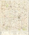
 Ordnance Survey One-Inch Sheet 167 Salisbury, Published 1940.jpg 8,211 × 9,424; 9.6 MB
-
 Ordnance Survey One-Inch Sheet 167 Salisbury, Published 1960.jpg 8,314 × 9,952; 11.27 MB
-
 Ordnance Survey One-Inch Sheet 167 Salisbury, Published 1971.jpg 11,130 × 13,186; 42.09 MB
-
 Paddling the Avon - geograph.org.uk - 745311.jpg 640 × 480; 69 KB
-
 -2021-06-15 River Avon viewed from High Street, Pewsey, Wiltshire.jpg 1,024 × 543; 248 KB
-
 Pollarded Willows - geograph.org.uk - 745317.jpg 640 × 480; 110 KB
-
 Ponte sobre o rio Avon - panoramio.jpg 800 × 581; 365 KB
-
 Punting on the River Avon in Salisbury - geograph.org.uk - 5253934.jpg 2,048 × 1,536; 2.2 MB
-
 Queen Elizabeth Gardens 2011.jpg 2,816 × 2,112; 2.6 MB
-
 Queensberry Bridge Amesbury - geograph.org.uk - 1761521.jpg 640 × 480; 115 KB
-

-
 Railway bridge over the river - geograph.org.uk - 2432693.jpg 800 × 588; 160 KB
-
 Railway bridge over the River Avon - geograph.org.uk - 5349115.jpg 2,571 × 1,795; 758 KB
-
 Reading (233562545).jpeg 2,048 × 1,360; 1.87 MB
-
 River as seen from Fisherton Street - geograph.org.uk - 1905063.jpg 640 × 480; 118 KB
-
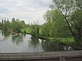
 River Avon - geograph.org.uk - 1764027.jpg 640 × 480; 108 KB
-
 River Avon - geograph.org.uk - 2143097.jpg 640 × 480; 132 KB
-
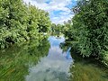
 River Avon - geograph.org.uk - 3625478.jpg 1,600 × 1,067; 1.32 MB
-
 River Avon - geograph.org.uk - 5630204.jpg 640 × 480; 107 KB
-
 River Avon - geograph.org.uk - 5630213.jpg 640 × 480; 149 KB
-
 River Avon - geograph.org.uk - 780893.jpg 640 × 466; 63 KB
-
 River Avon and Salisbury Cathedral - geograph.org.uk - 152430.jpg 480 × 640; 390 KB
-
 River Avon and St Thomas Church - geograph.org.uk - 780574.jpg 640 × 464; 64 KB
-
 River Avon and The Maltings - geograph.org.uk - 780571.jpg 640 × 500; 91 KB
-
 River Avon approaching Downton - geograph.org.uk - 745318.jpg 640 × 480; 74 KB
-
 River Avon at Durnford Mill - geograph.org.uk - 757217.jpg 640 × 506; 126 KB
-
 River Avon at Little Durnford - geograph.org.uk - 276237.jpg 640 × 479; 111 KB
-
 River Avon at Salisbury - geograph.org.uk - 1864543.jpg 640 × 480; 68 KB
-
 River Avon at Stratford sub Castle, Salisbury, UK.jpg 4,000 × 3,000; 2.74 MB
-
 River Avon backwater - geograph.org.uk - 5630196.jpg 640 × 480; 182 KB
-
 River Avon backwater - geograph.org.uk - 5630200.jpg 640 × 480; 192 KB
-
 River Avon below Downton - geograph.org.uk - 745319.jpg 640 × 480; 59 KB
-

-
 River Avon from Ayleswade Bridge - geograph.org.uk - 5160038.jpg 1,600 × 1,200; 757 KB
-
 River Avon from Churchill Gardens, Salisbury. (2).jpg 4,000 × 2,248; 3.7 MB
-
 River Avon from Churchill Gardens, Salisbury.jpg 4,000 × 2,248; 3.26 MB
-
 River Avon from Churchill Gardens.jpg 5,312 × 2,988; 12.86 MB
-
 River Avon from Cranebridge Road - geograph.org.uk - 780607.jpg 640 × 470; 91 KB
-
 River Avon from Harnham Bridge, Salisbury.jpg 4,000 × 3,000; 6.19 MB
-
 River Avon from Stratford Bridge - geograph.org.uk - 2526097.jpg 3,648 × 2,736; 2.32 MB
-
 River Avon Hatches - geograph.org.uk - 485998.jpg 640 × 480; 124 KB
-
 River Avon in central Salisbury.jpg 5,312 × 2,988; 6.72 MB
-
 River Avon in Salisbury - geograph.org.uk - 1856260.jpg 2,816 × 2,112; 1.37 MB
-
 River Avon leaving the Avon Nature Reserve, Salisbury, UK.jpg 5,312 × 2,988; 7.84 MB
-
 River Avon looking downstream - geograph.org.uk - 5630993.jpg 640 × 480; 154 KB
-
 River Avon looking upstream - geograph.org.uk - 5630998.jpg 640 × 480; 151 KB
-
 River Avon looking upstream - geograph.org.uk - 5631002.jpg 640 × 480; 144 KB
-
 River Avon near Amesbury - geograph.org.uk - 1399507.jpg 640 × 480; 127 KB
-
 River Avon near Bodenham - geograph.org.uk - 2529056.jpg 640 × 480; 88 KB
-
 River Avon near Churchill Gardens, Salisbury, UK.jpg 4,000 × 3,000; 5.88 MB
-
 River Avon near Downton - geograph.org.uk - 871408.jpg 640 × 467; 84 KB
-
 River Avon near Durrington - geograph.org.uk - 290070.jpg 640 × 409; 104 KB
-
 River Avon near Great Durnford - geograph.org.uk - 290287.jpg 640 × 436; 107 KB
-
 River Avon near Heale House - geograph.org.uk - 336680.jpg 640 × 480; 123 KB
-
 River Avon near Southampton Road, Salisbury, UK.jpg 4,000 × 3,000; 5.18 MB
-
 River Avon north of Downton - geograph.org.uk - 1148879.jpg 640 × 427; 106 KB
-
 River Avon north of Downton - geograph.org.uk - 1148884.jpg 640 × 427; 86 KB
-
 River Avon north of Downton - geograph.org.uk - 381826.jpg 480 × 640; 49 KB
-
 River Avon north of Salisbury - geograph.org.uk - 5630902.jpg 640 × 480; 141 KB
-
 River Avon over Ayleswade Bridge western parapet - geograph.org.uk - 2879368.jpg 683 × 1,024; 203 KB
-
 River Avon railway bridge, Salisbury - geograph.org.uk - 3809538.jpg 800 × 692; 175 KB
-
 River Avon, Amesbury - geograph.org.uk - 864007.jpg 640 × 480; 99 KB
-
 River Avon, Amesbury - geograph.org.uk - 864091.jpg 640 × 480; 122 KB
-
 River Avon, Britford - geograph.org.uk - 1377440.jpg 640 × 481; 141 KB
-
 River Avon, Downton - geograph.org.uk - 871399.jpg 640 × 480; 88 KB
-
 River Avon, Durnford Mill - geograph.org.uk - 757210.jpg 640 × 480; 134 KB
-
 River Avon, Figheldean - geograph.org.uk - 1055829.jpg 640 × 480; 121 KB
-
 River Avon, from Ayleswade Bridge.jpg 4,000 × 3,000; 4.31 MB
-
 River Avon, Harnham - geograph.org.uk - 745851.jpg 640 × 480; 80 KB
-
 River Avon, Harnham - geograph.org.uk - 745864.jpg 640 × 480; 98 KB
-
 River Avon, Lower Woodford - geograph.org.uk - 691804.jpg 640 × 426; 52 KB
-
 River Avon, Salisbury - geograph.org.uk - 2267262.jpg 640 × 480; 65 KB
-
 River Avon, Salisbury - geograph.org.uk - 2630316.jpg 640 × 480; 75 KB
-
 River Avon, Salisbury - geograph.org.uk - 2996341.jpg 1,600 × 1,200; 560 KB
-
 River Avon, Salisbury - geograph.org.uk - 5629634.jpg 640 × 480; 147 KB
-
 River Avon, Salisbury - geograph.org.uk - 5629711.jpg 640 × 480; 143 KB
-
 River Avon, Salisbury, England 2009-03-13 (3414232172).jpg 853 × 1,280; 386 KB
-
 River Avon-Salisbury - geograph.org.uk - 706515.jpg 640 × 383; 95 KB
-
 River Avon.jpg 2,424 × 1,616; 1.32 MB
-
 River channel in front of The Bishops Mill - geograph.org.uk - 6287420.jpg 1,024 × 576; 265 KB
-
 River Nadder, South Canonry, Salisbury.jpg 4,000 × 3,000; 6.17 MB
-
 Riverside apartments, Salisbury - geograph.org.uk - 3218338.jpg 640 × 427; 110 KB
-
 Riverside trees - geograph.org.uk - 745316.jpg 640 × 480; 77 KB
-
 Riverside trees in Salisbury - geograph.org.uk - 4126555.jpg 800 × 600; 191 KB
-

-
 Sainsbury's and the River Avon - geograph.org.uk - 314997.jpg 640 × 480; 95 KB
-
 Salisbury - Footpath - geograph.org.uk - 1717529.jpg 1,024 × 768; 316 KB
-
 Salisbury - Footpath And Bridge - geograph.org.uk - 2909183.jpg 800 × 600; 173 KB
-
 Salisbury - Nelson Road Bridge - geograph.org.uk - 1717404.jpg 1,024 × 768; 182 KB
-
 Salisbury - No 11 St Nicholas Road - geograph.org.uk - 1230141.jpg 640 × 480; 120 KB
-
 Salisbury - panoramio (10).jpg 2,048 × 1,360; 2.12 MB
-
 Salisbury - Railway Bridge - geograph.org.uk - 1717381.jpg 1,024 × 768; 253 KB
-
 Salisbury - Railway Bridge - geograph.org.uk - 2909191.jpg 800 × 600; 168 KB
-
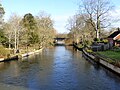
 Salisbury - River Avon - geograph.org.uk - 1713210.jpg 1,024 × 531; 188 KB


_-_geograph.org.uk_-_871208.jpg)


.jpeg)


.jpg)


.jpg)


.jpg)


_in_Wiltshire&filefrom=Salisbury+-+River+Avon+-+geograph.org.uk+-+1713235.jpg#mw-category-media)