Category:River Alde
Jump to navigation
Jump to search

river in Suffolk, England  | |||||
| Upload media | |||||
| Instance of | |||||
|---|---|---|---|---|---|
| Location | Suffolk, East of England, England | ||||
| Mouth of the watercourse | |||||
| Tributary | |||||
 | |||||
Subcategories
This category has the following 4 subcategories, out of 4 total.
Media in category "River Alde"
The following 67 files are in this category, out of 67 total.
-
 Appleton-Alb345b.1Cropped.jpg 2,892 × 2,001; 740 KB
-
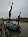
 Barge on River Alde - geograph.org.uk - 992630.jpg 640 × 480; 39 KB
-
 Blackstacks Reach - geograph.org.uk - 577981.jpg 640 × 480; 62 KB
-
 Boat, Westrow Reach, Aldeburgh - geograph.org.uk - 1010470.jpg 640 × 480; 86 KB
-
 Boats at Slaughden - geograph.org.uk - 762632.jpg 427 × 640; 57 KB
-
 Boats in the River Alde by Snape Maltings.jpg 3,072 × 2,304; 2.75 MB
-
 Bow of MV Nadir - geograph.org.uk - 666292.jpg 427 × 640; 44 KB
-
 Cliff Reach, Iken - geograph.org.uk - 666279.jpg 640 × 427; 67 KB
-
 Cliff Reach, River Alde - geograph.org.uk - 666253.jpg 640 × 427; 112 KB
-
 Downstream view from Langham Bridge - geograph.org.uk - 1131648.jpg 640 × 480; 193 KB
-
 Fence in River Alde - geograph.org.uk - 664836.jpg 427 × 640; 71 KB
-
 Footbridge over the River Alde - geograph.org.uk - 1050101.jpg 3,072 × 2,304; 1.63 MB
-

-
 Lower Troublesome Reach, Iken, Suffolk - geograph.org.uk - 43719.jpg 640 × 480; 60 KB
-
 Marshland near the River Alde and Snape Maltings.jpg 3,072 × 2,304; 3.34 MB
-
 MV Nadir at Snape Maltings - geograph.org.uk - 666290.jpg 427 × 640; 42 KB
-
 Ordnance Survey One-Inch Sheet 150 Ipswich, Published 1946.jpg 11,004 × 12,810; 12.76 MB
-
 Ordnance Survey One-Inch Sheet 150 Ipswich, Published 1956.jpg 8,321 × 9,932; 8.12 MB
-
 Ordnance Survey One-Inch Sheet 150 Ipswich, Published 1969.jpg 8,278 × 9,900; 29.02 MB
-
 Ordnance Survey One-Inch Sheet 87 Ipswich, Published 1921.jpg 12,187 × 8,446; 38.8 MB
-
 River Alde - geograph.org.uk - 1016187.jpg 640 × 480; 68 KB
-
 River Alde - geograph.org.uk - 1050160.jpg 3,072 × 2,304; 1.71 MB
-
 River Alde - geograph.org.uk - 1050170.jpg 3,072 × 2,304; 1.66 MB
-
 River Alde and surrounding marshland near Snape Maltings.jpg 3,072 × 2,304; 2.4 MB
-
 River Alde at Badingham - geograph.org.uk - 1064473.jpg 3,072 × 2,304; 1.51 MB
-
 River Alde at Rook's Bridge - geograph.org.uk - 1802718.jpg 2,304 × 3,072; 1.5 MB
-
 River Alde at Rook's Bridge - geograph.org.uk - 1802720.jpg 2,304 × 3,072; 1.56 MB
-
 River Alde at Snape - geograph.org.uk - 784531.jpg 640 × 395; 42 KB
-
 River Alde at Snape Maltings - geograph.org.uk - 846478.jpg 640 × 429; 73 KB
-
 River Alde at the bridge, Rendham - geograph.org.uk - 1073033.jpg 480 × 640; 154 KB
-
 River Alde at the Maltings - geograph.org.uk - 784532.jpg 640 × 399; 47 KB
-

-
-
 River Alde sunset in Slaughden, Suffolk.jpg 640 × 327; 184 KB
-
 Snape - quay and bridge - geograph.org.uk - 666296.jpg 427 × 640; 45 KB
-
 Storm clouds gathering at Orford Quay - geograph.org.uk - 42481.jpg 640 × 480; 52 KB
-

-
 Thames Barge on the River Alde.jpg 2,288 × 1,712; 765 KB
-
 The infant River Alde - geograph.org.uk - 766222.jpg 480 × 640; 129 KB
-
 The River Alde at Snape Maltings - geograph.org.uk - 1211338.jpg 640 × 429; 50 KB
-
 The Wherry Cygnet 8 April 2012.JPG 3,000 × 4,000; 2.17 MB
-
 View across the River Alde - geograph.org.uk - 1618521.jpg 640 × 480; 57 KB
-

-
 A Walk to the River Alde, Suffolk - geograph.org.uk - 208976.jpg 640 × 360; 81 KB
-
 A Walk to the River Alde, Suffolk - geograph.org.uk - 208977.jpg 640 × 360; 45 KB
-

-
 Bridge of River Alde, Bruisyard, Suffolk - geograph.org.uk - 43634.jpg 640 × 480; 175 KB
-

-
 Moorings at Snape - geograph.org.uk - 1730.jpg 425 × 640; 69 KB
-
 Old Barge moored on the River Alde - geograph.org.uk - 671816.jpg 480 × 640; 59 KB
-
 Reflections on the River Alde - geograph.org.uk - 671754.jpg 640 × 480; 47 KB
-

-
 River Alde above Snape Bridge - geograph.org.uk - 667113.jpg 640 × 427; 73 KB
-
 River Alde at Snape Bridge - geograph.org.uk - 666376.jpg 640 × 427; 46 KB
-
 River Alde at Snape Maltings - geograph.org.uk - 671724.jpg 480 × 640; 61 KB
-
 River Alde at Snape Maltings - geograph.org.uk - 9767.jpg 640 × 480; 35 KB
-
 River Alde below Snape Bridge - geograph.org.uk - 666298.jpg 640 × 427; 85 KB
-
 River Alde estuary - geograph.org.uk - 666272.jpg 427 × 640; 72 KB
-
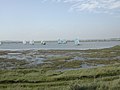 Sailing on the River Alde - geograph.org.uk - 377028.jpg 640 × 480; 60 KB
-
 Sampling point on the River Alde - geograph.org.uk - 671654.jpg 480 × 640; 66 KB
-

-
 The quay at Snape Maltings - geograph.org.uk - 671759.jpg 480 × 640; 38 KB
-
 The River Alde at Iken - geograph.org.uk - 65773.jpg 640 × 480; 62 KB
-
 The River Alde at Snape Maltings - geograph.org.uk - 671718.jpg 640 × 485; 67 KB
-
 Westrow Reach, River Alde - geograph.org.uk - 319101.jpg 640 × 480; 65 KB
-

-


