Category:River Aire
Jump to navigation
Jump to search
river in Yorkshire, England, UK  .png) | |||||
| Upload media | |||||
| Instance of | |||||
|---|---|---|---|---|---|
| Location |
| ||||
| Length |
| ||||
| Origin of the watercourse |
| ||||
| Mouth of the watercourse | |||||
| Tributary | |||||
 | |||||
Subcategories
This category has the following 25 subcategories, out of 25 total.
- Boats on the River Aire (42 F)
A
- Alan (riverside resident) (18 F)
B
- River Aire in Bingley (5 F)
C
F
G
- River Aire at Gargrave (39 F)
H
K
L
- Leeds Flood Alleviation Scheme (135 F)
M
R
- River of Hope (1 F)
S
- River Aire in Saltaire (8 F)
Media in category "River Aire"
The following 200 files are in this category, out of 219 total.
(previous page) (next page)-
 A notice on the bank of the River Aire - geograph.org.uk - 2117848.jpg 800 × 600; 272 KB
-
 A strange contraption - geograph.org.uk - 3837710.jpg 3,240 × 4,320; 2.24 MB
-
 Access temporarily denied - geograph.org.uk - 664395.jpg 640 × 480; 309 KB
-
 Aire (rivière d'Angleterre).png 617 × 383; 519 KB
-
 Aire (rivière).png 361 × 436; 352 KB
-
 Aire Springs - geograph.org.uk - 1031876.jpg 480 × 640; 182 KB
-
 Aire valley west of Fairburn - geograph.org.uk - 540762.jpg 640 × 480; 96 KB
-
 Airton - geograph.org.uk - 29239.jpg 640 × 480; 169 KB
-
 Airton Old Mill Andh.JPG 2,048 × 1,536; 561 KB
-

-
 Barge on the River Aire - geograph.org.uk - 888575.jpg 640 × 480; 69 KB
-
 Beal Lock - geograph.org.uk - 579884.jpg 640 × 463; 93 KB
-
 Beal Lock, River Aire - geograph.org.uk - 827641.jpg 640 × 407; 78 KB
-
 Bear left for Lemonroyd Lock on Aire ^ Calder - geograph.org.uk - 4580808.jpg 1,024 × 615; 107 KB
-
 Bell Busk Bridge - geograph.org.uk - 6285054.jpg 1,024 × 768; 173 KB
-
 Bend around Gardener's Grounds - geograph.org.uk - 664295.jpg 640 × 480; 223 KB
-
-
 Bird Hide over the river - geograph.org.uk - 5691209.jpg 4,608 × 3,072; 2.03 MB
-
 Birder on the floodbank - geograph.org.uk - 2221042.jpg 1,024 × 768; 158 KB
-
 Boathouse, Saltaire (5117873567).jpg 1,645 × 2,468; 4.3 MB
-
 Boom time for seagulls - geograph.org.uk - 579177.jpg 640 × 444; 103 KB
-
 Boom time for seagulls - geograph.org.uk - 579179.jpg 640 × 427; 121 KB
-
 Canal Overflow, Thackley End - geograph.org.uk - 353938.jpg 457 × 640; 142 KB
-
 Chemicals, River and Canal - geograph.org.uk - 435536.jpg 640 × 480; 88 KB
-

-

-
 County boundary - geograph.org.uk - 664521.jpg 640 × 480; 236 KB
-
 Cricket by the River Aire (7262816492).jpg 3,516 × 2,511; 5.8 MB
-
 Cricket pavilion and River Aire, Saltaire (24723474129).jpg 4,000 × 2,672; 8.44 MB
-
 Dead steam crane - geograph.org.uk - 894524.jpg 640 × 419; 86 KB
-
 Dock on the River Aire (10th of May 2010).jpg 3,648 × 2,736; 2.22 MB
-
 Dowley Gap Aqueduct - geograph.org.uk - 1350247.jpg 640 × 480; 131 KB
-
 Drax Power Station from Gowdall - geograph.org.uk - 1094326.jpg 640 × 480; 58 KB
-
 Ducks, both real and sculpted on the South bank of the River Aire (10th May 2010).jpg 2,736 × 3,648; 2.32 MB
-
 Early morning on the infant River Aire - geograph.org.uk - 596058.jpg 640 × 480; 106 KB
-
 Entering Malham on the Pennine Way - geograph.org.uk - 630533.jpg 640 × 480; 232 KB
-
 Ferry Lane - geograph.org.uk - 664015.jpg 640 × 480; 295 KB
-
 Ferrybridge power station - geograph.org.uk - 4021977.jpg 3,435 × 2,535; 1.64 MB
-
 Field between Canal and River Aire - geograph.org.uk - 129107.jpg 640 × 480; 63 KB
-
 Flood - geograph.org.uk - 478466.jpg 640 × 144; 21 KB
-
 Flood defence - geograph.org.uk - 1094350.jpg 480 × 640; 58 KB
-
 Flow of Aire - geograph.org.uk - 663704.jpg 640 × 480; 262 KB
-
 Grazing Land towards the River Aire - geograph.org.uk - 2746516.jpg 640 × 480; 102 KB
-

-
 Haddlesey Old Lock, River Aire, Yorkshire - geograph.org.uk - 214913.jpg 640 × 458; 103 KB
-
 Haddlesey Weir, River Aire, Yorkshire - geograph.org.uk - 377362.jpg 640 × 508; 114 KB
-

-
 Hicksons and river Aire - geograph.org.uk - 649853.jpg 640 × 463; 88 KB
-
 Hirst Mill and Hirst Weir - geograph.org.uk - 1340593.jpg 640 × 480; 88 KB
-
 Hunslet Mills and the River Aire. - geograph.org.uk - 57132.jpg 640 × 480; 82 KB
-
 Hunslet Mills from John Smeaton Way.jpg 4,096 × 3,072; 2.32 MB
-
 Iron Bridge - geograph.org.uk - 559819.jpg 640 × 480; 111 KB
-
 Islands in the stream - geograph.org.uk - 562579.jpg 640 × 480; 118 KB
-

-
 Kildwick Bridge - geograph.org.uk - 880804.jpg 640 × 480; 167 KB
-
 Kildwick Bridge January 2008. - geograph.org.uk - 666890.jpg 640 × 480; 76 KB
-
 Kildwick Bridge over River Aire - geograph.org.uk - 65005.jpg 640 × 480; 89 KB
-
 Kingsmill Flour Mill - geograph.org.uk - 553546.jpg 640 × 480; 91 KB
-
 Knottingley Weir on the river Aire - geograph.org.uk - 579174.jpg 640 × 427; 53 KB
-
 Lady Beck Mabgate 2016.jpg 2,448 × 3,264; 2.58 MB
-
 Leeds and Liverpool Canal (34372991872).jpg 5,623 × 2,936; 9.43 MB
-
 Malham Cove 11 October 2022.jpg 6,000 × 4,000; 7.2 MB
-
 Malhom Cave.jpg 6,000 × 4,000; 7.51 MB
-
 Malhom Cove 1.jpg 6,000 × 4,000; 7.18 MB
-
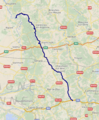
 Map-Aire Gap England.png 586 × 457; 305 KB
-
 Map-Aire Gap North-England.png 705 × 548; 108 KB
-
 Map-Craven-Wapentakes 1000.png 705 × 548; 92 KB
-

-
 Mr Blue Sky - geograph.org.uk - 664333.jpg 640 × 480; 201 KB
-
 New buildings, old barges, in the Leeds and Liverpool Canal.jpg 1,797 × 2,480; 3.67 MB
-
 New development - Canal Wharf - geograph.org.uk - 66458.jpg 640 × 480; 79 KB
-
 New Mill and Weir.jpg 1,800 × 1,200; 1.21 MB
-
 New Mill Saltaire (166217277).jpeg 1,280 × 857; 401 KB
-
 New riverside trail - geograph.org.uk - 1290484.jpg 640 × 447; 257 KB
-
 Newland Bridge - geograph.org.uk - 581941.jpg 640 × 466; 80 KB
-
 Newton Ings - geograph.org.uk - 657054.jpg 640 × 455; 65 KB
-
 Number 1 Whitehall Riverside (9) - geograph.org.uk - 630713.jpg 426 × 640; 58 KB
-
 Old Eye Pumping Station - geograph.org.uk - 685998.jpg 640 × 427; 64 KB
-
 Ordnance Survey One-Inch Sheet 32 Goole & Pontefract, Published 1924.jpg 11,849 × 8,879; 36.24 MB
-
 Ordnance Survey One-Inch Sheet 97 York, Published 1947.jpg 10,949 × 12,768; 14.95 MB
-
 Ordnance Survey One-Inch Sheet 97 York, Published 1960.jpg 8,248 × 9,876; 10 MB
-
 Overflowing Aire - geograph.org.uk - 291786.jpg 640 × 480; 110 KB
-
 Path beside the River Aire (2476219717).jpg 2,560 × 1,920; 5.2 MB
-
 Path by the River Aire, near Esholt (2489846655).jpg 2,292 × 2,400; 7.13 MB
-
 Pennine way along River Aire - geograph.org.uk - 4644649.jpg 640 × 426; 98 KB
-
 Pennine Way south of Airton - geograph.org.uk - 1031827.jpg 640 × 480; 120 KB
-
 Piers of an earlier Bridge - geograph.org.uk - 1198405.jpg 640 × 480; 70 KB
-

-
 Pumping Station and Sluice - geograph.org.uk - 1199715.jpg 480 × 640; 98 KB
-
 Rippled shallows - geograph.org.uk - 664516.jpg 640 × 480; 229 KB
-
 River Aire (17794847129).jpg 2,518 × 3,309; 4.85 MB
-
 River Aire (18212682446).jpg 2,626 × 2,186; 3.74 MB
-
 River Aire (18239193915).jpg 2,466 × 3,699; 7.9 MB
-
 River Aire (18352035052).jpg 3,186 × 2,124; 4.42 MB
-
 River Aire (27250221710).jpg 3,000 × 4,000; 10.08 MB
-
 River Aire (27431278304).jpg 4,000 × 2,250; 7.33 MB
-
 River Aire (28010490616).jpg 4,000 × 2,857; 11.57 MB
-
 River Aire (2829071758).jpg 2,560 × 1,920; 4.15 MB
-
 River Aire (29691577451).jpg 4,000 × 2,857; 11.25 MB
-
 River Aire (4569022430).jpg 2,560 × 1,842; 4.7 MB
-
 River Aire - Aire Street - geograph.org.uk - 1215367.jpg 640 × 434; 204 KB
-
 River Aire - Bradford Road - geograph.org.uk - 977250.jpg 640 × 489; 228 KB
-

-

-
 River Aire - geograph.org.uk - 1337932.jpg 450 × 600; 95 KB
-
 River Aire - geograph.org.uk - 135717.jpg 640 × 230; 34 KB
-
 River Aire - geograph.org.uk - 1563227.jpg 640 × 480; 108 KB
-
 River Aire - geograph.org.uk - 29236.jpg 640 × 480; 196 KB
-
 River Aire - geograph.org.uk - 441969.jpg 640 × 480; 132 KB
-
 River Aire - geograph.org.uk - 686443.jpg 640 × 427; 85 KB
-
 River Aire - geograph.org.uk - 787733.jpg 640 × 480; 119 KB
-
 River Aire - Keighley Road - geograph.org.uk - 1513659.jpg 640 × 480; 64 KB
-
 River Aire - panoramio.jpg 1,798 × 1,804; 732 KB
-
 River Aire 1974.jpg 3,900 × 2,600; 1.94 MB
-
 River Aire and Embankment - geograph.org.uk - 1199697.jpg 640 × 480; 73 KB
-
 River Aire and River Ouse.jpg 5,312 × 2,988; 5.15 MB
-
 River Aire at Airmyn - geograph.org.uk - 412802.jpg 640 × 480; 109 KB
-
 River Aire at Airmyn.jpg 5,312 × 2,988; 6.48 MB
-
 River Aire at Bell Busk - geograph.org.uk - 1046616.jpg 640 × 480; 83 KB
-
 River Aire at Calls Landing - panoramio.jpg 1,620 × 1,080; 551 KB
-
 River Aire at Cononley Ings - geograph.org.uk - 868083.jpg 640 × 480; 53 KB
-
 River Aire at Esholt - geograph.org.uk - 2611180.jpg 640 × 480; 134 KB
-
 River Aire at Hirst Mill (15508209772).jpg 4,554 × 3,384; 8.02 MB
-
 River Aire at Rawcliffe - geograph.org.uk - 1256119.jpg 640 × 480; 88 KB
-
 River Aire at Wheldale - geograph.org.uk - 558899.jpg 640 × 462; 86 KB
-
 River Aire Bank towards Airmyn - geograph.org.uk - 1214872.jpg 640 × 480; 72 KB
-
 River Aire below Hirst Weir - geograph.org.uk - 1339974.jpg 640 × 480; 131 KB
-
 River Aire below Lemonroyd Lock.jpg 1,914 × 1,914; 3.58 MB
-
 River Aire between Carleton and Skipton - geograph.org.uk - 129854.jpg 640 × 480; 101 KB
-
 River Aire downstream at Brotherton - geograph.org.uk - 775701.jpg 640 × 480; 52 KB
-
 River Aire flood plain - geograph.org.uk - 1240352.jpg 640 × 480; 88 KB
-

-

-
 River Aire from Dowley Gap Aqueduct - geograph.org.uk - 1350266.jpg 640 × 480; 133 KB
-

-

-
 River Aire from Stourton bridge - geograph.org.uk - 1252595.jpg 640 × 480; 75 KB
-
 River Aire from the Carrs - geograph.org.uk - 284652.jpg 640 × 480; 81 KB
-

-
 River Aire from the South bank (10th May 2010).jpg 3,648 × 2,736; 2.95 MB
-
 River Aire in flood (geograph 6393230).jpg 2,928 × 2,196; 1.19 MB
-
 River Aire Malhom Cove.jpg 6,000 × 4,000; 6.94 MB
-
 River Aire near Airton - geograph.org.uk - 618115.jpg 640 × 480; 113 KB
-
 River Aire near Carleton - geograph.org.uk - 1518747.jpg 640 × 480; 87 KB
-
 River Aire near Eskamhorn - geograph.org.uk - 1735648.jpg 640 × 480; 99 KB
-
 River Aire near Silsden, West Yorkshire.jpg 3,648 × 2,736; 1.41 MB
-

-
 River Aire seen from St. Paul's churchyard, Esholt - geograph.org.uk - 4466590.jpg 1,943 × 1,461; 644 KB
-
 River Aire south of Malham.jpg 640 × 480; 125 KB
-
 River Aire Study Visit 2022 Sight insoection.jpg 6,000 × 4,000; 7.2 MB
-
 River Aire Study Visit 2022 Study Walk.jpg 6,000 × 4,000; 6.89 MB
-
 River Aire Study Visit 2022 Witness at Saltaire.jpg 6,000 × 4,000; 6.58 MB
-
 River Aire Study Visit Field Discussion.jpg 6,000 × 4,000; 6.01 MB
-
 River Aire Study Visit Field trials.jpg 6,000 × 4,000; 7.72 MB
-
 River Aire under Newland bridge - geograph.org.uk - 1240402.jpg 640 × 480; 53 KB
-
 River Aire, Armley (7190894234).jpg 4,121 × 2,941; 8.98 MB
-
 River Aire, Armley.jpg 2,696 × 3,730; 7.78 MB
-
 River Aire, Beal.jpg 640 × 460; 97 KB
-
 River Aire, Carlton Marsh - geograph.org.uk - 1735643.jpg 640 × 480; 101 KB
-
 River Aire, looking West from the Stew and Oyster (19th July 2014).JPG 4,608 × 3,456; 6.39 MB
-
 River Aire, near Appleby, Yorkshire Bentley.jpg 800 × 524; 339 KB
-
 River Aire, Saltaire (10563338866).jpg 3,302 × 2,405; 6.04 MB
-
 River Aire, West Haddlesey - geograph.org.uk - 1167720.jpg 640 × 379; 59 KB
-
 River Bank Scene - geograph.org.uk - 553538.jpg 640 × 480; 114 KB
-
 Rivers of Hope. LEEDS 2023.jpg 6,707 × 4,471; 2.37 MB
-
 Riverside Mill - panoramio.jpg 1,688 × 1,780; 574 KB
-
 Riverside Sycamore - geograph.org.uk - 567038.jpg 640 × 480; 256 KB
-
 Saltaire Flickr 24 July 2021.jpg 4,785 × 3,190; 11.36 MB
-
 Skylark (27269877060).jpg 2,679 × 3,750; 8.84 MB
-

-
 Snaith, Pipe Bridge over the River Aire - geograph.org.uk - 192370.jpg 640 × 480; 194 KB
-
 Snaiths Four Piers - geograph.org.uk - 1198420.jpg 480 × 640; 84 KB
-
 Snow Stopped Play (8425227036).jpg 3,924 × 2,616; 6.87 MB
-
 Steps and stile (2490674248).jpg 3,056 × 2,292; 6.4 MB
-
 Strata Aire Valley.png 3,508 × 1,299; 223 KB
-
 The Boathouse, Saltaire (7243645048).jpg 3,733 × 1,935; 5.22 MB
-
 The boom for Knottingley weir. - geograph.org.uk - 579176.jpg 626 × 408; 71 KB
-
 The End - geograph.org.uk - 1155780.jpg 640 × 429; 253 KB
-
 The Infant River Aire - geograph.org.uk - 151426.jpg 640 × 480; 96 KB
-
 The Katmandu Caravan Club - geograph.org.uk - 963193.jpg 640 × 480; 64 KB
-
 The Lock - geograph.org.uk - 563636.jpg 640 × 480; 75 KB
-
 The New A1 Bridge over the River Aire - geograph.org.uk - 895417.jpg 640 × 480; 52 KB
-
 The New A1 Crossing the River Aire - geograph.org.uk - 895420.jpg 640 × 480; 47 KB
-
 The Pennine Way, Airedale - geograph.org.uk - 4644619.jpg 640 × 426; 105 KB
-
 The Quarterly journal of the Geological Society of London (12961444804).jpg 1,185 × 2,056; 502 KB
-
 The River Aire - geograph.org.uk - 1286124.jpg 640 × 427; 62 KB
-

-
 The river Aire near Brotherton - geograph.org.uk - 948449.jpg 640 × 436; 58 KB
-
 The River Aire, Fleet Bridge - geograph.org.uk - 333126.jpg 480 × 640; 61 KB
-
 The weir on the River Aire, Knottingley - geograph.org.uk - 553550.jpg 640 × 480; 118 KB
-
 Thwaite Putty Mills, steam day. - geograph.org.uk - 335205.jpg 640 × 430; 68 KB
-
 To the river - geograph.org.uk - 184277.jpg 640 × 480; 128 KB
-
 Transport, old and the new - geograph.org.uk - 764920.jpg 640 × 384; 75 KB
-
 Tubular bridge, River Aire, Brotherton.jpg 1,978 × 1,567; 855 KB
-
 Two Boats - geograph.org.uk - 1155930.jpg 640 × 439; 249 KB
-
 View from a Bridge - geograph.org.uk - 1187066.jpg 480 × 640; 44 KB
-
 View from a York - Doncaster train - River Aire in Flood - geograph.org.uk - 4780234.jpg 1,600 × 1,143; 238 KB
-

-
 View from diamond pond - geograph.org.uk - 664520.jpg 640 × 480; 182 KB
-
 View from Millgate Bridge - geograph.org.uk - 420401.jpg 640 × 392; 91 KB


.png)


.jpg)


.jpg)
.jpg)

.jpg)


.jpg)


_-_geograph.org.uk_-_196521.jpg)


.jpg)


.jpeg)


_-_geograph.org.uk_-_630713.jpg)


.jpg)
.jpg)


.jpg)
.jpg)
.jpg)
.jpg)
.jpg)
.jpg)
.jpg)
.jpg)
.jpg)
.jpg)


.jpg)


.jpg)
.jpg)


.jpg)


.JPG)

.jpg)


.jpg)


.jpg)
.jpg)
.jpg)


.jpg)


