Category:Rittergut Dittersdorf (Amtsberg)
Jump to navigation
Jump to search
| Object location | | View all coordinates using: OpenStreetMap |
|---|
| (Wikidata) |
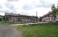
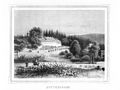
house in Amtsberg, Germany  | |||||
| Upload media | |||||
| Instance of | |||||
|---|---|---|---|---|---|
| Location | Amtsberg, Erzgebirgskreis, Saxony, Germany | ||||
| Street address |
| ||||
| Heritage designation | |||||
| Inception |
| ||||
 | |||||
Media in category "Rittergut Dittersdorf (Amtsberg)"
The following 8 files are in this category, out of 8 total.
-
 20150924400DR Dittersdorf zu Amtsberg Rittergut.jpg 3,150 × 2,259; 3.92 MB
-
 20150924405DR Dittersdorf zu Amtsberg Rittergut.jpg 3,264 × 2,067; 3.32 MB
-
 20150924410DR Dittersdorf zu Amtsberg Rittergut.jpg 2,448 × 2,650; 3.44 MB
-
 20150924415DR Dittersdorf zu Amtsberg Rittergut.jpg 3,264 × 2,436; 2.48 MB
-
 20150924420DR Dittersdorf zu Amtsberg Rittergut.jpg 3,147 × 2,223; 3.89 MB
-
 Album der Schlösser und Rittergüter im Königreiche Sachsen IV 091.jpg 3,701 × 2,782; 3.4 MB
-
 Rittergut Dittersdorf.jpg 1,514 × 1,132; 381 KB
-
 Schloss Dittersdorf (Amtsberg), geschnitztes Relief.jpg 4,000 × 3,000; 1.95 MB


,_geschnitztes_Relief.jpg)