Category:Riseley, Bedfordshire
Jump to navigation
Jump to search
village and civil parish in Bedfordshire, UK  | |||||
| Upload media | |||||
| Instance of | |||||
|---|---|---|---|---|---|
| Location | Bedford, Bedfordshire, East of England, England | ||||
| Population |
| ||||
 | |||||
English: Riseley is a village and civil parish in north Bedfordshire, about nine miles north of Bedford. It is near the county boundary with Northamptonshire and about eight miles southeast of the Northamptonshire town of Rushden.
Subcategories
This category has only the following subcategory.
Media in category "Riseley, Bedfordshire"
The following 99 files are in this category, out of 99 total.
-
 All Saints' church from the path - geograph.org.uk - 6494565.jpg 1,600 × 1,066; 610 KB
-
 All Saints' churchyard - geograph.org.uk - 6494563.jpg 1,600 × 1,066; 376 KB
-
 Allotments by the footpath - geograph.org.uk - 6494541.jpg 1,600 × 1,068; 638 KB
-
 Bedford Autodrome at Thurleigh Airfield - geograph.org.uk - 1825102.jpg 2,592 × 1,944; 1.51 MB
-
 Bedford Autodrome at Thurleigh Airfield - geograph.org.uk - 1832081.jpg 1,024 × 768; 121 KB
-
 Bedford Autodrome at Thurleigh Airfield - geograph.org.uk - 1832084.jpg 1,024 × 768; 131 KB
-
 Bedford Autodrome at Thurleigh Airfield - geograph.org.uk - 1832086.jpg 1,024 × 768; 135 KB
-
 Bedford Autodrome at Thurleigh Airfield - geograph.org.uk - 1832087.jpg 1,024 × 768; 115 KB
-
 Bedford Autodrome at Thurleigh Airfield - geograph.org.uk - 1832090.jpg 1,024 × 768; 104 KB
-
 Bedford Autodrome at Thurleigh Airfield - geograph.org.uk - 1832093.jpg 1,024 × 768; 128 KB
-
 Bedford Autodrome at Thurleigh Airfield - geograph.org.uk - 1832095.jpg 1,024 × 768; 121 KB
-
 Bedford Autodrome at Thurleigh Airfield - geograph.org.uk - 1832097.jpg 1,024 × 768; 144 KB
-
 Bedford Autodrome at Thurleigh Airfield - geograph.org.uk - 1832099.jpg 1,024 × 768; 67 KB
-
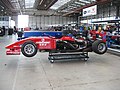 Bedford Autodrome at Thurleigh Airfield - geograph.org.uk - 1832101.jpg 1,024 × 768; 139 KB
-
 Bedford Autodrome at Thurleigh Airfield - geograph.org.uk - 1832103.jpg 1,024 × 768; 112 KB
-
 Bedford Autodrome at Thurleigh Airfield - geograph.org.uk - 1832104.jpg 1,024 × 768; 110 KB
-
 Bedford Autodrome at Thurleigh Airfield - geograph.org.uk - 1832106.jpg 1,024 × 768; 118 KB
-
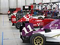 Bedford Autodrome at Thurleigh Airfield - geograph.org.uk - 1832109.jpg 1,024 × 768; 135 KB
-
 Bench Mark on the Bridge at Riseley - geograph.org.uk - 1805154.jpg 3,648 × 2,736; 2.26 MB
-
 Bridge over the Cedar Brook - geograph.org.uk - 1805131.jpg 3,648 × 2,736; 2.21 MB
-
 Bridleway by Willow Spinney - geograph.org.uk - 1987287.jpg 640 × 480; 85 KB
-
 Bridleway heading North - geograph.org.uk - 6526965.jpg 1,600 × 1,066; 494 KB
-
 Bridleway round the autodrome - geograph.org.uk - 6494548.jpg 1,600 × 1,066; 616 KB
-
 Bridleway to Coldham Lodge Farm - geograph.org.uk - 6494533.jpg 1,600 × 1,066; 429 KB
-
 Bridleway to Galsey Wood - geograph.org.uk - 6494989.jpg 1,600 × 1,066; 551 KB
-
 Bridleway to Melchbourne - geograph.org.uk - 6528095.jpg 1,600 × 1,066; 556 KB
-
 Bridleway to Riseley - geograph.org.uk - 6494549.jpg 1,600 × 1,066; 559 KB
-
 Bridleway to Riseley - geograph.org.uk - 6528028.jpg 1,600 × 1,066; 698 KB
-
 Bridleway to Sackville Cottage - geograph.org.uk - 1551431.jpg 640 × 480; 118 KB
-
 Bridleway to Willow Spinney - geograph.org.uk - 6494513.jpg 1,600 × 1,066; 528 KB
-
 Bridleway towards Galsey Wood - geograph.org.uk - 6494573.jpg 1,600 × 1,066; 331 KB
-
 Bridleway towards High Barn Farm - geograph.org.uk - 6494708.jpg 1,600 × 1,066; 490 KB
-
 Bridleway towards Lady Wood - geograph.org.uk - 6528039.jpg 1,600 × 1,066; 414 KB
-
 Bridleway towards Willow Spinney - geograph.org.uk - 4570716.jpg 640 × 480; 69 KB
-
 Bridleway towards Willow Spinney - geograph.org.uk - 4570719.jpg 480 × 640; 73 KB
-
 Bridleway towards Worley's Wood - geograph.org.uk - 6494578.jpg 1,600 × 1,066; 448 KB
-
 Byway out to Riseley Road - geograph.org.uk - 6494713.jpg 1,600 × 1,066; 598 KB
-
 Cameron Balloons C-80 Concept AN1472643.jpg 1,024 × 681; 416 KB
-
 Cameron Balloons C-80 Concept AN1481497.jpg 1,024 × 720; 196 KB
-
 Cameron Balloons V-90 Viva AN1474365.jpg 1,024 × 741; 463 KB
-
 Coldham Lodge Farm and bridleway - geograph.org.uk - 6494502.jpg 1,600 × 1,066; 509 KB
-
 Cottage on Gold Street - geograph.org.uk - 3131710.jpg 640 × 480; 121 KB
-
 Cyclone Pegasus Quantum 15-912 AN1472619.jpg 1,024 × 685; 556 KB
-
 Dead tree by the footpath sign - geograph.org.uk - 6494977.jpg 1,066 × 1,600; 266 KB
-
 Faces through the wire fence - geograph.org.uk - 1806753.jpg 640 × 480; 81 KB
-
 Farmland and Keysoepark Wood - geograph.org.uk - 3131692.jpg 640 × 480; 77 KB
-
 Farmland near Bourne End - geograph.org.uk - 3131729.jpg 640 × 480; 103 KB
-
 Farmland near Mill Farm - geograph.org.uk - 3131703.jpg 640 × 480; 81 KB
-
 Farmland near Riseley (3) - geograph.org.uk - 1626705.jpg 640 × 480; 160 KB
-
 Farmland near Riseley - geograph.org.uk - 3131693.jpg 640 × 480; 67 KB
-
 Farmland, High Barn Farm - geograph.org.uk - 3131724.jpg 640 × 480; 64 KB
-
 Farmland, Riseley - geograph.org.uk - 3131699.jpg 640 × 480; 87 KB
-
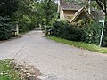
 Footpath into Riseley - geograph.org.uk - 6494543.jpg 1,600 × 1,066; 486 KB
-
 Footpath into Riseley - geograph.org.uk - 6494707.jpg 1,600 × 1,066; 619 KB
-
 Footpath sign at crossroads - geograph.org.uk - 4570712.jpg 480 × 640; 139 KB
-
 Footpath to Arnoe farm - geograph.org.uk - 6494979.jpg 1,600 × 1,066; 644 KB
-
 Footpath to Church Lane - geograph.org.uk - 1551385.jpg 640 × 480; 88 KB
-
 Footpath to Hardwick End - geograph.org.uk - 6494503.jpg 1,600 × 1,066; 559 KB
-
 Footpath to Hardwick End - geograph.org.uk - 6494508.jpg 1,600 × 1,066; 471 KB
-
 Footpath to the church - geograph.org.uk - 6494569.jpg 1,600 × 1,066; 411 KB
-
 Footpath to Worley's Wood - geograph.org.uk - 6494570.jpg 1,600 × 1,066; 507 KB
-
 Footpath towards Riseley - geograph.org.uk - 6494981.jpg 1,600 × 1,066; 377 KB
-
 Footpath towards the church - geograph.org.uk - 6494538.jpg 1,600 × 1,066; 377 KB
-
 Footpath towards the moat - geograph.org.uk - 6494576.jpg 1,600 × 1,066; 449 KB
-
 Fox ^ Hounds, Riseley - geograph.org.uk - 5081254.jpg 640 × 480; 55 KB
-
 Gold Street, Riseley - geograph.org.uk - 3131711.jpg 640 × 480; 90 KB
-
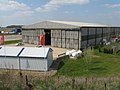
 Hangars at Bedford Autodrome - geograph.org.uk - 6494551.jpg 1,600 × 1,066; 331 KB
-
 High Street, Riseley - geograph.org.uk - 3131698.jpg 640 × 480; 94 KB
-
 High Street, Riseley - geograph.org.uk - 3131709.jpg 640 × 480; 63 KB
-
 Keysoe Road towards Riseley - geograph.org.uk - 3131694.jpg 640 × 480; 99 KB
-
 Keysoe Road, Riseley - geograph.org.uk - 1420739.jpg 640 × 480; 216 KB
-
 Knotting Lane - geograph.org.uk - 1551487.jpg 640 × 480; 87 KB
-
 Masts beyond the barley - geograph.org.uk - 6526983.jpg 1,600 × 1,066; 416 KB
-
 Raj Hamsa X'Air 512(5) AN1472644.jpg 1,024 × 728; 465 KB
-
 Riseley church - geograph.org.uk - 5081257.jpg 480 × 640; 66 KB
-
 Riseley Playing Fields - geograph.org.uk - 1551418.jpg 640 × 480; 56 KB
-
 Riseley primary school - geograph.org.uk - 6494536.jpg 1,600 × 1,066; 291 KB
-
 Riseley village sign - geograph.org.uk - 1420756.jpg 480 × 640; 253 KB
-
 Riseley village stores - geograph.org.uk - 1420750.jpg 640 × 480; 234 KB
-
 Riseley, aerial 2017 (2) - geograph.org.uk - 5444447.jpg 800 × 533; 98 KB
-
 Riseley, aerial 2017 - geograph.org.uk - 5444437.jpg 640 × 427; 74 KB
-
 Riseley, All Saints - geograph.org.uk - 5472816.jpg 4,608 × 3,456; 3.96 MB
-
 Road towards Bletsoe - geograph.org.uk - 3131721.jpg 640 × 480; 87 KB
-
 Road towards Bourne End - geograph.org.uk - 3131727.jpg 640 × 480; 64 KB
-
 Road towards Bourne End - geograph.org.uk - 3131730.jpg 640 × 480; 79 KB
-
 Road towards Swineshead - geograph.org.uk - 3131701.jpg 640 × 480; 95 KB
-
 Road towards Swineshead - geograph.org.uk - 3131704.jpg 640 × 480; 63 KB
-
 Satellite dishes - geograph.org.uk - 405833.jpg 640 × 480; 115 KB
-
 Spinney on the hill - geograph.org.uk - 6494986.jpg 1,600 × 1,066; 561 KB
-
 Springtime on the Butts - geograph.org.uk - 1805017.jpg 3,648 × 2,736; 2.29 MB
-
 Stores, Riseley - geograph.org.uk - 3131707.jpg 640 × 480; 96 KB
-
 Stubble in the field - geograph.org.uk - 1551506.jpg 640 × 480; 58 KB
-
 Thatched cottage, Riseley - geograph.org.uk - 3131697.jpg 640 × 480; 55 KB
-
 The Fox and Hounds, Riseley - geograph.org.uk - 3131708.jpg 1,024 × 596; 123 KB
-
 Towards Riseley church - geograph.org.uk - 5081255.jpg 640 × 480; 65 KB
-

-

-
 Wind turbine - geograph.org.uk - 6494504.jpg 1,600 × 1,066; 325 KB
-
 Worley's Wood - geograph.org.uk - 6528027.jpg 1,600 × 1,066; 496 KB


_-_geograph.org.uk_-_1626705.jpg)


_AN1472644.jpg)


_-_geograph.org.uk_-_5444447.jpg)


