Category:Rio Grande National Forest
Jump to navigation
Jump to search
national forest in Colorado, United States | |||||
| Upload media | |||||
| Instance of | |||||
|---|---|---|---|---|---|
| Location | Colorado | ||||
| IUCN protected areas category | |||||
| Inception |
| ||||
| Highest point | |||||
| Replaces |
| ||||
| official website | |||||
 | |||||
Subcategories
This category has the following 16 subcategories, out of 16 total.
C
- Carnero Pass (2 F)
- Cochetopa Pass (3 F)
- Conejos Peak (2 F)
D
- Del Norte Peak (2 F)
G
- Goose Creek Fire (12 F)
L
P
- Platoro Reservoir (2 F)
R
- Rio Grande Dam (2 F)
- Rio Grande Reservoir (8 F)
- Road Canyon Reservoirs (3 F)
S
T
W
- Wheeler Geologic Area (7 F)
- Wolf Creek Ski Area (7 F)
Media in category "Rio Grande National Forest"
The following 46 files are in this category, out of 46 total.
-
130626-Z-BR512-254 (9160041300).jpg 2,832 × 4,256; 5.61 MB
-
20110930-FS-UNK-0006 - Flickr - USDAgov.jpg 1,000 × 667; 651 KB
-
A272, Wheeler Geologic Area, La Garita Wilderness, Colorado, USA, 2008.JPG 1,024 × 683; 595 KB
-
American forestry (Page 452) BHL3990630.jpg 2,736 × 1,731; 629 KB
-
Antora Peak.JPG 5,902 × 3,695; 18.16 MB
-
Distance road sign on Rio Grande National Forest Road 520.JPG 5,607 × 3,468; 17.63 MB
-
Eagle Rock (Saguache County, Colorado).JPG 4,789 × 2,681; 9.12 MB
-
Elwood Cabin Rio Grande Forest Colorado September 2013.JPG 4,272 × 2,848; 7.02 MB
-
GreatDivideNationalForests.JPG 2,272 × 1,704; 842 KB
-
La Ventana Natural Arch.JPG 5,760 × 3,258; 12.95 MB
-
LaGaritaWilderness.jpg 2,032 × 1,524; 2.18 MB
-
Lost Trail Creek area 2.JPG 5,800 × 2,879; 13.26 MB
-
Lost Trail Creek area.JPG 5,772 × 3,337; 14.9 MB
-
Lost Trail Creek.JPG 4,696 × 3,697; 15.86 MB
-
McIntyre Peak.JPG 4,609 × 3,291; 13.8 MB
-
Million Reservoir.JPG 6,000 × 3,200; 13.76 MB
-
North aspect of Shotgun Mountain.JPG 5,034 × 3,256; 14.1 MB
-
Platoro, Colorado from above.JPG 4,818 × 3,544; 10.24 MB
-
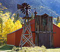
Red Barn (8059359005).jpg 5,087 × 4,351; 20.03 MB
-
Rio De Los Pinos Falls - panoramio.jpg 3,000 × 4,000; 3.04 MB
-
Rio GHrande National Forest (1).JPG 2,448 × 3,264; 2.84 MB
-
Rio GHrande National Forest (2).JPG 3,264 × 2,448; 2.35 MB
-
Rio GHrande National Forest (3).JPG 3,264 × 2,448; 2.66 MB
-
Rio GHrande National Forest (4).JPG 3,264 × 2,448; 2.84 MB
-
Rio Grande - Lost Trail Creek confluence area.JPG 5,863 × 3,903; 17.62 MB
-
Rio Grande National Forest (49806849797).jpg 3,600 × 2,400; 3.16 MB
-
Rio Grande National Forest in Southern Colorado.jpg 1,000 × 667; 735 KB
-
Rio Grande National Forest locator map.svg 278 × 278; 2.24 MB
-
Rio Grande National Forest September 2013.JPG 4,272 × 2,848; 4.13 MB
-
Rio Grande National Forest sign.JPG 4,333 × 2,943; 9.85 MB
-
Rio Grande River at Thirty Mile Campground.JPG 5,692 × 4,000; 15.88 MB
-
RioGrandeForestDivideStation.JPG 1,704 × 2,272; 832 KB
-
RioGrandeNationalForestNearSouthForkColoradoNovember2011.JPG 3,264 × 2,448; 4.02 MB
-
Saguache-logcleaning - Flickr - USDAgov.jpg 4,000 × 3,000; 5.94 MB
-
Saguache-Ranger-House - Flickr - USDAgov.jpg 4,000 × 3,000; 5.57 MB
-
SangreDeCristoRangeColoradoFromAguaRamonMountainNovember2011.JPG 3,264 × 2,448; 2.83 MB
-
SmokePlumeWestForkComplex.jpg 1,968 × 3,264; 425 KB
-
South San Juan Wilderness.JPG 5,493 × 3,426; 13.27 MB
-
SouthForkColoradoFromAguaRamonMountainNovember2011.JPG 3,264 × 2,448; 3.51 MB
-
Stony Pass road (better), Colo.jpg 3,968 × 2,232; 2.81 MB
-
Stony Pass road, Colo.jpg 3,968 × 2,232; 2.92 MB
-
Summer Coon Volcano.JPG 5,920 × 3,246; 17.8 MB
-
The Pinnacles (Conejos County, Colorado).JPG 5,554 × 3,234; 16.68 MB
-
Trujillow Medows Res. - panoramio.jpg 4,000 × 3,000; 4.13 MB
-
Upper Rio De Los Pinos Falls - panoramio.jpg 4,000 × 3,000; 3.9 MB


