Category:Ringwould with Kingsdown
Jump to navigation
Jump to search

civil parish in Dover, Kent, England | |||||
| Upload media | |||||
| Instance of | |||||
|---|---|---|---|---|---|
| Location | Dover, Kent, South East England, England | ||||
 | |||||
Subcategories
This category has the following 2 subcategories, out of 2 total.
K
R
Media in category "Ringwould with Kingsdown"
The following 200 files are in this category, out of 295 total.
(previous page) (next page)-
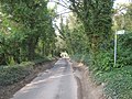
 A 258 from Ringwould to Walmer - geograph.org.uk - 2198712.jpg 2,272 × 1,704; 654 KB
-
 A broomrape on old rifle range - geograph.org.uk - 5567260.jpg 480 × 640; 190 KB
-
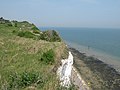
 A grassy cliff top - geograph.org.uk - 2727213.jpg 640 × 430; 64 KB
-
 A long drop over the White Cliffs - geograph.org.uk - 530651.jpg 480 × 640; 113 KB
-
 Alexandra Road, Kingsdown - geograph.org.uk - 4554660.jpg 2,272 × 1,704; 798 KB
-
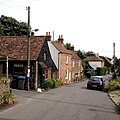
 Back Street, Ringwould - geograph.org.uk - 5061420.jpg 2,448 × 2,448; 1.55 MB
-
 Back Street, Ringwould - geograph.org.uk - 5061427.jpg 3,008 × 2,206; 1.43 MB
-
 Balmoral Road, Kingsdown - geograph.org.uk - 4554657.jpg 2,272 × 1,704; 803 KB
-
 Bayview Road, Kingsdown - geograph.org.uk - 4556856.jpg 2,272 × 1,704; 930 KB
-
 Beach at Oldstairs Bay - geograph.org.uk - 1980232.jpg 1,024 × 768; 235 KB
-
 Beach at Oldstairs Bay - geograph.org.uk - 1980247.jpg 1,024 × 768; 198 KB
-
 Beach at Oldstairs Bay - geograph.org.uk - 1980305.jpg 1,024 × 768; 291 KB
-
 Beach at Oldstairs Bay - geograph.org.uk - 1999997.jpg 1,024 × 768; 271 KB
-
 Beach at Oldstairs Bay - geograph.org.uk - 3710103.jpg 4,320 × 3,240; 4.77 MB
-
 Beach Boulders - geograph.org.uk - 5237735.jpg 2,698 × 1,799; 1.15 MB
-
 Beach hut at Oldstairs Bay - geograph.org.uk - 2905396.jpg 1,023 × 768; 151 KB
-
 Beach huts and boats behind Kingsdown Beach - geograph.org.uk - 3028102.jpg 3,872 × 2,592; 5.66 MB
-
 Beach huts at Kingsdown - geograph.org.uk - 4458772.jpg 4,000 × 3,000; 4.09 MB
-
 Beach Huts near Kingsdown - geograph.org.uk - 2369983.jpg 3,072 × 2,304; 1.81 MB
-
 Beach huts, Kingsdown - geograph.org.uk - 2730457.jpg 640 × 430; 70 KB
-
 Beach Mews, Kingsdown Road - geograph.org.uk - 5495239.jpg 3,264 × 2,448; 3.52 MB
-
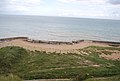
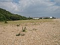
 Beach south of Kingsdown - geograph.org.uk - 2728554.jpg 640 × 313; 45 KB
-
 Beach, Kingsdown - geograph.org.uk - 4024901.jpg 640 × 480; 153 KB
-
 Beach, Oldstairs Bay - geograph.org.uk - 2728543.jpg 640 × 368; 69 KB
-
 Bearing Down On Kingsdown, Walmer and Deal - geograph.org.uk - 5880407.jpg 1,600 × 1,200; 552 KB
-
 Below the white cliffs - geograph.org.uk - 4024955.jpg 640 × 480; 130 KB
-
 Bench beside the Saxon Shore Way - geograph.org.uk - 2380147.jpg 3,072 × 2,304; 2.57 MB
-
 Bench with a view - geograph.org.uk - 2728492.jpg 640 × 430; 60 KB
-
 Benches and beach huts - geograph.org.uk - 3624625.jpg 640 × 427; 94 KB
-
 Boats and Beach Huts near Kingsdown - geograph.org.uk - 2370003.jpg 3,072 × 2,304; 1.96 MB
-
 Boundary Rd - geograph.org.uk - 2730470.jpg 640 × 430; 83 KB
-
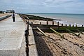
 Breakwaters at Walmer - geograph.org.uk - 3624637.jpg 640 × 427; 70 KB
-
 Breakwaters on Kingsdown Beach - geograph.org.uk - 2369847.jpg 3,072 × 2,304; 1.89 MB
-
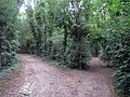
 Bridleway beside Knights Hill Wood - geograph.org.uk - 2370122.jpg 2,304 × 3,072; 3.45 MB
-
 Bridleway crosses Ringwould Road - geograph.org.uk - 2370078.jpg 3,072 × 2,304; 2.47 MB
-
 Bridleway junction on Glen Road - geograph.org.uk - 2340516.jpg 3,072 × 2,304; 1.72 MB
-
 Bridleway junction on Otty Bottom track - geograph.org.uk - 2340649.jpg 3,072 × 2,304; 2.06 MB
-
 Bridleway junction on Wood Hill - geograph.org.uk - 2340533.jpg 3,072 × 2,304; 2.58 MB
-
 Bridleway near Otty Bottom - geograph.org.uk - 2340582.jpg 3,072 × 2,304; 2.26 MB
-
 Bridleway northeast of Free Down Wood - geograph.org.uk - 2846705.jpg 979 × 734; 202 KB
-
 Bridleway to Glen Road - geograph.org.uk - 2340522.jpg 3,072 × 2,304; 2.11 MB
-
 Bridleway to Glen Road - geograph.org.uk - 2370097.jpg 3,072 × 2,304; 2.6 MB
-
 Bridleway to Otty Bottom - geograph.org.uk - 2340604.jpg 3,072 × 2,304; 1.31 MB
-
 Bridleway to Ringwould Road - geograph.org.uk - 2345779.jpg 3,072 × 2,304; 2.27 MB
-
 Bridleway to Victoria Road (2) - geograph.org.uk - 2340595.jpg 3,072 × 2,304; 2.98 MB
-
 Bridleway to Victoria Road (3) - geograph.org.uk - 2340634.jpg 3,072 × 2,304; 2.08 MB
-
 Bridleway to Victoria Road - geograph.org.uk - 2340553.jpg 3,072 × 2,304; 2.54 MB
-
 Bridleway to Victoria Road - geograph.org.uk - 2340571.jpg 3,072 × 2,304; 2.58 MB
-
 Bridleway to West Cliffe - geograph.org.uk - 2340538.jpg 3,072 × 2,304; 1.98 MB
-
 Broken sea defences, Kingsdown - geograph.org.uk - 5567015.jpg 640 × 480; 104 KB
-
 Broken sea wall, Oldstairs Bay - geograph.org.uk - 2728509.jpg 640 × 430; 62 KB
-
 Byway Junction - geograph.org.uk - 1997338.jpg 1,024 × 768; 417 KB
-
 Camping in a field, Kingsdown - geograph.org.uk - 2728508.jpg 640 × 430; 51 KB
-
 Carlton Road, Kingsdown - geograph.org.uk - 4554652.jpg 2,272 × 1,704; 772 KB
-
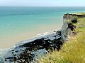
 Chalk cliffs and pebble beach - geograph.org.uk - 485482.jpg 640 × 480; 96 KB
-
 Chalk Cliffs, near Kingsdown - geograph.org.uk - 1408774.jpg 426 × 640; 94 KB
-
 Church Lane, Ringwould - geograph.org.uk - 5061385.jpg 2,448 × 2,448; 1.53 MB
-
 Church Lane, Ringwould - geograph.org.uk - 5061411.jpg 3,264 × 2,448; 2.56 MB
-
 Cliff path near Kingsdown - geograph.org.uk - 3026200.jpg 3,872 × 2,592; 4.36 MB
-
 Cliff top footpath - geograph.org.uk - 2728491.jpg 640 × 430; 82 KB
-
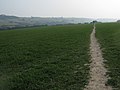
 Cliff top path (Saxon Shore Way) - geograph.org.uk - 2727199.jpg 640 × 430; 84 KB
-
 Cliff top path (Saxon Shore Way) - geograph.org.uk - 2727201.jpg 640 × 430; 80 KB
-
 Cliff top path near Kingsdown - geograph.org.uk - 1408782.jpg 640 × 426; 114 KB
-
 Cliff top path near Kingsdown - geograph.org.uk - 3026222.jpg 3,872 × 2,592; 5.97 MB
-
 Cliffe Road, Kingsdown - geograph.org.uk - 4554535.jpg 2,272 × 1,704; 734 KB
-
 Cliffs near The Leas, Kingsdown - geograph.org.uk - 2380168.jpg 3,072 × 2,304; 2.41 MB
-
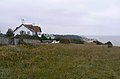 Clifftop houses near Oldstairs Bay - geograph.org.uk - 1505500.jpg 640 × 424; 119 KB
-
 Closed footpath - geograph.org.uk - 5496566.jpg 2,448 × 3,264; 2.15 MB
-
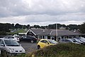 Club House - geograph.org.uk - 2728502.jpg 640 × 430; 63 KB
-
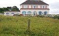
 Clubhouse at Walmer ^ Kingsdown Golf Club - geograph.org.uk - 6392040.jpg 5,456 × 3,632; 2.96 MB
-
 Coastal path above Old Parker's Cap - geograph.org.uk - 3026246.jpg 3,872 × 2,592; 6.05 MB
-
 Completed building, Home Farm - geograph.org.uk - 3232966.jpg 799 × 636; 132 KB
-
 Concrete feature on old rifle range - geograph.org.uk - 5567231.jpg 640 × 480; 199 KB
-
 Concrete stump below high tide level - geograph.org.uk - 5567030.jpg 640 × 480; 139 KB
-
 Connecting footpath in The Lynch - geograph.org.uk - 2345542.jpg 3,072 × 2,304; 2.97 MB
-
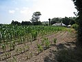 Corn Field off Church Lane - geograph.org.uk - 1980213.jpg 1,024 × 768; 274 KB
-
 Corner of golf course - geograph.org.uk - 5574223.jpg 640 × 480; 132 KB
-
 Crop Field near Oxney Bottom Wood - geograph.org.uk - 1997329.jpg 1,024 × 768; 226 KB
-

-
 Erection of a house, Balmoral Road - geograph.org.uk - 5496574.jpg 3,264 × 2,448; 2.14 MB
-
 Erosion at work - geograph.org.uk - 485500.jpg 480 × 640; 68 KB
-
 Farmland, Ringwould - geograph.org.uk - 5986777.jpg 3,264 × 2,448; 3.09 MB
-
 Farmland, Ringwould - geograph.org.uk - 5986783.jpg 3,264 × 2,448; 3.94 MB
-
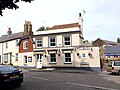 Five Bells, Ringwould - geograph.org.uk - 5061406.jpg 3,264 × 2,448; 1.64 MB
-
 Footpath beside Follyclose Wood - geograph.org.uk - 2345464.jpg 3,072 × 2,304; 1.96 MB
-
 Footpath crosses Glen Road - geograph.org.uk - 2340507.jpg 3,072 × 2,304; 2.33 MB
-
 Footpath in Free Down Wood (2) - geograph.org.uk - 2345350.jpg 3,072 × 2,304; 3.41 MB
-
 Footpath in Free Down Wood - geograph.org.uk - 2345316.jpg 3,072 × 2,304; 2.95 MB
-
 Footpath in Free Down Wood - geograph.org.uk - 2345361.jpg 3,072 × 2,304; 3.73 MB
-
 Footpath in The Lynch - geograph.org.uk - 2345495.jpg 3,072 × 2,304; 3.29 MB
-
 Footpath off Oldstairs Rd - geograph.org.uk - 2728538.jpg 640 × 430; 132 KB
-
 Footpath on Claytons Hill - geograph.org.uk - 2370138.jpg 3,072 × 2,304; 2.29 MB
-
 Footpath sign near The Leas - geograph.org.uk - 2728496.jpg 640 × 399; 69 KB
-
 Footpath to Free Down Wood - geograph.org.uk - 2345707.jpg 3,072 × 2,304; 2.14 MB
-
 Footpath to Glen Road (2) - geograph.org.uk - 2340468.jpg 3,072 × 2,304; 1.58 MB
-
 Footpath to Glen Road - geograph.org.uk - 2340414.jpg 3,072 × 2,304; 2.06 MB
-
 Footpath to Ringwould (2) - geograph.org.uk - 2345700.jpg 3,072 × 2,304; 2.64 MB
-
 Footpath to Ringwould (3) - geograph.org.uk - 2345725.jpg 3,072 × 2,181; 2.74 MB
-
 Footpath to Ringwould - geograph.org.uk - 2345682.jpg 3,072 × 2,304; 2.47 MB
-
 Forge House - geograph.org.uk - 2345729.jpg 3,072 × 2,304; 1.71 MB
-
 Fossil Beach - geograph.org.uk - 4326498.jpg 640 × 480; 34 KB
-
 Front Street, Ringwould - geograph.org.uk - 2846657.jpg 1,059 × 794; 169 KB
-
 Front Street, Ringwould - geograph.org.uk - 2846674.jpg 1,059 × 794; 176 KB
-
 Front Street, Ringwould - geograph.org.uk - 5061380.jpg 3,264 × 2,448; 1.93 MB
-
 Front Street, Ringwould - geograph.org.uk - 5061389.jpg 3,264 × 2,448; 1.7 MB
-
 Front Street, Ringwould - geograph.org.uk - 5061395.jpg 2,448 × 2,448; 1.35 MB
-
 Galleon House, Oldstairs Bay - geograph.org.uk - 6392068.jpg 5,456 × 3,632; 2.4 MB
-
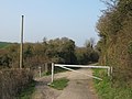 Gate on the track on Otty Bottom - geograph.org.uk - 2340656.jpg 3,072 × 2,304; 2.31 MB
-
 Georgian postbox at Oldstairs Bay - geograph.org.uk - 6392063.jpg 3,632 × 5,456; 2.83 MB
-
 Glen Road - geograph.org.uk - 2340484.jpg 3,072 × 2,304; 3.35 MB
-
 Glen Road, Kingsdown - geograph.org.uk - 4554659.jpg 2,272 × 1,704; 848 KB
-
 Golf course, East Hill - geograph.org.uk - 5574205.jpg 640 × 480; 77 KB
-
 Groynes on the beach at Kingsdown - geograph.org.uk - 3028080.jpg 3,872 × 2,592; 4.91 MB
-
 Hangman's Lane - geograph.org.uk - 5107604.jpg 2,052 × 1,532; 1.27 MB
-
 Hangman's Lane bridleway to Ringwould - geograph.org.uk - 5109590.jpg 2,592 × 1,936; 1.74 MB
-
 Hangman's Lane, Ringwould - geograph.org.uk - 5061433.jpg 3,264 × 2,448; 1.74 MB
-
 Hangman's Lane, Ringwould - geograph.org.uk - 5061469.jpg 3,264 × 2,448; 2.51 MB
-
 Hillcrest Road, Kingsdown - geograph.org.uk - 4556861.jpg 2,272 × 1,704; 949 KB
-
 Hope Point - geograph.org.uk - 4556966.jpg 2,272 × 1,704; 835 KB
-
 House near Hope Point - geograph.org.uk - 2727224.jpg 640 × 430; 77 KB
-
 House on The Leas - geograph.org.uk - 2728495.jpg 640 × 430; 60 KB
-
 House on The Leas - geograph.org.uk - 6391923.jpg 5,456 × 3,632; 3.11 MB
-
 House on The Leas - geograph.org.uk - 6391929.jpg 5,456 × 3,632; 2.57 MB
-
 House on The Lees - geograph.org.uk - 2325241.jpg 640 × 480; 102 KB
-
 Houses in South Road - geograph.org.uk - 3624622.jpg 640 × 427; 79 KB
-
 Houses on Hangman's Lane - geograph.org.uk - 1980208.jpg 1,024 × 768; 234 KB
-
 Houses on South Road - geograph.org.uk - 1980294.jpg 1,024 × 768; 264 KB
-
 KAC (Kingsdown Angling Club) - geograph.org.uk - 2730461.jpg 640 × 430; 63 KB
-
 Kings Head, Kingsdown - geograph.org.uk - 4554638.jpg 2,272 × 1,704; 787 KB
-
 Kingsdown Hill, Kingsdown - geograph.org.uk - 4556937.jpg 2,272 × 1,704; 1.19 MB
-
 Kingsdown Wood - geograph.org.uk - 1097350.jpg 640 × 480; 168 KB
-
 Kissinggate near Glen Road - geograph.org.uk - 2340434.jpg 3,072 × 2,304; 2.43 MB
-

-
 Landing Ramp near Kingsdown - geograph.org.uk - 2369968.jpg 3,072 × 2,304; 2.04 MB
-
 Large house near Hope Point - geograph.org.uk - 2727220.jpg 640 × 430; 74 KB
-

-
 Low tide below the white cliffs - geograph.org.uk - 5567132.jpg 640 × 480; 97 KB
-
 Low tide fishermen - geograph.org.uk - 4024933.jpg 640 × 480; 121 KB
-
 Low tide fishermen - geograph.org.uk - 5567037.jpg 640 × 480; 125 KB
-
 Lower footpath in The Lynch - geograph.org.uk - 2345618.jpg 3,072 × 2,304; 2.79 MB
-

-
 Marine Villa - geograph.org.uk - 530654.jpg 640 × 480; 89 KB
-
-

-
 Muddy track heading SW near Hill Farm - geograph.org.uk - 346863.jpg 640 × 480; 161 KB
-
 National Cycle Network 1 - geograph.org.uk - 6392059.jpg 3,632 × 5,456; 3.96 MB
-

-
 National Trust sign on cliff walk - geograph.org.uk - 1505486.jpg 640 × 480; 228 KB
-
 New building, Home Farm, Ringwould - geograph.org.uk - 2846694.jpg 832 × 623; 126 KB
-
 North Road, Kingsdown - geograph.org.uk - 4554545.jpg 2,272 × 1,704; 855 KB
-
 North Road, Kingsdown - geograph.org.uk - 6392171.jpg 5,456 × 3,632; 3.03 MB
-
 North St - geograph.org.uk - 2730458.jpg 640 × 430; 72 KB
-
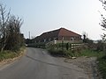
 Nutwood, Dover Road (A258) - geograph.org.uk - 5708915.jpg 3,264 × 2,448; 3.8 MB
-
 Old Sea wall - geograph.org.uk - 2728501.jpg 640 × 430; 66 KB
-

-
 Old sea wall from clifftop, near Oldstairs Bay - geograph.org.uk - 2380171.jpg 3,072 × 2,304; 2.34 MB
-
 Oldstairs Bay - geograph.org.uk - 2321460.jpg 480 × 640; 85 KB
-
 Oldstairs Bay - geograph.org.uk - 2905395.jpg 1,024 × 768; 229 KB
-
 Oldstairs Bay - geograph.org.uk - 3026255.jpg 3,872 × 2,592; 5.04 MB
-
 Oldstairs Bay - geograph.org.uk - 4326496.jpg 640 × 480; 49 KB
-
 Oldstairs Bay - geograph.org.uk - 4556947.jpg 2,272 × 1,704; 808 KB
-
 Oldstairs Bay - geograph.org.uk - 4556949.jpg 2,272 × 1,704; 865 KB
-
 Oldstairs Bay - geograph.org.uk - 4556953.jpg 2,185 × 1,639; 597 KB
-
 Oldstairs Bay near Kingsdown - geograph.org.uk - 6391937.jpg 5,456 × 3,632; 2.54 MB
-
 Oldstairs Road - geograph.org.uk - 2905391.jpg 1,024 × 768; 200 KB
-
 Oldstairs Road, Kingsdown - geograph.org.uk - 4556940.jpg 2,272 × 1,704; 933 KB
-
 On the beach, Kingsdown - geograph.org.uk - 4024915.jpg 640 × 480; 167 KB
-
 Part of the military firing range - geograph.org.uk - 485457.jpg 640 × 480; 37 KB
-
 Path along Cliffs - geograph.org.uk - 4326491.jpg 480 × 640; 45 KB
-
 Path between St. Margaret's Bay and Kingsdown - geograph.org.uk - 3709765.jpg 4,320 × 3,240; 3.84 MB
-

-
 Pentire House on The Leas - geograph.org.uk - 6391935.jpg 3,971 × 2,509; 1.84 MB
-
 Pioneer vegetation on the beach - geograph.org.uk - 2730469.jpg 640 × 430; 74 KB
-
 Postbox by the shore - geograph.org.uk - 2905393.jpg 640 × 480; 159 KB
-
 Primroses along Church Cliff - geograph.org.uk - 4458615.jpg 4,000 × 3,000; 4.26 MB
-
 Public footpath at foot of cliffs - geograph.org.uk - 5567564.jpg 640 × 480; 144 KB
-
 Public footpath to Wood Hill - geograph.org.uk - 348592.jpg 640 × 480; 178 KB
-
 Queen's Rise, Ringwould - geograph.org.uk - 5061423.jpg 3,264 × 2,448; 1.66 MB
-
 Queensdown Road, Kingsdown - geograph.org.uk - 4556847.jpg 2,272 × 1,704; 895 KB
-
 Queensdown Road, Kingsdown - geograph.org.uk - 4556852.jpg 2,272 × 1,704; 948 KB
-
 Queensdown Road, Kingsdown - geograph.org.uk - 4556859.jpg 2,272 × 1,704; 917 KB
-
 Raised feature on rifle range sea wall - geograph.org.uk - 5567215.jpg 640 × 480; 111 KB
-
 Remains of a wind turbine-pump circa 1940^ - geograph.org.uk - 75237.jpg 640 × 480; 126 KB
-
 Ringwould Road, Ringwould - geograph.org.uk - 5061377.jpg 3,264 × 2,448; 1.54 MB
-
 Ringwould, Ripple Mill - geograph.org.uk - 2198705.jpg 2,272 × 1,704; 551 KB
-
 Road to Hill Farm - geograph.org.uk - 348579.jpg 640 × 480; 209 KB
-
 Roadside verge, Undercliffe Rd - geograph.org.uk - 2728550.jpg 640 × 430; 60 KB
-
 Saxon Shore Way - geograph.org.uk - 2314042.jpg 640 × 288; 63 KB
-
 Saxon Shore Way - geograph.org.uk - 2325248.jpg 640 × 480; 97 KB
-
 Saxon Shore Way - geograph.org.uk - 2325254.jpg 640 × 427; 90 KB
-
 Saxon Shore Way - geograph.org.uk - 2727225.jpg 640 × 430; 93 KB
-
 Saxon Shore Way approaching Kingsdown - geograph.org.uk - 3264072.jpg 911 × 626; 177 KB
-
 Saxon Shore Way approaching Kingsdown in 2003 - geograph.org.uk - 3264082.jpg 1,115 × 749; 198 KB
-
 Saxon Shore Way at Kingsdown - geograph.org.uk - 6392092.jpg 5,456 × 3,632; 2.43 MB
-
 Saxon Shore Way at Kingsdown - geograph.org.uk - 6392093.jpg 5,456 × 3,632; 3.08 MB
-
 Saxon Shore Way at Kingsdown Leas - geograph.org.uk - 6391884.jpg 5,456 × 3,632; 5.39 MB
-
 Saxon Shore Way at Kingsdown Leas - geograph.org.uk - 6391885.jpg 5,456 × 3,632; 2.87 MB
-
 Saxon Shore Way at Kingsdown Leas - geograph.org.uk - 6391889.jpg 5,456 × 3,632; 2.62 MB
-
 Saxon Shore Way at Oldstairs Bay - geograph.org.uk - 6392060.jpg 4,739 × 3,190; 1.94 MB
-
 Saxon Shore Way at Oldstairs Bay - geograph.org.uk - 6392091.jpg 5,456 × 3,632; 1.79 MB


_-_geograph.org.uk_-_2340595.jpg)
_-_geograph.org.uk_-_2340634.jpg)


_-_geograph.org.uk_-_2727199.jpg)
_-_geograph.org.uk_-_2727201.jpg)


_-_geograph.org.uk_-_2345350.jpg)


_-_geograph.org.uk_-_2340468.jpg)

_-_geograph.org.uk_-_2345700.jpg)
_-_geograph.org.uk_-_2345725.jpg)


_-_geograph.org.uk_-_2730461.jpg)


_-_geograph.org.uk_-_5708915.jpg)


