Category:Ringstraße (Kiel)
Jump to navigation
Jump to search
street in Kiel, Schleswig-Holstein, Germany  | |||||
| Upload media | |||||
| Instance of | |||||
|---|---|---|---|---|---|
| Location | |||||
 | |||||
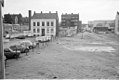
Deutsch: Die Ringstraße sollte ab 1870 nach dem Ausbauplan des Stadtbaumeisters Gustav Ludolf Martens ringförmig, beginnend an der Kaistraße an der Hörn, um die Stadt herum gebaut werden und sie gemeinsam mit der Brunswiker Straße umschließen. Dieser Plan wurde jedoch nicht vollständig umgesetzt, u. a. durch den Bau des Kieler Hauptbahnhofs. Die Straße verläuft später nur vom Sophienblatt zum Schützenwall.
English: From 1870 onwards, according to the expansion plan of the city architect Gustav Ludolf Martens, the Ringstrasse should built in a ring shape around the city, starting at Kaistrasse at the Hörn (southern tip of the Kiel harbour) and enclosing it together with Brunswiker Strasse. This plan was not fully implemented, et al. through the construction of Kiel Central Train Station. Later the street only runs from Sophienblatt to Schützenwall.
Subcategories
This category has the following 6 subcategories, out of 6 total.
C
- Club 68 (Kiel) (3 F)
H
- Hintz Hotel (Kiel) (6 F)
R
- Rabe's Hotel (Kiel) (6 F)
- Ringstraße 28 (Kiel) (4 F)
- Ringstraße 32 (Kiel) (13 F)
Media in category "Ringstraße (Kiel)"
The following 70 files are in this category, out of 70 total.
-

-
 Abriss Hintz Hotel und Neubau Bordesholmer Sparkasse (Kiel 43.953).jpg 1,024 × 675; 96 KB
-
 Abriss Wohnhaus in der Ringstraße 8 (Ecke Hopfenstraße) (Kiel 68.868).jpg 1,024 × 689; 123 KB
-
 Bauerndemonstration auf der Ringstraße (Kiel 48.519).jpg 1,024 × 689; 137 KB
-

-
 Debeka kiel 20170221 111834.jpg 3,024 × 4,032; 3.08 MB
-

-
 Drogeriemarkt Dromarkt in der Ringstraße 48 (Kiel 68.781).jpg 1,024 × 685; 113 KB
-
 Ecke Kirchhofallee Ringstraße.jpg 5,664 × 4,248; 5.58 MB
-

-

-

-
 Hausabriss in der Ringstraße 7-11 (Kiel 43.271).jpg 1,024 × 680; 127 KB
-
 Hausabriss in der Ringstraße 7-11 (Kiel 43.272).jpg 1,024 × 680; 122 KB
-
 Holprige Ringstraße (Kiel 31.540).jpg 1,024 × 701; 151 KB
-
 HUK-COBURG Versicherung - Geschäftsstelle Kiel.jpg 2,992 × 2,992; 3.25 MB
-
 In der Ringstraße (01) (53137247117).jpg 5,184 × 3,456; 11.95 MB
-
 In der Ringstraße (02) (53139469122).jpg 5,184 × 3,456; 13.1 MB
-
 In der Ringstraße (09) (53149945636).jpg 3,456 × 5,184; 7.95 MB
-
 Kiel 20170221 111813.jpg 3,024 × 4,032; 4.69 MB
-
 Kreuzung Ringstraße und Königsweg (Kiel 57.355).jpg 1,024 × 687; 98 KB
-
 Kreuzung Ringstraße und Königsweg (Kiel 57.356).jpg 1,024 × 687; 114 KB
-
 Luftangriff auf Kiel in der Nacht vom 07. zum 08.04.1941 (Kiel 49.897).jpg 1,024 × 1,479; 208 KB
-
 Luftangriff auf Kiel in der Nacht vom 07. zum 08.04.1941 (Kiel 49.898).jpg 1,024 × 1,461; 236 KB
-
 Luftbilder Kiel (Kiel 36.325).jpg 1,012 × 724; 147 KB
-

-

-

-

-

-
 Pflanzung eines Baumes an der Ringstraße, Ecke Königsweg (Kiel 54.584).jpg 1,024 × 1,515; 267 KB
-
 Rathaus Hopfenstraße (03) (53139470947).jpg 5,184 × 3,456; 16.12 MB
-
 Rathaus Hopfenstraße (03) (53142482103).jpg 5,184 × 3,456; 20.36 MB
-
 Rathaus Hopfenstraße (04) (53144597053).jpg 5,184 × 3,456; 9.83 MB
-
 Rathaus Hopfenstraße (05) (53146771911).jpg 5,184 × 3,456; 15.35 MB
-
 Richtfest Neubau Bordesholmer Sparkasse (Kiel 45.240).jpg 1,024 × 678; 96 KB
-
 Richtfest Neubau der Bordesholmer Sparkasse (Kiel 45.239).jpg 1,024 × 678; 122 KB
-
 Ringstrasse 52-54 Kiel Einfriedung.jpg 2,061 × 1,546; 1.18 MB
-
 Ringstrasse 52-54 Kiel.jpg 2,576 × 1,932; 2.4 MB
-
 Ringstraße in Kiel 2017.jpg 2,626 × 3,469; 5.25 MB
-
 Ringstraße (Kiel 31.541).jpg 1,024 × 678; 150 KB
-
 Ringstraße (Kiel 31.542).jpg 1,024 × 1,548; 235 KB
-
 Ringstraße (Kiel 31.543).jpg 1,024 × 1,543; 198 KB
-
 Ringstraße (Kiel 31.544).jpg 1,024 × 685; 101 KB
-
 Ringstraße (Kiel 31.806).jpg 1,024 × 1,512; 183 KB
-
 Ringstraße (Kiel 31.807).jpg 1,024 × 1,533; 232 KB
-
 Ringstraße 57.jpg 5,664 × 4,248; 5.75 MB
-
 Ringstraße Ecke Sophienblatt (Kiel 41.733).jpg 1,024 × 676; 114 KB
-
 Ringstraße Ecke Sophienhof (Kiel 41.734).jpg 1,024 × 676; 114 KB
-
 Ringstraße Kiel-Südfriedhof.jpg 3,648 × 2,736; 1.98 MB
-

-
 Ringstraße, Ecke Königsweg (Kiel 29.744).jpg 1,024 × 673; 107 KB
-

-

-
-

-

-
 Sophienblatt (01) (53140538553).jpg 5,184 × 3,456; 12.76 MB
-
 Sophienblatt (02) (53141412367).jpg 5,184 × 3,456; 11.41 MB
-
 Sophienblatt (09) (53190945578).jpg 5,184 × 3,456; 9.49 MB
-
 Sophienblatt, Ecke Ringstraße (Kiel 41.382).jpg 1,024 × 678; 99 KB
-
 St Juergen Kapelle 1 2768.jpg 1,024 × 795; 201 KB
-
 Stadtwerke kiel auto 20170221 112758.jpg 4,032 × 3,024; 4.48 MB
-
 Straßenbauarbeiten in der Ringstraße (Kiel 65.635).jpg 1,024 × 685; 151 KB
-
 Südfriedhof (Kiel 66.150).jpg 1,024 × 682; 202 KB
-
 Trümmerräumung und Wiederaufbau (Kiel 50.145).jpg 1,024 × 696; 97 KB
-
 Trümmerräumung und Wiederaufbau (Kiel 50.146).jpg 1,024 × 734; 100 KB
-
 Verbreiterung der Ringstraße (Kiel 65.451).jpg 1,024 × 677; 156 KB
-
 Verlängerung des Schützenwalls bis zum Exerzierplatz (Kiel 47.700).jpg 1,024 × 681; 102 KB
-
 Wohnhaus in der Ringstraße 8 (Ecke Hopfenstraße) (Kiel 68.760).jpg 1,024 × 685; 111 KB
.jpg)
.jpg)
_(Kiel_68.868).jpg)
.jpg)
.jpg)

.jpg)
.jpg)

_in_der_Ringstra%C3%9Fe_(Kiel_41.115).jpg)
_in_der_Ringstra%C3%9Fe_(Kiel_41.116).jpg)
.jpg)
.jpg)
.jpg)
.jpg)

_(53137247117).jpg)
_(53139469122).jpg)
_(53149945636).jpg)

.jpg)
.jpg)
.jpg)
.jpg)
.jpg)
_(Kiel_45.685).jpg)
.jpg)
.jpg)
.jpg)
.jpg)
.jpg)
_(53139470947).jpg)
_(53142482103).jpg)
_(53144597053).jpg)
_(53146771911).jpg)
.jpg)
.jpg)


.jpg)
.jpg)
.jpg)
.jpg)
.jpg)
.jpg)

.jpg)
.jpg)

.jpg)
.jpg)
.jpg)
.jpg)
.jpg)
.jpg)
_(53140538553).jpg)
_(53141412367).jpg)
_(53190945578).jpg)
.jpg)


.jpg)
.jpg)
.jpg)
.jpg)
.jpg)
.jpg)
_(Kiel_68.760).jpg)