Category:Ring of Gullion
Jump to navigation
Jump to search
geological formation and area  | |||||
| Upload media | |||||
| Instance of | |||||
|---|---|---|---|---|---|
| Location | County Armagh, Northern Ireland | ||||
| Heritage designation | |||||
| official website | |||||
 | |||||
Media in category "Ring of Gullion"
The following 23 files are in this category, out of 23 total.
-

-

-

-
 Fallen trees across the track - geograph.org.uk - 3537938.jpg 1,024 × 768; 392 KB
-
 Gullion3Dsatelliteview.jpg 920 × 322; 86 KB
-
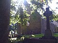 KilleavyOldChurch 09 12 09.jpg 1,600 × 1,200; 840 KB
-
 Mountain Road in the Townland of Lislea - geograph.org.uk - 1527649.jpg 640 × 480; 101 KB
-
 Mountain Road near Drumilly - geograph.org.uk - 1527634.jpg 640 × 480; 76 KB
-
-

-
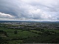
 Ring of Gullion AONB - 20200903113927.jpg 4,032 × 3,024; 10.34 MB
-

-

-
 Stile across the forest boundary fence - geograph.org.uk - 3537775.jpg 1,024 × 768; 361 KB
-

-

-
 Track leading northwards to the Ballynamona Road - geograph.org.uk - 3537958.jpg 768 × 1,024; 348 KB
-

-

-
 View northwards to the Gap of the North.jpg 2,560 × 1,536; 1.31 MB
-
 View of standing stone in adjacent field.jpg 2,560 × 1,536; 1.26 MB
-

-
 Way marker of the Ring of Gullion Way - geograph.org.uk - 3537762.jpg 768 × 1,024; 284 KB


