Category:Rinerhorn
Jump to navigation
Jump to search
| Object location | | View all coordinates using: OpenStreetMap |
|---|
mountain in Switzerland  | |||||
| Upload media | |||||
| Instance of | |||||
|---|---|---|---|---|---|
| Location |
| ||||
| Mountain range | |||||
| Topographic prominence |
| ||||
| Topographic isolation |
| ||||
| Elevation above sea level |
| ||||
 | |||||
Media in category "Rinerhorn"
The following 21 files are in this category, out of 21 total.
-
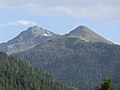
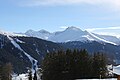 Alplihorn and Rinerhorn from Schatzalp.jpg 5,760 × 3,840; 5.02 MB
-
 Bergstation Hubel as seen from Rinerhorn.jpg 4,608 × 3,456; 8.85 MB
-
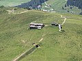
 Bergstation Juonli.jpg 4,608 × 3,456; 7.86 MB
-
 Bergstation Nüllisch.jpg 4,608 × 3,456; 8.56 MB
-
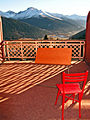 Blick auf die Zimmerterasse.jpg 1,536 × 2,048; 2.65 MB
-
 Davos as seen from Rinerhorn.jpg 2,048 × 1,536; 1.17 MB
-
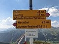 Fingerpost on Rinerhorn.jpg 4,608 × 3,456; 5.79 MB
-
 Geschichte Rinerhorn.JPEG 1,536 × 2,048; 898 KB
-
 Jakobshorn as seen from Rinerhorn.jpg 4,608 × 3,456; 6.89 MB
-
 Leidbachhorn and Rinerhorn as seen from Davos.jpg 4,608 × 3,456; 7.1 MB
-
 Leidbachhorn as seen from Rinerhorn.jpg 4,608 × 3,456; 7.69 MB
-
 Rinerhorn as seen from Marchhüreli.jpg 4,608 × 3,456; 7.45 MB
-
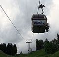
 Rinerhorn Bahn 01.JPG 3,456 × 2,592; 1.26 MB
-
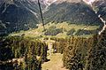
 Rinerhorn Bahn 02.JPG 2,657 × 2,590; 793 KB
-
 Rinerhorn Bahn.jpg 898 × 1,165; 310 KB
-
 Rinerhorn Panorama Hochauflösend.jpg 59,904 × 4,036; 22.81 MB
-
 Rinerhorn Panorama.jpg 11,520 × 1,080; 7.24 MB
-
 Rinerhorn, Leidbachhorn and Älplihorn as seen from Wannengrat.jpg 5,184 × 3,888; 5.44 MB
-
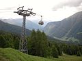
 Rinerhornbahn June 2006.jpg 1,796 × 1,184; 522 KB
-
 Stn. Jatzmeden-Rinerhorn and Bergstation Juonli as seen from Rinerhorn.jpg 4,608 × 3,456; 9.98 MB
-
 Summit of Rinerhorn.jpg 4,608 × 3,456; 7.89 MB


