Category:Rimington
Jump to navigation
Jump to search
English: Rimington is a civil parish in the Ribble Valley, Lancashire, England. It is east of Clitheroe and south of the A59 road. The parish consists of the hamlets of Howgill, Martin Top, Newby and Stopper Lane, and was formerly in the West Riding of Yorkshire. The parish council is called Rimington and Middop, and is shared with Middop, a small rural parish east of Rimington with a population of 43 as of the 2001 census. (→Rimington)
Nederlands: Rimington is een plaats en civil parish in het bestuurlijke gebied Ribble Valley, in het Engelse graafschap Lancashire met 382 inwoners. (→Rimington)
Polski: Rimington – wieś w Anglii, w hrabstwie Lancashire, w dystrykcie Ribble Valley. Leży 50 km na północ od miasta Manchester i 304 km na północny zachód od Londynu. W 2001 miejscowość liczyła 382 mieszkańców. (→Rimington)

village and civil parish in Lancashire, UK  | |||||
| Upload media | |||||
| Instance of | |||||
|---|---|---|---|---|---|
| Location | Ribble Valley, Lancashire, North West England, England | ||||
| Population |
| ||||
| Said to be the same as | Rimington (Wikimedia duplicated page, civil parish) | ||||
 | |||||
Subcategories
This category has the following 3 subcategories, out of 3 total.
Media in category "Rimington"
The following 199 files are in this category, out of 199 total.
-
 "Cosgroves" - geograph.org.uk - 181824.jpg 640 × 480; 254 KB
-
 47445 crosses Swan Side Viaduct.jpg 1,024 × 768; 395 KB
-
 A farmhouse at Howgill - geograph.org.uk - 4889345.jpg 4,530 × 2,425; 7.83 MB
-
 A gate at Rough Hill offering a view of Pendle Hill - geograph.org.uk - 4574595.jpg 4,372 × 2,909; 5.51 MB
-
 A small new pond - geograph.org.uk - 1579960.jpg 640 × 480; 48 KB
-
 A682 towards Gisburn - geograph.org.uk - 5870676.jpg 640 × 480; 74 KB
-
 A682, Todber - geograph.org.uk - 5870691.jpg 640 × 480; 69 KB
-
 Access Drive to Coverdale - geograph.org.uk - 2762766.jpg 4,320 × 3,240; 3.47 MB
-
 Access Lane to Rakes Barn - geograph.org.uk - 3252054.jpg 4,320 × 3,240; 3.74 MB
-
 Access Track leaving Higher Gills - geograph.org.uk - 3388894.jpg 4,320 × 3,240; 3.87 MB
-
 An "S" bend in Stopper Lane - geograph.org.uk - 4574408.jpg 640 × 400; 140 KB
-
 Back Lane, Rimington - geograph.org.uk - 2630418.jpg 4,000 × 3,000; 6.17 MB
-
 Barn at Hollins Farm - geograph.org.uk - 3252058.jpg 4,127 × 3,220; 3.34 MB
-
 Below Jackson Slack Hill - geograph.org.uk - 3387779.jpg 4,320 × 3,240; 4.84 MB
-
 Bench Mark, Salem Congregational Church - geograph.org.uk - 2202273.jpg 480 × 640; 103 KB
-
 The 'Black Bull', Rimington - geograph.org.uk - 872945.jpg 640 × 508; 91 KB
-
 Bridge over Ings Beck - geograph.org.uk - 5065694.jpg 4,000 × 3,000; 3.84 MB
-
 Buried Footpath near Clough Head - geograph.org.uk - 3388906.jpg 4,320 × 3,240; 3.17 MB
-
 Cattle crossing Rimington Bridge - geograph.org.uk - 4574441.jpg 4,336 × 2,698; 7.81 MB
-
 Cattle grazing near Westby Hall Farm - geograph.org.uk - 5870698.jpg 640 × 480; 53 KB
-
 Clough Head through a wall - geograph.org.uk - 1579950.jpg 640 × 480; 131 KB
-
 Coal Pit Lane in Winter - geograph.org.uk - 2762773.jpg 4,320 × 3,240; 3.46 MB
-
 Cottage under repair (geograph 2708751).jpg 2,592 × 1,944; 1.27 MB
-
 Cottages on Martin Top Lane - geograph.org.uk - 2630419.jpg 4,000 × 3,000; 5.46 MB
-
 Countryside beside Rimington Lane - geograph.org.uk - 3249832.jpg 4,320 × 3,240; 5.49 MB
-
 Deer Farming Near Gisburn - geograph.org.uk - 3281789.jpg 1,600 × 1,200; 923 KB
-
 Direction Sign – Signpost on Rimington Lane - geograph.org.uk - 6692401.jpg 1,044 × 407; 153 KB
-
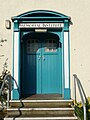
 Door in Rimington.JPG 2,592 × 3,456; 3.69 MB
-
 Downham Bridge - geograph.org.uk - 4573436.jpg 4,592 × 2,845; 6.9 MB
-
 Drive to Raikes Farm - geograph.org.uk - 2202291.jpg 482 × 640; 79 KB
-
 Drive to What Close - geograph.org.uk - 2202155.jpg 640 × 480; 95 KB
-
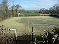 FC Rimington 01.JPG 3,456 × 2,592; 4.26 MB
-
 FC Rimington 02.JPG 3,456 × 2,592; 4.22 MB
-
 FC Rimington 03.JPG 3,456 × 2,592; 4.29 MB
-
 FC Rimington 04.JPG 3,456 × 2,592; 4.44 MB
-
 Fence in Rimington.JPG 3,456 × 2,592; 4.34 MB
-
 Field , with Moor Close - geograph.org.uk - 1579969.jpg 640 × 480; 52 KB
-
 Field below Cringlands Hill - geograph.org.uk - 3251741.jpg 4,320 × 3,240; 5.88 MB
-
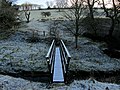 Footbridge over Ings Beck - geograph.org.uk - 3250313.jpg 4,320 × 3,240; 5.31 MB
-
 Footpath descends towards Ings Beck - geograph.org.uk - 1579993.jpg 640 × 480; 95 KB
-
 Footpath leading North from Great Todber - geograph.org.uk - 3251752.jpg 4,222 × 3,234; 5.94 MB
-
 Footpath, Hardacre Hill - geograph.org.uk - 2202159.jpg 640 × 480; 84 KB
-
 Gisburn, Hardhouse Farm - geograph.org.uk - 3121989.jpg 3,456 × 2,304; 3.36 MB
-
 Grass Track leading away from Hollins Farm - geograph.org.uk - 3252612.jpg 4,320 × 3,240; 4.9 MB
-
 Grassland near Great Todber - geograph.org.uk - 5870679.jpg 640 × 480; 60 KB
-
 Grassland, Widow Hill - geograph.org.uk - 5870694.jpg 640 × 480; 104 KB
-
 Grazing near Little Middop - geograph.org.uk - 5870673.jpg 640 × 480; 68 KB
-
 Great Todber Hill - geograph.org.uk - 4888953.jpg 3,664 × 2,700; 6.95 MB
-
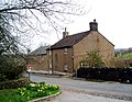 Halsteads Farm, Rimington - geograph.org.uk - 1679638.jpg 2,080 × 1,608; 957 KB
-
 Hard House Farm - geograph.org.uk - 105803.jpg 640 × 426; 124 KB
-
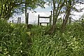 Hidden steps and a stile lead to a footpath at Eel Beck - geograph.org.uk - 4576165.jpg 4,592 × 3,056; 7.68 MB
-
 Howgill Beck - geograph.org.uk - 4694019.jpg 4,959 × 2,729; 1.56 MB
-
 Howgill Beck - geograph.org.uk - 4889865.jpg 4,466 × 2,965; 7.86 MB
-
 Howgill Beck - geograph.org.uk - 4890377.jpg 4,592 × 3,056; 7.07 MB
-
 Howgill Farm - geograph.org.uk - 3252035.jpg 4,320 × 3,240; 3.56 MB
-
 Howgill Lane - geograph.org.uk - 3251755.jpg 4,308 × 2,965; 4.58 MB
-
 Howgill Lane - geograph.org.uk - 4889024.jpg 4,592 × 3,056; 7.7 MB
-
 Howgill Lane - geograph.org.uk - 5870686.jpg 640 × 480; 95 KB
-
-
 Ings Beck - geograph.org.uk - 166939.jpg 640 × 480; 132 KB
-
 Ings Beck - Old Lancashire and Yorkshire Border.jpg 3,456 × 2,304; 5.42 MB
-
 Ings Beck from Downham Bridge - geograph.org.uk - 4573452.jpg 4,592 × 3,056; 6.84 MB
-
 Ings End - geograph.org.uk - 4575969.jpg 4,157 × 2,766; 5.72 MB
-
 Ings End - geograph.org.uk - 4694007.jpg 5,045 × 3,251; 1.69 MB
-
 Looking north on the A682 - geograph.org.uk - 5870699.jpg 640 × 480; 75 KB
-
 Mailbox in Rimington.JPG 2,592 × 3,456; 4.28 MB
-
 Main Street, Rimington - geograph.org.uk - 2630413.jpg 3,355 × 2,323; 2.94 MB
-
 Memorial - geograph.org.uk - 169685.jpg 640 × 480; 187 KB
-
 Memorial Institute Rimington 1.JPG 2,592 × 3,456; 4.05 MB
-
 Memorial Institute Rimington 2.JPG 3,456 × 2,592; 4.33 MB
-
 Memorial Institute Rimington 3.JPG 3,456 × 2,592; 4.29 MB
-
 Mill stone in Rimington.JPG 3,456 × 2,592; 4.38 MB
-
 Mill stones in Rimington.JPG 3,456 × 2,592; 4.6 MB
-
 Mist over Pendle - geograph.org.uk - 1579978.jpg 640 × 480; 56 KB
-

-
 On Bale Hill - geograph.org.uk - 3387786.jpg 4,320 × 3,240; 5.32 MB
-
 On Howgill Lane - geograph.org.uk - 3252040.jpg 4,320 × 3,240; 4.44 MB
-
 Pasture beside Clough Head - geograph.org.uk - 3388923.jpg 4,320 × 3,240; 5.09 MB
-
 Pasture beside Stankill Beck - geograph.org.uk - 3250323.jpg 4,320 × 3,240; 6.44 MB
-
 Pasture by Rimington Lane - geograph.org.uk - 3249821.jpg 4,320 × 3,240; 4.76 MB
-
 Pasture in Rimington - geograph.org.uk - 3250308.jpg 4,320 × 3,240; 4.46 MB
-
 Path in Rimington 01.JPG 2,592 × 3,456; 4.51 MB
-
 Path near Rimington.JPG 2,592 × 3,456; 4.34 MB
-
 Pendle Hill 01.JPG 3,456 × 2,592; 4.16 MB
-
 Railway viaduct over Ings Beck - geograph.org.uk - 1139604.jpg 640 × 480; 215 KB
-
 Rimington - geograph.org.uk - 4573521.jpg 4,445 × 2,287; 7.35 MB
-
 Rimington 01.JPG 3,456 × 2,592; 3.58 MB
-
 Rimington 03.JPG 3,456 × 2,592; 4.6 MB
-
 Rimington 04.JPG 3,456 × 2,592; 4.49 MB
-
 Rimington 05.JPG 3,456 × 2,592; 4.44 MB
-
 Rimington 07.JPG 3,456 × 2,592; 4.61 MB
-
 Rimington 08.JPG 3,456 × 2,592; 4.3 MB
-
 Rimington 09.JPG 3,456 × 2,592; 4.31 MB
-
 Rimington 10.JPG 3,456 × 2,592; 3.66 MB
-
 Rimington 12.JPG 3,456 × 2,592; 4.14 MB
-
 Rimington 13.JPG 3,456 × 2,592; 4.18 MB
-
 Rimington 14.JPG 3,456 × 2,592; 4.55 MB
-
 Rimington 15.JPG 3,456 × 2,592; 4.21 MB
-
 Rimington 16.JPG 3,456 × 2,592; 4.59 MB
-
 Rimington 17.JPG 3,456 × 2,592; 4.55 MB
-
 Rimington 19.JPG 3,456 × 2,592; 4.28 MB
-
 Rimington 20.JPG 3,456 × 2,592; 4.62 MB
-
 Rimington 21.JPG 3,456 × 2,592; 4.27 MB
-
 Rimington 22.JPG 3,456 × 2,592; 4.11 MB
-
 Rimington 23.JPG 3,456 × 2,592; 4.39 MB
-
 Rimington 24.JPG 3,456 × 2,592; 4.58 MB
-
 Rimington 28.JPG 3,456 × 2,592; 4.19 MB
-
 Rimington 29.JPG 3,456 × 2,592; 4.28 MB
-
 Rimington 32.JPG 3,456 × 2,592; 4.09 MB
-
 Rimington 33.JPG 3,456 × 2,592; 4.49 MB
-
 Rimington 35.JPG 3,456 × 2,592; 4.28 MB
-
 Rimington 36.JPG 3,456 × 2,592; 4.23 MB
-
 Rimington 38.JPG 3,456 × 2,592; 4.26 MB
-
 Rimington 41.JPG 3,456 × 2,592; 4.43 MB
-
 Rimington 43.JPG 3,456 × 2,592; 4.11 MB
-
 Rimington 44.JPG 3,456 × 2,592; 4.42 MB
-
 Rimington 47.JPG 3,456 × 2,592; 4.65 MB
-
 Rimington 48.JPG 3,456 × 2,592; 4.4 MB
-
 Rimington 50.JPG 3,456 × 2,592; 4.6 MB
-
 Rimington 54.JPG 3,456 × 2,592; 4.31 MB
-
 Rimington 55.JPG 3,456 × 2,592; 4.28 MB
-
 Rimington 56.JPG 3,456 × 2,592; 4.28 MB
-
 Rimington 61.JPG 3,456 × 2,592; 3.61 MB
-
 Rimington 63.JPG 3,456 × 2,592; 3.85 MB
-
 Rimington 64.JPG 3,456 × 2,592; 4.47 MB
-
 Rimington 66.JPG 3,456 × 2,592; 4.37 MB
-
 Rimington 68.JPG 3,456 × 2,592; 4.54 MB
-
 Rimington 70.JPG 3,456 × 2,592; 4.11 MB
-
 Rimington and Middop Boundary Stone - geograph.org.uk - 758079.jpg 640 × 479; 164 KB
-
 Rimington at Twilight - geograph.org.uk - 3250302.jpg 4,320 × 3,240; 2.86 MB
-
 Rimington Bridge - geograph.org.uk - 4576102.jpg 4,556 × 3,032; 7.84 MB
-
 Rimington Lane - geograph.org.uk - 4573490.jpg 4,592 × 3,056; 6.4 MB
-
 Rimington Lane - geograph.org.uk - 4573584.jpg 3,727 × 2,529; 7.71 MB
-
 Rimington Lane near Rimington Bridge - geograph.org.uk - 872955.jpg 640 × 480; 103 KB
-
 Rimington Station 2.JPG 3,456 × 2,592; 4.48 MB
-
 Rimington, 'Ingledale' on Newby Lane - geograph.org.uk - 3122513.jpg 3,456 × 2,304; 3.96 MB
-
 Rimington, Cottages at Newby - geograph.org.uk - 3122027.jpg 3,456 × 2,304; 5.32 MB
-
 Rimington, Cottages on Newby Lane - geograph.org.uk - 3122498.jpg 3,456 × 2,304; 4.89 MB
-
 Rimington, Looking uphill in Newby - geograph.org.uk - 3122046.jpg 3,456 × 2,304; 4.31 MB
-
 Rimington, Salem Congregational Chapel - geograph.org.uk - 3121999.jpg 3,456 × 2,304; 3.7 MB
-
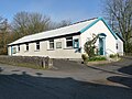
 Rimington, Salem Sunday School - geograph.org.uk - 3122007.jpg 3,456 × 2,304; 3.89 MB
-
 Rimmington Bridge - geograph.org.uk - 2802176.jpg 1,000 × 669; 218 KB
-
 Running repairs - geograph.org.uk - 4576002.jpg 2,724 × 3,450; 7.87 MB
-
 Salem Chapel Rimington 01.JPG 3,456 × 2,592; 4.22 MB
-
 Salem Chapel Rimington 02.JPG 3,456 × 2,592; 4.4 MB
-
 Salem Chapel Rimington 03.JPG 3,456 × 2,592; 4.76 MB
-
 Salem Chapel Rimington 04.JPG 3,456 × 2,592; 4.18 MB
-
 Salem Chapel Rimington 05.JPG 3,456 × 2,592; 4.23 MB
-
 Salem Congregational Chapel - geograph.org.uk - 2593742.jpg 3,264 × 2,448; 5.31 MB
-
 Salem Congregational Chapel at Martin Top - geograph.org.uk - 3252052.jpg 4,320 × 3,240; 3.82 MB
-
 Salem Congregational Chapel, Martin Top - geograph.org.uk - 5549597.jpg 2,592 × 1,944; 1.39 MB
-
 Salem Congregational Chapel, Martin Top - geograph.org.uk - 85252.jpg 640 × 426; 125 KB
-
 Salem Congregational Church and Manse - geograph.org.uk - 2630428.jpg 4,000 × 3,000; 6.08 MB
-

-
 Series of Gates at Ox Close Farm - geograph.org.uk - 3252648.jpg 4,320 × 3,240; 5.48 MB
-
 Stankill Beck at Rimington Bridge - geograph.org.uk - 872948.jpg 640 × 480; 108 KB
-
 Station Road, Rimington - geograph.org.uk - 3558274.jpg 1,024 × 768; 528 KB
-
 Stile and footpath to Great Todber - geograph.org.uk - 4889152.jpg 2,832 × 4,149; 7.32 MB
-
 Stile on the A682 - geograph.org.uk - 4889188.jpg 3,988 × 2,750; 7.13 MB
-
 Stopper Lane - geograph.org.uk - 4694011.jpg 3,241 × 3,771; 1.76 MB
-
 Straight section of the A682 - geograph.org.uk - 5870696.jpg 640 × 480; 106 KB
-
 Sundial Salem Chapel in Rimington.JPG 2,592 × 3,456; 4.24 MB
-
 The A682 approaching Todber - geograph.org.uk - 2062768.jpg 3,264 × 2,448; 1.97 MB
-
 The A682 heading to Gisburn - geograph.org.uk - 4287869.jpg 1,500 × 999; 131 KB
-
 The A682 near Little Middop - geograph.org.uk - 4287860.jpg 1,500 × 999; 82 KB
-
 The A682 running down Widow Hill - geograph.org.uk - 4287878.jpg 1,500 × 999; 117 KB
-

-
 The house that Jack built in Rimington.JPG 2,855 × 1,446; 404 KB
-
 The Pennine Bridleway near Coverdale - geograph.org.uk - 6682693.jpg 4,000 × 3,000; 4.61 MB
-
 Time Flies Swift Away - geograph.org.uk - 2202199.jpg 480 × 640; 101 KB
-
 Track leaving Higher Gills - geograph.org.uk - 3387877.jpg 4,320 × 3,240; 5.07 MB
-
 View from Bale Hill - geograph.org.uk - 3387790.jpg 4,320 × 3,240; 5.25 MB
-
 Village name sign - geograph.org.uk - 4575900.jpg 4,334 × 2,884; 7.46 MB
-
 Whitwell Hill - geograph.org.uk - 4890410.jpg 4,589 × 2,868; 7.92 MB
-
 Window in Rimington 01.JPG 2,592 × 3,456; 2.52 MB
-
 Window in Rimington 02.JPG 2,592 × 3,456; 3.63 MB
-
 Window in Rimington 03.JPG 2,592 × 3,456; 3.05 MB
-
 Window in Rimington 04.JPG 2,592 × 3,456; 4.22 MB
-
 Window in Rimington 05.JPG 2,592 × 3,456; 4.19 MB
-
 Wytha Road - geograph.org.uk - 4694016.jpg 5,077 × 2,847; 1.76 MB
-
 Wytha Road - geograph.org.uk - 4694021.jpg 4,631 × 3,118; 1.7 MB
-
 Bridge at Clough Head - geograph.org.uk - 169739.jpg 640 × 480; 184 KB
-
 Britain's Most Dangerous Road - geograph.org.uk - 155773.jpg 640 × 480; 98 KB
-
 Clough Head - geograph.org.uk - 169639.jpg 640 × 480; 100 KB
-
 Commemorative Stone - geograph.org.uk - 729273.jpg 640 × 480; 130 KB
-
 Cottages near Rimington Bridge - geograph.org.uk - 155765.jpg 640 × 480; 102 KB
-
 Great Todber - geograph.org.uk - 105109.jpg 640 × 426; 117 KB
-
 Halstead's Farm, Rimington - geograph.org.uk - 155757.jpg 640 × 480; 114 KB
-
 High Croft, Stopper Lane, Rimington - geograph.org.uk - 122762.jpg 640 × 426; 143 KB
-
 Howgill Beck - geograph.org.uk - 169748.jpg 640 × 480; 178 KB
-
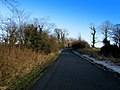
 Howgill Lane - geograph.org.uk - 156271.jpg 640 × 480; 154 KB
-
 Mines Cottage - geograph.org.uk - 122770.jpg 640 × 426; 171 KB
-
 Rimington mine - geograph.org.uk - 62337.jpg 640 × 480; 88 KB
-
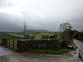
 Rimington Moor - geograph.org.uk - 268891.jpg 640 × 426; 143 KB
-
 Rimington Moor Firber House Ruin - geograph.org.uk - 269979.jpg 640 × 426; 140 KB
-
 The Black Bull Hotel, Rimington - geograph.org.uk - 155748.jpg 640 × 480; 90 KB
-
 The road to Higher Gill Farm - geograph.org.uk - 122765.jpg 640 × 426; 165 KB
-
 The road to The Wood - geograph.org.uk - 166943.jpg 640 × 480; 104 KB
-
 The slope of Pendle Big End - geograph.org.uk - 585744.jpg 640 × 426; 357 KB


.jpg)


