Category:Rijnbeek (Venlo) on old maps
Jump to navigation
Jump to search
Wikimedia category | |||||
| Upload media | |||||
| Instance of | |||||
|---|---|---|---|---|---|
| Category combines topics | |||||
| Rijnbeek | |||||
stream in Venlo, Netherlands   | |||||
| Instance of | |||||
| Location | Venlo, Limburg, Netherlands | ||||
| Mouth of the watercourse | |||||
| Drainage basin | |||||
 | |||||
| Category:Old maps of Venlo | |||||
Wikimedia category | |||||
| Instance of | |||||
| Category combines topics | |||||
| |||||
Media in category "Rijnbeek (Venlo) on old maps"
The following 25 files are in this category, out of 25 total.
-
 1560 Kaart van Venlo door Jacob van Deventer.jpg 3,672 × 3,904; 3.87 MB
-
 Plattegrond der stad, naar gravure - Venlo - 20241008 - RCE.jpg 3,132 × 2,340; 2.81 MB
-
 Siege of Venlo 1646.jpg 927 × 695; 576 KB
-
 Blaeu 1652 - Venlo.jpg 2,420 × 1,943; 604 KB
-
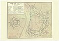
 1729 G.J.E. Marlet - Plan de la ville de Venlo et du fort Sint-Michiel.jpg 1,214 × 1,435; 450 KB
-
 1751 Plan van Venlo en het Fort St. Michiel.jpg 6,884 × 4,901; 10.21 MB
-
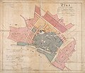
 1763 Plan van de stad Venlo nevens het fort St. Michiel met destinatie.jpg 10,536 × 5,436; 3.85 MB
-

-

-
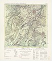 TrK33 Venlo.jpg 2,541 × 2,951; 1.21 MB
-
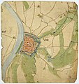
 Venlo. Blerick met oeververbinding over de Maas, 1843.jpg 1,604 × 942; 598 KB
-
 RivierenkaartVenlo.jpg 1,159 × 877; 318 KB
-
 1850 Kaart van het stroomgebied van de Maas bij Venlo.jpg 10,824 × 7,540; 45.43 MB
-
 1850 Venlo op Algemene Rivierkaart van Nederland.jpg 2,893 × 2,021; 2.04 MB
-
 2006 Uitbreidingsplan van Van Gendt (1872) met Venlo Q4 plangebied (2006).jpg 1,311 × 1,212; 410 KB
-
 1872 Uitbreidingplan voor de binnenstad van Van Gendt.jpg 1,637 × 1,414; 442 KB
-
 Lageplan des Bahnhofes Venlo Ost.jpg 7,915 × 3,158; 5.48 MB
-

-

-
 1908 Rijnbeek en Hoogmolenbeek rond emplacement van het Station Venlo Ost te Venlo.jpg 4,226 × 2,590; 1.97 MB
-
 1908 Verder verloop waterwegen rond emplacement van het Station Venlo Ost te Venlo.jpg 4,332 × 2,801; 2.22 MB
-

-
 Eugeniana02.jpg 1,001 × 667; 128 KB
-

-


.jpg)


_met_Venlo_Q4_plangebied_(2006).jpg)


.jpg)


