Category:Rifugio Prabello
Jump to navigation
Jump to search
|
Rifugio Prabello has an entry on OpenStreetMap (show). |
mountain hut in the Italian municipality of Cerano d'Intelvi     | |||||
| Upload media | |||||
| Instance of | |||||
|---|---|---|---|---|---|
| Location | Sasso Gordona, Schignano, Province of Como, Lombardy, Italy | ||||
| Mountain range | |||||
| Elevation above sea level |
| ||||
| official website | |||||
 | |||||
Subcategories
This category has only the following subcategory.
Media in category "Rifugio Prabello"
The following 18 files are in this category, out of 18 total.
-
 Crocifisso al Rifugio Prabello.jpg 3,648 × 2,736; 3.95 MB
-
 Ingresso del Rifugio Prabello.jpg 5,736 × 2,868; 6.18 MB
-
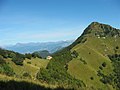 Mte Bisbino sasso Gordona - panoramio.jpg 1,024 × 768; 100 KB
-
 Rifugio Prabello (1).jpg 4,608 × 3,456; 7.13 MB
-
 Rifugio Prabello (2).jpg 4,608 × 3,456; 4.95 MB
-
 Rifugio Prabello (3).jpg 4,608 × 3,456; 7.23 MB
-
 Rifugio Prabello (4).jpg 3,648 × 2,736; 4.44 MB
-
 Rifugio Prabello (5).jpg 3,648 × 2,736; 4.4 MB
-
 Rifugio Prabello (foto panoramica).jpg 5,736 × 2,868; 6.56 MB
-
 Rifugio Prabello sullo sfondo del Monte Generoso.jpg 3,648 × 2,736; 4.42 MB
-
 Rifugio Prabello sullo sfondo del Sasso Gordona.jpg 3,648 × 2,736; 4.45 MB
-
 Rifugio Prabello, immagine invernale.jpg 3,648 × 2,736; 2.84 MB
-
 Rifugio Prabello, lato ingresso.jpg 5,120 × 3,840; 4.57 MB
-
 Rifugio Prabello.jpg 3,648 × 2,736; 4.18 MB
-
 Sasso Gordona dalla soglia del Rifugio Prabello.jpg 5,120 × 3,840; 6.42 MB
-
 Sasso Gordona.jpg 4,608 × 3,456; 13.75 MB
-
 Segnavia presso il rifugio Prabello.jpg 7,296 × 5,472; 5.71 MB
-
 Segnavia svizzero presso il Rifugio Prabello.jpg 4,608 × 3,456; 8.09 MB


.jpg)
.jpg)
.jpg)
.jpg)
.jpg)
.jpg)


