Category:Riddlesden
Jump to navigation
Jump to search
Suburban village in West Yorkshire, England, United Kingdom | |||||
| Upload media | |||||
| Instance of | |||||
|---|---|---|---|---|---|
| Location | Keighley, Bradford, West Yorkshire, Yorkshire and the Humber, England | ||||
 | |||||
English: Riddlesden is a village in the county of West Yorkshire, England, near Keighley and on the Leeds and Liverpool Canal. Most of Riddlesden is made up of hills and steep land, like farms and even woodland. However the access to Riddlesden is good as it has close contacts with various main roads. As well as the roads there are various residential communities. Estimated population is over 300.
Italiano: Riddlesden è un villaggio nella contea del West Yorkshire, in Inghilterra, situato vicino a Keighley ed al Leeds and Liverpool Canal.
Subcategories
This category has the following 2 subcategories, out of 2 total.
E
- East Riddlesden Hall (54 F)
Media in category "Riddlesden"
The following 37 files are in this category, out of 37 total.
-
 Abandoned Buildings near The Heights Farm - geograph.org.uk - 719080.jpg 640 × 480; 120 KB
-
 Access Lane to Larkfield Farm - geograph.org.uk - 719049.jpg 640 × 480; 117 KB
-
 Aqueduct crossing beck behind Barley Cote - geograph.org.uk - 471965.jpg 640 × 479; 123 KB
-
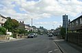
 Bar Lane - Bradford Road - geograph.org.uk - 977258.jpg 640 × 506; 243 KB
-
 Beechwood Avenue - Westlea Avenue - geograph.org.uk - 1111803.jpg 640 × 480; 240 KB
-

-
 Compeigne Avenue - Bradford Road - geograph.org.uk - 1111799.jpg 640 × 508; 208 KB
-
 Cornwall Road - Bradford Road - geograph.org.uk - 1111707.jpg 640 × 469; 211 KB
-
 Farm Buildings at The Height - geograph.org.uk - 719060.jpg 640 × 480; 85 KB
-
 From Swine Lane Bridge - geograph.org.uk - 1069327.jpg 640 × 480; 79 KB
-
 Granby Drive - Bar Lane - geograph.org.uk - 977267.jpg 640 × 418; 177 KB
-
 Grange Road - Bradford Road - geograph.org.uk - 1111714.jpg 640 × 415; 189 KB
-
 Leeds and Liverpool Canal - Bar Lane - geograph.org.uk - 977263.jpg 640 × 450; 186 KB
-
 Leeds and Liverpool Canal - Bar Lane - geograph.org.uk - 977265.jpg 640 × 414; 217 KB
-
 Leeds and Liverpool Canal - Granby Lane - geograph.org.uk - 977270.jpg 640 × 468; 223 KB
-
 Leeds and Liverpool Canal - Granby Lane - geograph.org.uk - 977272.jpg 640 × 466; 270 KB
-
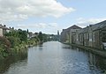
 Leeds and Liverpool Canal at Riddlesden. - geograph.org.uk - 201360.jpg 640 × 480; 123 KB
-

-

-
 Narrow Boat on Leeds Liverpool Canal - geograph.org.uk - 129190.jpg 640 × 480; 99 KB
-
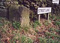 Old Milestone, N of Riddlesden (geograph 6750410).jpg 684 × 492; 89 KB
-
 Ordnance Survey Cut Mark (geograph 6062997).jpg 4,000 × 3,000; 4.24 MB
-
 Primrose Farm - geograph.org.uk - 47312.jpg 640 × 480; 157 KB
-
 Riddlesden (29825432646).jpg 2,051 × 2,051; 5.67 MB
-
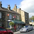 Riddlesden Post Office - Bar Lane - geograph.org.uk - 977259.jpg 640 × 636; 297 KB
-

-

-
 Rosewood Avenue - Beechwood Avenue - geograph.org.uk - 1111804.jpg 640 × 480; 241 KB
-
 Swine Lane Bridge - geograph.org.uk - 353055.jpg 640 × 480; 115 KB
-
 Swing Bridge in Riddlesden - geograph.org.uk - 719759.jpg 640 × 480; 67 KB
-
-
 Unity Street, Riddlesden (28491738791).jpg 3,625 × 2,429; 7.5 MB
-
 War Memorial, Riddlesden Cemetery, Keighley (7329266798).jpg 3,232 × 3,232; 3.92 MB
-
 Westlea Avenue - Bradford Road - geograph.org.uk - 1111802.jpg 640 × 443; 204 KB
-
 Willow Tree, Riddlesden (27431214104).jpg 1,966 × 2,242; 3.17 MB
-
 Canal West of Riddlesden - geograph.org.uk - 719767.jpg 640 × 480; 118 KB
-
 The Leeds and Liverpool Canal - geograph.org.uk - 353039.jpg 640 × 480; 131 KB


.jpg)
.jpg)

.jpg)


.jpg)
.jpg)

.jpg)

