Category:Richard's Castle, Herefordshire
Jump to navigation
Jump to search
civil parish in Herefordshire, England | |||||
| Upload media | |||||
| Instance of | |||||
|---|---|---|---|---|---|
| Location | Herefordshire, West Midlands, England | ||||
 | |||||
English: Richard's Castle is a village, castle and two civil parishes on the border of the counties of Herefordshire and Shropshire in England. The Herefordshire section of the parish had a population of 250 at the 2011 Census. The Shropshire section of the parish had a population of 424 at the 2011 Census.
Polski: Richard's Castle – wieś w Anglii, na granicy hrabstw Herefordshire i Shropshire. Leży 31 km na północ od miasta Hereford i 203 km na północny zachód od Londynu.

Subcategories
This category has the following 3 subcategories, out of 3 total.
C
- The Castle, Richard's Castle (5 F)
R
Media in category "Richard's Castle, Herefordshire"
The following 200 files are in this category, out of 631 total.
(previous page) (next page)-

-

-
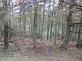
 1950s conifers, Bringewood - geograph.org.uk - 2210353.jpg 640 × 480; 108 KB
-
 405 line transmitter, Mary Knoll - geograph.org.uk - 4214889.jpg 800 × 600; 495 KB
-
 A good question - geograph.org.uk - 4668060.jpg 800 × 669; 344 KB
-
 A long field - geograph.org.uk - 206159.jpg 480 × 640; 88 KB
-
 A survivor in Haye Park - geograph.org.uk - 5230946.jpg 1,024 × 683; 345 KB
-
 Above Sunny Dingle - geograph.org.uk - 5810638.jpg 1,000 × 665; 956 KB
-
 Above Sunny Dingle - geograph.org.uk - 5811520.jpg 1,000 × 665; 924 KB
-
 Across Sunny Dingle - geograph.org.uk - 4448236.jpg 800 × 530; 648 KB
-
 All Saints Church (Richards Castle) - geograph.org.uk - 5721987.jpg 3,264 × 2,448; 1.6 MB
-
 All Saints Church (Richards Castle) - geograph.org.uk - 6113265.jpg 3,648 × 2,736; 3.62 MB
-
 All Saints Church (Richards Castle) - geograph.org.uk - 6113267.jpg 3,648 × 2,736; 3.7 MB
-
 An old path, Haye Park - geograph.org.uk - 5665474.jpg 1,024 × 683; 402 KB
-
 Another wet summer's day in the woods - geograph.org.uk - 916610.jpg 640 × 429; 72 KB
-
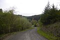
 Approaching a junction - geograph.org.uk - 1369520.jpg 640 × 425; 119 KB
-
 Armorial Bearings of the ZOUCHE family of Richard's Castle, Herefordshire.png 1,200 × 1,200; 785 KB
-
 B4361 in Richards Castle - geograph.org.uk - 4458700.jpg 1,600 × 1,200; 1.63 MB
-
 B4361 northwest of Bilbury - geograph.org.uk - 3749367.jpg 3,425 × 2,435; 1.18 MB
-
 B4361 passes through Richards Castle - geograph.org.uk - 3749368.jpg 3,487 × 2,514; 1.65 MB
-
 B4361 towards Ludlow - geograph.org.uk - 6314180.jpg 640 × 480; 70 KB
-
 B4361 towards Ludlow - geograph.org.uk - 6314184.jpg 640 × 480; 45 KB
-
 Bank under Haye Park - geograph.org.uk - 5999966.jpg 1,024 × 575; 274 KB
-
 Batchcott Common - geograph.org.uk - 4402911.jpg 800 × 600; 524 KB
-
 Bench by Richards Castle (Wall ^2) - geograph.org.uk - 6111840.jpg 3,648 × 2,736; 4.73 MB
-
 Big field near Richards Castle - geograph.org.uk - 3684767.jpg 640 × 480; 65 KB
-
 Black Pool car park - geograph.org.uk - 4214846.jpg 640 × 480; 273 KB
-
 Bluebells, Climbing Jack Common - geograph.org.uk - 5231284.jpg 1,024 × 683; 311 KB
-
 Bluebells, Climbing Jack Common - geograph.org.uk - 5231291.jpg 1,024 × 683; 295 KB
-
 Brambles and birches - geograph.org.uk - 4402896.jpg 800 × 600; 474 KB
-
-
 Bridleway, Bringewood. - geograph.org.uk - 53380.jpg 640 × 480; 137 KB
-
 Bringewood Forest (Mortimer Forest) - geograph.org.uk - 2316337.jpg 640 × 430; 119 KB
-
 Brook, Richards Castle - geograph.org.uk - 5232785.jpg 533 × 800; 158 KB
-
 Bus in the woods - geograph.org.uk - 4668106.jpg 800 × 600; 459 KB
-
 Castle Road near Richards Castle - geograph.org.uk - 6033600.jpg 833 × 1,024; 453 KB
-
 Castle Road, Richards Castle - geograph.org.uk - 6399447.jpg 1,024 × 768; 338 KB
-
 Cat at Upper House (Richards Castle) - geograph.org.uk - 5721296.jpg 3,264 × 2,448; 2.82 MB
-
 Ceiling at St. Bartholomew's Church (Nave ^ Richards Castle) - geograph.org.uk - 6113088.jpg 3,648 × 2,056; 2.71 MB
-
 Church House (Richards Castle) - geograph.org.uk - 5721978.jpg 3,264 × 2,448; 3.22 MB
-
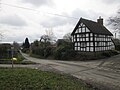
 Church House, Richards Castle - geograph.org.uk - 5395208.jpg 1,024 × 768; 233 KB
-
-

-
-

-

-
 Churchyard at St. Bartholomew's Church (Richards Castle) - geograph.org.uk - 5721648.jpg 3,264 × 2,448; 2.69 MB
-
 Churchyard at St. Bartholomew's Church (Richards Castle) - geograph.org.uk - 6113056.jpg 3,648 × 2,736; 4.8 MB
-
 Churchyard, Richards Castle - geograph.org.uk - 4810559.jpg 3,429 × 2,280; 2.77 MB
-
 Cider House (Richards Castle) - geograph.org.uk - 5721244.jpg 3,264 × 2,448; 2.36 MB
-
 Climb out of Sunny Gutter - geograph.org.uk - 5664663.jpg 1,024 × 683; 399 KB
-
 Climbing Jack Common - geograph.org.uk - 3138092.jpg 640 × 425; 343 KB
-
 Climbing Jack Common - geograph.org.uk - 3138119.jpg 425 × 640; 420 KB
-
 Climbing Jack Common - geograph.org.uk - 4214906.jpg 800 × 600; 387 KB
-
 Climbing Jack Common - geograph.org.uk - 4214917.jpg 800 × 600; 412 KB
-
 Climbing Jack Common - geograph.org.uk - 4672144.jpg 800 × 600; 379 KB
-
 Climbing Jack Common - geograph.org.uk - 5231287.jpg 1,024 × 683; 312 KB
-
 Climbing Jack Common - geograph.org.uk - 5813609.jpg 1,000 × 665; 814 KB
-
 Climbing Jack Common - geograph.org.uk - 5813611.jpg 1,000 × 665; 801 KB
-
 Climbing Jack Common - geograph.org.uk - 5813614.jpg 1,000 × 665; 820 KB
-
 Climbing Jack Common - geograph.org.uk - 5813615.jpg 1,000 × 665; 734 KB
-
 Climbing Jack Common - geograph.org.uk - 6000063.jpg 1,024 × 575; 331 KB
-
 Climbing Jack Common - geograph.org.uk - 6451257.jpg 1,024 × 705; 188 KB
-
 Climbing out of Mary Knoll Valley - geograph.org.uk - 3138235.jpg 640 × 425; 414 KB
-
 Climbing out of The Hope - geograph.org.uk - 4270876.jpg 800 × 533; 102 KB
-
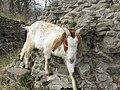 Close-up of the Goats at Richards Castle - geograph.org.uk - 5721938.jpg 3,264 × 2,448; 2.46 MB
-

-
 Conifers, Mortimer Forest - geograph.org.uk - 2316305.jpg 640 × 430; 116 KB
-
 Corner of Hanway Common - geograph.org.uk - 4449842.jpg 800 × 530; 563 KB
-
 Corner of Hanway Common - geograph.org.uk - 5026902.jpg 1,000 × 664; 782 KB
-

-
 Court Cottage (Richards Castle) - geograph.org.uk - 5721202.jpg 3,264 × 2,448; 2.77 MB
-
 Crossroads at Rock Cottage (Richards Castle) - geograph.org.uk - 5721310.jpg 3,264 × 2,448; 1.79 MB
-
 Crossroads at Rock Cottage (Richards Castle) - geograph.org.uk - 6113254.jpg 3,648 × 2,736; 4.23 MB
-
 Crossroads at Wheatcommon Lane (Richards Castle) - geograph.org.uk - 5721986.jpg 3,264 × 2,448; 2.75 MB
-

-
 Deer lawn, Lower Evans - geograph.org.uk - 5664690.jpg 1,024 × 683; 343 KB
-
 Deer lawn, The Hope - geograph.org.uk - 5230942.jpg 1,024 × 683; 295 KB
-
 Deer lawn, The Hope - geograph.org.uk - 5999960.jpg 1,024 × 575; 312 KB
-

-
 Dried out pond, The Hope - geograph.org.uk - 5999939.jpg 1,024 × 575; 398 KB
-
 Drive to the Vallets - geograph.org.uk - 5395185.jpg 1,024 × 768; 190 KB
-
 Edge of Haye Park - geograph.org.uk - 5231292.jpg 683 × 1,024; 564 KB
-
 Entrance Gate to Richards Castle - geograph.org.uk - 6112502.jpg 3,648 × 2,736; 4.99 MB
-
 Entrance Gates to St. Bartholomew's Church (Richards Castle) - geograph.org.uk - 6113239.jpg 3,648 × 2,736; 4.75 MB
-
 Entrance to Little Folly - geograph.org.uk - 6314181.jpg 800 × 600; 135 KB
-
 Entrance to Richards Castle - geograph.org.uk - 5721650.jpg 3,264 × 2,448; 2.94 MB
-
 Fallow Deer near Richard's Castle - geograph.org.uk - 2429927.jpg 640 × 480; 68 KB
-
 Farm track near Richard's Castle - geograph.org.uk - 2429986.jpg 640 × 480; 106 KB
-
 Farmland at Richards Castle - geograph.org.uk - 5395330.jpg 1,024 × 768; 274 KB
-
 Fenced enclosure, The Hope - geograph.org.uk - 5999955.jpg 1,024 × 575; 282 KB
-
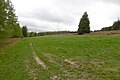
 Field, Vallets - geograph.org.uk - 2212118.jpg 640 × 480; 314 KB
-
 Fields near Richard's Castle in May - geograph.org.uk - 2429912.jpg 640 × 480; 85 KB
-
 Footpath to Merefield - geograph.org.uk - 4458681.jpg 1,600 × 1,198; 1.35 MB
-
-
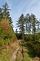
 Forest edge path, Haye Park - geograph.org.uk - 965059.jpg 640 × 480; 157 KB
-
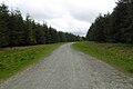
 Forest road in Bringewood near Ludlow - geograph.org.uk - 4668069.jpg 800 × 600; 428 KB
-

-
 Goat at Richards Castle - geograph.org.uk - 6112019.jpg 3,648 × 2,736; 4.38 MB
-
 Goat at Richards Castle - geograph.org.uk - 6112027.jpg 3,648 × 2,736; 4.88 MB
-
 Goat at Richards Castle - geograph.org.uk - 6112173.jpg 3,648 × 2,736; 4.78 MB
-
 Goat at Richards Castle - geograph.org.uk - 6112242.jpg 3,648 × 2,736; 4.98 MB
-
 Goat at Richards Castle - geograph.org.uk - 6112355.jpg 3,648 × 2,736; 5.08 MB
-
 Goat at Richards Castle - geograph.org.uk - 6112370.jpg 3,648 × 2,736; 4.76 MB
-
 Goat at Richards Castle - geograph.org.uk - 6112498.jpg 3,648 × 2,736; 5.25 MB
-
 Goats at Richard's Castle (Wall ^2) - geograph.org.uk - 6395566.jpg 2,363 × 1,332; 733 KB
-
 Goats at Richard's Castle (Wall ^2) - geograph.org.uk - 6395570.jpg 2,363 × 1,332; 783 KB
-
 Goats at Richard's Castle - geograph.org.uk - 6395520.jpg 3,648 × 2,056; 2.2 MB
-
 Goats at Richard's Castle - geograph.org.uk - 6395530.jpg 2,048 × 1,536; 962 KB
-
 Goats at Richard's Castle - geograph.org.uk - 6395541.jpg 2,048 × 1,536; 1.05 MB
-
 Goats at Richard's Castle - geograph.org.uk - 6395554.jpg 3,648 × 2,736; 3.09 MB
-
 Goats at Richards Castle - geograph.org.uk - 5589800.jpg 640 × 480; 124 KB
-
 Goats at Richards Castle - geograph.org.uk - 5721698.jpg 3,264 × 2,448; 2.2 MB
-
 Goats at Richards Castle - geograph.org.uk - 5721703.jpg 3,264 × 2,448; 3.09 MB
-
 Goats at Richards Castle - geograph.org.uk - 6111917.jpg 3,648 × 2,736; 4.53 MB
-
 Goats at Richards Castle - geograph.org.uk - 6111962.jpg 3,648 × 2,736; 4.66 MB
-
 Goats at Richards Castle - geograph.org.uk - 6112016.jpg 3,648 × 2,736; 4.93 MB
-
 Goats at Richards Castle - geograph.org.uk - 6112193.jpg 3,648 × 2,736; 4.93 MB
-
 Goats at Richards Castle - geograph.org.uk - 6112196.jpg 3,648 × 2,736; 4.81 MB
-
 Goats at Richards Castle - geograph.org.uk - 6112199.jpg 3,648 × 2,736; 4.88 MB
-
 Goats at Richards Castle - geograph.org.uk - 6112325.jpg 3,648 × 2,056; 3.59 MB
-
 Goats at Richards Castle - geograph.org.uk - 6112363.jpg 3,648 × 2,736; 5.17 MB
-
 Goats at Richards Castle - geograph.org.uk - 6112377.jpg 3,648 × 2,736; 4.92 MB
-
 Goats at Richards Castle - geograph.org.uk - 6112482.jpg 2,736 × 3,648; 4.78 MB
-
 Goats at Richards Castle - geograph.org.uk - 6112483.jpg 3,648 × 2,736; 4.87 MB
-
 Goats at Richards Castle - geograph.org.uk - 6112489.jpg 3,648 × 2,736; 5.27 MB
-
 Goats at Richards Castle - geograph.org.uk - 6112492.jpg 3,648 × 2,736; 5.21 MB
-
 Goats at Richards Castle - geograph.org.uk - 6112499.jpg 3,648 × 2,736; 5.26 MB
-
 Goats at Richards Castle - geograph.org.uk - 6319075.jpg 3,648 × 2,736; 3.63 MB
-
 Goats running up the Motte at Richards Castle - geograph.org.uk - 5721934.jpg 3,264 × 2,448; 3.38 MB
-
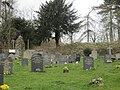
 Graveyard of St Bartholomew's Church - geograph.org.uk - 5026733.jpg 1,000 × 664; 858 KB
-
 Green Farm (Richards Castle) - geograph.org.uk - 5721359.jpg 3,264 × 2,448; 2.58 MB
-
 Green Farm (Richards Castle) - geograph.org.uk - 5721363.jpg 3,264 × 2,448; 1.51 MB
-
 Green Farm (Richards Castle) - geograph.org.uk - 5721644.jpg 3,264 × 2,448; 1.78 MB
-
 Green Farm (Richards Castle) - geograph.org.uk - 5721985.jpg 3,264 × 2,448; 2.55 MB
-
 Green Farm (Richards Castle) - geograph.org.uk - 6108787.jpg 3,648 × 2,736; 4.6 MB
-
 Green Farm (Richards Castle) - geograph.org.uk - 6108789.jpg 3,648 × 2,736; 4.42 MB
-
 Green Farm (Richards Castle) - geograph.org.uk - 6108791.jpg 3,648 × 2,736; 4.61 MB
-
 Green Farm (Richards Castle) - geograph.org.uk - 6108793.jpg 3,648 × 2,736; 3.58 MB
-
 Green Farm (Richards Castle) - geograph.org.uk - 6109146.jpg 3,648 × 2,736; 4.53 MB
-
 Green Farm (Richards Castle) - geograph.org.uk - 6109150.jpg 3,648 × 2,736; 4.39 MB
-
 Green Farm (Richards Castle) - geograph.org.uk - 6109152.jpg 3,648 × 2,736; 3.73 MB
-
 Green Farm (Richards Castle) - geograph.org.uk - 6111670.jpg 3,648 × 2,736; 4.28 MB
-
 Green Farm (Richards Castle) - geograph.org.uk - 6111681.jpg 3,648 × 2,736; 4.63 MB
-
 Green Farm (Richards Castle) - geograph.org.uk - 6112948.jpg 3,648 × 2,736; 4.67 MB
-
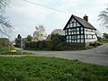
 Green Farmhouse - geograph.org.uk - 5395257.jpg 1,024 × 768; 194 KB
-
 Gully, Haye Park Wood - geograph.org.uk - 4402887.jpg 800 × 600; 477 KB
-
-
 Hanway Common - geograph.org.uk - 4449897.jpg 800 × 530; 420 KB
-
 Hanway Common - geograph.org.uk - 4672680.jpg 800 × 600; 388 KB
-
 Hanway Common Lane (Richards Castle) - geograph.org.uk - 6109159.jpg 3,648 × 2,736; 4.64 MB
-
 Haye Park - geograph.org.uk - 4270860.jpg 800 × 533; 204 KB
-
 Haye Park - geograph.org.uk - 5231296.jpg 1,024 × 683; 499 KB
-
 Haye Park Rally Stage - geograph.org.uk - 5062351.jpg 1,500 × 1,000; 1.16 MB
-
 Haye Park singletrack - geograph.org.uk - 5231303.jpg 1,024 × 683; 472 KB
-
 Haye Park singletrack - geograph.org.uk - 5665476.jpg 1,024 × 683; 433 KB
-
 Haye Park Wood - geograph.org.uk - 4451289.jpg 800 × 530; 589 KB
-
 Haye Park Wood - geograph.org.uk - 4451322.jpg 530 × 800; 721 KB
-
 Haye Park Wood - geograph.org.uk - 5810664.jpg 665 × 1,000; 978 KB
-
 Haye Park Wood - geograph.org.uk - 5810667.jpg 1,000 × 665; 1.12 MB
-
 Haye Park Wood - geograph.org.uk - 5813566.jpg 1,000 × 665; 929 KB
-
 Haye Park Wood - geograph.org.uk - 5813567.jpg 665 × 1,000; 885 KB
-
 Haye Park Wood - geograph.org.uk - 5813568.jpg 1,000 × 665; 835 KB
-
 Haye Park Wood - geograph.org.uk - 5813574.jpg 1,000 × 665; 850 KB
-
 Haye Park Wood - geograph.org.uk - 5813578.jpg 665 × 1,000; 956 KB
-
 Haye Park Wood - geograph.org.uk - 5813582.jpg 1,000 × 665; 859 KB
-
 Haye Park Wood - geograph.org.uk - 5813602.jpg 1,000 × 665; 942 KB
-
 Haye Park Wood - geograph.org.uk - 5813605.jpg 1,000 × 665; 920 KB
-
 Haye Park Wood - geograph.org.uk - 5813607.jpg 1,000 × 665; 786 KB
-
 Haye Park's drive - geograph.org.uk - 1638240.jpg 640 × 480; 159 KB
-
 Head of the Hope - geograph.org.uk - 5999990.jpg 1,024 × 575; 413 KB
-
 Heading into Shropshire - geograph.org.uk - 6314193.jpg 640 × 480; 66 KB
-
 High Vinnalls - geograph.org.uk - 1638277.jpg 640 × 338; 44 KB
-
 High Vinnalls - geograph.org.uk - 4668111.jpg 800 × 600; 402 KB
-
 High Vinnalls - geograph.org.uk - 4672083.jpg 800 × 600; 364 KB
-

-
 Information about St. Bartholomew's Church (Richards Castle) - geograph.org.uk - 5721414.jpg 3,264 × 2,448; 1.83 MB
-
 Into Sunny Dingle - geograph.org.uk - 5811517.jpg 665 × 1,000; 917 KB
-
 Japanese larch, Haye Park - geograph.org.uk - 1638253.jpg 640 × 480; 165 KB
-
 Lane in Richards Castle - geograph.org.uk - 6105532.jpg 3,648 × 2,736; 4.16 MB
-
 Lane to Hanway Common - geograph.org.uk - 4994070.jpg 1,000 × 664; 849 KB
-
 Lane to Hanway Common - geograph.org.uk - 4994071.jpg 1,000 × 664; 809 KB
-
 Larch wood, Upper Evens - geograph.org.uk - 5664699.jpg 1,024 × 683; 507 KB
-
 Larches, Haye Park - geograph.org.uk - 6000069.jpg 1,024 × 575; 473 KB
-
 Larches, Haye Park - geograph.org.uk - 965061.jpg 480 × 640; 154 KB
-
 Larches, The Hope - geograph.org.uk - 4672672.jpg 800 × 600; 516 KB
-
 Logging road above Sunny Gutter - geograph.org.uk - 3877081.jpg 640 × 427; 103 KB
-
 Logging road, Haye Park - geograph.org.uk - 1638267.jpg 640 × 480; 100 KB
-
 Logging road, Haye Park - geograph.org.uk - 965064.jpg 640 × 480; 97 KB
-
 Logging road, Maryknoll - geograph.org.uk - 5664703.jpg 1,024 × 683; 322 KB
-
 Logging road, The Hope - geograph.org.uk - 4402942.jpg 800 × 533; 396 KB
-
 Logging road, The Hope - geograph.org.uk - 5230938.jpg 1,024 × 683; 290 KB
-
 Logging road, The Hope - geograph.org.uk - 5230943.jpg 1,024 × 683; 374 KB
-
 Logging road, The Hope - geograph.org.uk - 961384.jpg 640 × 480; 68 KB
-
 Lower Evans - geograph.org.uk - 5664679.jpg 1,024 × 683; 415 KB
-
 Lower Evens - geograph.org.uk - 3138012.jpg 640 × 425; 311 KB
-
 Lower Evens - geograph.org.uk - 3138028.jpg 425 × 640; 425 KB
-
 Lower Evens - geograph.org.uk - 4214868.jpg 800 × 600; 513 KB
-
 Lower Evens - geograph.org.uk - 4668090.jpg 800 × 600; 493 KB
-
 Lower Evens - geograph.org.uk - 4668101.jpg 800 × 600; 416 KB
.jpg)


_-_geograph.org.uk_-_5721987.jpg)
_-_geograph.org.uk_-_6113265.jpg)
_-_geograph.org.uk_-_6113267.jpg)


_-_geograph.org.uk_-_6111840.jpg)


_-_geograph.org.uk_-_2316337.jpg)


_-_geograph.org.uk_-_5721296.jpg)
_-_geograph.org.uk_-_6113088.jpg)
_-_geograph.org.uk_-_5721978.jpg)

_-_geograph.org.uk_-_5721416.jpg)
_-_geograph.org.uk_-_5721404.jpg)
_-_geograph.org.uk_-_5721413.jpg)
_-_geograph.org.uk_-_6395505.jpg)
_-_geograph.org.uk_-_6395573.jpg)
_-_geograph.org.uk_-_5721648.jpg)
_-_geograph.org.uk_-_6113056.jpg)

_-_geograph.org.uk_-_5721244.jpg)


_-_geograph.org.uk_-_2316394.jpg)


_-_geograph.org.uk_-_5721202.jpg)
_-_geograph.org.uk_-_5721310.jpg)
_-_geograph.org.uk_-_6113254.jpg)
_-_geograph.org.uk_-_5721986.jpg)
_-_geograph.org.uk_-_6112985.jpg)


_-_geograph.org.uk_-_6113230.jpg)


_-_geograph.org.uk_-_6113239.jpg)


_-_geograph.org.uk_-_6395566.jpg)
_-_geograph.org.uk_-_6395570.jpg)


_-_geograph.org.uk_-_5721359.jpg)
_-_geograph.org.uk_-_5721363.jpg)
_-_geograph.org.uk_-_5721644.jpg)
_-_geograph.org.uk_-_5721985.jpg)
_-_geograph.org.uk_-_6108787.jpg)
_-_geograph.org.uk_-_6108789.jpg)
_-_geograph.org.uk_-_6108791.jpg)
_-_geograph.org.uk_-_6108793.jpg)
_-_geograph.org.uk_-_6109146.jpg)
_-_geograph.org.uk_-_6109150.jpg)
_-_geograph.org.uk_-_6109152.jpg)
_-_geograph.org.uk_-_6111670.jpg)
_-_geograph.org.uk_-_6111681.jpg)
_-_geograph.org.uk_-_6112948.jpg)


_-_geograph.org.uk_-_6109159.jpg)


_-_geograph.org.uk_-_5721414.jpg)


