Category:Rhydcymerau
Jump to navigation
Jump to search
village in United Kingdom | |||||
| Upload media | |||||
| Instance of | |||||
|---|---|---|---|---|---|
| Location | Carmarthenshire, Wales | ||||
 | |||||
Cymraeg: Lleolir pentref bach Rhydcymerau 8.5 cilometr i'r de-ddwyrain o Lanybydder yr ochr draw i Fynydd Llanybydder, yn Sir Gaerfyrddin, de-orllewin Cymru.
English: Rhydcymerau is a small village 8.5 kilometres to the south-east of Llanybydder, around the side of Mynydd Llanybydder, in Carmarthenshire, south-west Wales.
Media in category "Rhydcymerau"
The following 33 files are in this category, out of 33 total.
-
 Abernant - geograph.org.uk - 406801.jpg 640 × 480; 183 KB
-
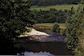 Afon Cothi - geograph.org.uk - 388973.jpg 640 × 426; 87 KB
-
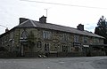 Cross Hands Hotel - geograph.org.uk - 729985.jpg 640 × 418; 54 KB
-
 Cwm below Cefnblaenau - geograph.org.uk - 837661.jpg 640 × 428; 137 KB
-
 Edwinsford Estate Bridge - geograph.org.uk - 388964.jpg 640 × 426; 126 KB
-
 Edwinsford Manor - geograph.org.uk - 563573 (cropped).jpg 361 × 361; 60 KB
-
 Edwinsford Manor - geograph.org.uk - 563573.jpg 412 × 640; 84 KB
-
 Edwinsford Mansion - geograph.org.uk - 399335.jpg 640 × 480; 110 KB
-
 Grazing on the hill, near Maestyle - geograph.org.uk - 1067092.jpg 640 × 426; 108 KB
-
 Lane passing barn - geograph.org.uk - 837647.jpg 640 × 428; 118 KB
-
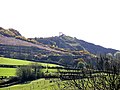 Pen y Ddinas - geograph.org.uk - 405747.jpg 640 × 480; 85 KB
-
 Rhydcymerau Church - geograph.org.uk - 406809.jpg 640 × 480; 147 KB
-
 Road along the ridge - geograph.org.uk - 837629.jpg 640 × 428; 90 KB
-
 Unfenced road on the ridge - geograph.org.uk - 837641.jpg 640 × 428; 90 KB
-
 Unmade Road - geograph.org.uk - 1390468.jpg 640 × 480; 93 KB
-
 Unsurfaced road above Cefnblaenau - geograph.org.uk - 837648.jpg 640 × 428; 130 KB
-
 Ysgol Rhydcymerau - geograph.org.uk - 406790.jpg 640 × 480; 123 KB
-
 Black and Tan - geograph.org.uk - 837914.jpg 640 × 430; 127 KB
-
 Cilwenau Uchaf - geograph.org.uk - 406810.jpg 640 × 480; 107 KB
-
 Edwinsford Manor in winter - geograph.org.uk - 563578.jpg 640 × 424; 95 KB
-
 Forest Path - geograph.org.uk - 591225.jpg 640 × 427; 115 KB
-
 Forestry Road - geograph.org.uk - 406804.jpg 640 × 480; 167 KB
-
 Forestry Track - geograph.org.uk - 591229.jpg 640 × 427; 131 KB
-
 Pen y Ddinas - geograph.org.uk - 404621.jpg 640 × 480; 80 KB
-
 River at Abergorlech, early Spring - geograph.org.uk - 435719.jpg 426 × 640; 154 KB
-
 Road Junction - geograph.org.uk - 406795.jpg 640 × 480; 122 KB
-
 Road Junction - geograph.org.uk - 406797.jpg 640 × 480; 116 KB
-
 Road Sign - geograph.org.uk - 406784.jpg 640 × 480; 173 KB
-
 Shiloh Chapel - geograph.org.uk - 399296.jpg 640 × 480; 92 KB
-
 Sign, Edwinsford Picnic Site - geograph.org.uk - 399309.jpg 640 × 480; 160 KB
-
 The Croft - geograph.org.uk - 406816.jpg 640 × 480; 73 KB
-
 Tyncwm - geograph.org.uk - 404629.jpg 640 × 480; 105 KB
-
 Wern - geograph.org.uk - 406787.jpg 640 × 480; 154 KB


.jpg)


