
Category:Rhineland-Palatinate in the 18th century
Federal states of Germany:
Subcategories
This category has the following 27 subcategories, out of 27 total.
#
*
B
T
Media in category "Rhineland-Palatinate in the 18th century"
The following 3 files are in this category, out of 3 total.
-
 Laurenziburg Nieder-Olm.jpg 800 × 567; 203 KB
-
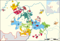 Map of the Oberämter of the Electoral Palatinate (1789) - Numbered.svg 3,770 × 2,570; 532 KB
-
 The Rhineland circa 1789.jpg 516 × 1,522; 443 KB

_-_Numbered.svg)