Category:Rhandirmwyn
Jump to navigation
Jump to search

village in United Kingdom  | |||||
| Upload media | |||||
| Instance of | |||||
|---|---|---|---|---|---|
| Location | Carmarthenshire, Wales | ||||
 | |||||
Subcategories
This category has the following 2 subcategories, out of 2 total.
N
- Nantymwyn Lead Mine (12 F)
S
Media in category "Rhandirmwyn"
The following 44 files are in this category, out of 44 total.
-
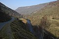 Afon Twyi Valley - geograph.org.uk - 1220380.jpg 640 × 426; 64 KB
-
 Afon Tywi at Rhandirmwyn - geograph.org.uk - 1339892.jpg 640 × 428; 114 KB
-
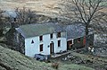
 Broncwrt - geograph.org.uk - 1220363.jpg 640 × 426; 85 KB
-
 Bryn Poeth Uchaf Youth Hostel - geograph.org.uk - 1752118.jpg 960 × 621; 257 KB
-
 Cairn on upland above Rhandirmwyn - geograph.org.uk - 1218872.jpg 640 × 426; 99 KB
-
 Capel Bwlchyrhiw - Bwlchyrhiw Chapel (geograph 7403086).jpg 1,024 × 768; 227 KB
-
 Cleared forestry - geograph.org.uk - 1223683.jpg 640 × 426; 95 KB
-
 Countryside near Rhandirmwyn - geograph.org.uk - 1134364.jpg 640 × 481; 195 KB
-
 Cwm Doethie path - geograph.org.uk - 928688.jpg 640 × 479; 99 KB
-
 Doethie path - geograph.org.uk - 913222.jpg 479 × 640; 96 KB
-
 Dolfallt Farm - geograph.org.uk - 1219139.jpg 640 × 426; 63 KB
-
 Drovers Road to Soar y Mynydd - geograph.org.uk - 359264.jpg 640 × 480; 107 KB
-
 Drovers Road to Soar y Mynydd - geograph.org.uk - 359824.jpg 640 × 447; 96 KB
-
 Entrance to Pen-y-rhiw-fach - geograph.org.uk - 1223707.jpg 426 × 640; 84 KB
-
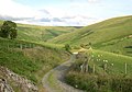
 Farmland south of Rhandirmwyn - geograph.org.uk - 1223700.jpg 640 × 426; 88 KB
-
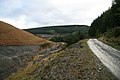
 Forest road above Rhandirmwyn - geograph.org.uk - 1218877.jpg 640 × 426; 104 KB
-
 Forest road beside the Nant Bai - geograph.org.uk - 783328.jpg 640 × 427; 72 KB
-

-
 Lime Kilns - geograph.org.uk - 389994.jpg 640 × 427; 157 KB
-
 Man cerdded cerddwyr Rhandirmwyn.jpg 3,024 × 3,024; 5.35 MB
-
 Nant Lluest-fach - geograph.org.uk - 910713.jpg 479 × 640; 107 KB
-
 Nant y Bai Mill - geograph.org.uk - 389991.jpg 640 × 427; 68 KB
-

-
 Roadside tree - geograph.org.uk - 1219138.jpg 426 × 640; 106 KB
-
 Rock strata - geograph.org.uk - 1219134.jpg 640 × 426; 143 KB
-
 Sgwt Craig Rhosan (Craig Rhosan Waterfall) - geograph.org.uk - 6321488.jpg 1,024 × 768; 284 KB
-
 Standing stone - geograph.org.uk - 1219140.jpg 640 × 426; 94 KB
-
 Start of the Caravanning Season in Rhandirmwyn - panoramio.jpg 2,816 × 2,112; 2.66 MB
-
 Summer meadow - geograph.org.uk - 453854.jpg 485 × 640; 94 KB
-
 Tadpoles - geograph.org.uk - 1219145.jpg 640 × 426; 84 KB
-

-
-
 The road to Llyn Brianne - geograph.org.uk - 1220372.jpg 640 × 426; 61 KB
-
 The road to Rhandirmwyn - geograph.org.uk - 1134587.jpg 640 × 481; 105 KB
-
 The Royal Oak Inn, Rhandirmwyn - geograph.org.uk - 1220355.jpg 640 × 426; 86 KB
-
 The Royal Oak Inn, Rhandirmwyn - geograph.org.uk - 1220358.jpg 640 × 426; 79 KB
-
 The Towy Valley - geograph.org.uk - 1134415.jpg 640 × 481; 110 KB
-
 The Towy valley at Rhandirmwyn - geograph.org.uk - 1223714.jpg 640 × 426; 86 KB
-

-
 The Twyi valley near Rhandirmwyn - geograph.org.uk - 1220366.jpg 640 × 426; 56 KB
-
 Thistles on the Doethie bridleway - geograph.org.uk - 928740.jpg 640 × 479; 95 KB
-
 Track and rough grazing - geograph.org.uk - 1219142.jpg 640 × 426; 93 KB
-
 Trees near Rhandirmwyn - geograph.org.uk - 1223703.jpg 640 × 426; 99 KB
-
 Campsite on the banks of the AfonTywi - geograph.org.uk - 389999.jpg 640 × 427; 131 KB


.jpg)


_-_geograph.org.uk_-_6321488.jpg)


_valley_at_Rhandirmwyn_-_geograph.org.uk_-_1220360.jpg)


