Category:Residential Red Zone
Jump to navigation
Jump to search
Land zoned unsuitable for housing after Christchurch earthquakes | |||||
| Upload media | |||||
| Instance of | |||||
|---|---|---|---|---|---|
| Location |
| ||||
 | |||||
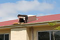
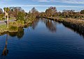
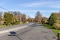
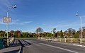
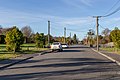
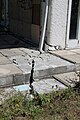
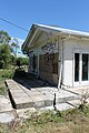
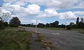
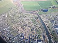
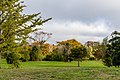
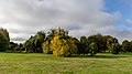
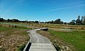
The Residential Red Zone comprises residential property on flat land in Christchurch that has been zoned red by the Government when the land has been so badly damaged by the earthquakes that it is unlikely that it can be rebuilt on for a prolonged period.
Subcategories
This category has the following 3 subcategories, out of 3 total.
Media in category "Residential Red Zone"
The following 70 files are in this category, out of 70 total.
-
 574 Avonside Dr 952.JPG 4,272 × 2,848; 5.4 MB
-
 574 Avonside Dr 953.JPG 4,272 × 2,848; 3.19 MB
-
 Aerial photographs of Christchurch 161.jpg 3,593 × 2,695; 3.66 MB
-
 Aerial photographs of Christchurch 162.jpg 3,503 × 2,627; 3.86 MB
-
 Avon River at the Red Zone, Christchurch, New Zealand.jpg 5,457 × 3,073; 9.36 MB
-
 Avon River from Swanns Rd, Red Zone, Christchurch, New Zealand.jpg 4,806 × 3,423; 10.14 MB
-
 Avonside Dr, Red Zone, Christchurch, New Zealand.jpg 5,289 × 3,526; 14.06 MB
-
 Avonside from Dallington Tce 564.JPG 4,272 × 2,848; 5.3 MB
-
 Bowie Place 948.JPG 4,272 × 2,848; 6.66 MB
-
 Bowie Place 949.JPG 4,272 × 2,848; 6.99 MB
-
 Bridge across Avon River, Swanns Rd, Red Zone, Christchurch, New Zealand.jpg 5,327 × 3,309; 8.68 MB
-
 Cabbage trees along River Rd, Red Zone, Christchurch, New Zealand.jpg 4,373 × 3,357; 13.25 MB
-
 Corner of River Rd & Glade Ave, Red Zone, Christchurch, New Zealand.jpg 5,298 × 3,167; 14.84 MB
-
 Cowlishaw St, Red Zone, Christchurch, New Zealand.jpg 5,472 × 3,648; 12.73 MB
-
 Dallington Terrace 811.jpg 3,024 × 4,032; 3.28 MB
-
 Dallington Terrace 812.jpg 3,024 × 4,032; 3.83 MB
-
 Dallington Terrace 813.jpg 3,024 × 4,032; 3.68 MB
-
 Fence is level house is not 955.JPG 4,272 × 2,848; 6.31 MB
-
 Galbraith Ave 968.JPG 4,272 × 2,848; 5.39 MB
-
 Glade Ave, Red Zone, Christchurch, New Zealand.jpg 4,902 × 3,489; 14.82 MB
-
 House on River Road 559.JPG 2,848 × 4,272; 6.4 MB
-
 House on River Road 562.JPG 2,848 × 4,272; 6.07 MB
-

-
 Kaiapoi Community BMX Track within Norman Kirk Park.jpg 1,440 × 1,080; 158 KB
-
 Kaiapoi East Residential Red Zone A.jpg 1,334 × 800; 126 KB
-
 Kaiapoi East Residential Red Zone B.jpg 1,334 × 800; 191 KB
-
 Kaiapoi empty red zone 008.JPG 3,264 × 2,448; 3.43 MB
-
 Kaiapoi empty red zone 009.JPG 3,264 × 2,448; 3.34 MB
-
 Liquefaction in Avonside 961.JPG 4,272 × 2,848; 8.59 MB
-
 Liquefaction in Avonside 962.JPG 4,272 × 2,848; 9.18 MB
-
 Norman Kirk Park.jpg 1,440 × 1,080; 204 KB
-
 Platycladus orientalis in Avonside, NZ 963.jpg 4,272 × 2,848; 4.27 MB
-
 Platycladus orientalis in Avonside, NZ 964.jpg 4,272 × 2,848; 6.86 MB
-
 Platycladus orientalis in Avonside, NZ 965.jpg 4,272 × 2,848; 6.44 MB
-
 Poo collection container 951.JPG 2,848 × 4,272; 8.24 MB
-
 Railing on a bridge at Swanns Rd Red Zone, Christchurch, New Zealand.jpg 5,212 × 3,340; 9.22 MB
-
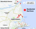 Red Zone map first upload.png 2,757 × 2,230; 1.45 MB
-
 Red Zone, Christchurch, New Zealand.jpg 5,472 × 3,033; 13.13 MB
-
 Red-billed gull, Red Zone, Christchurch, New Zealand.jpg 4,069 × 3,340; 5.46 MB
-
 Residential Red Zone 214.JPG 5,472 × 3,648; 4.67 MB
-
 Residential Red Zone 215.JPG 5,472 × 3,648; 5.99 MB
-
 Residential Red Zone 216.JPG 5,472 × 3,648; 5.69 MB
-
 Residential Red Zone 217.JPG 5,472 × 3,648; 4.75 MB
-
 Residential Red Zone 219.JPG 5,472 × 3,648; 4.53 MB
-
 Residential Red Zone 220.JPG 5,472 × 3,648; 5.45 MB
-
 Residential Red Zone 223.JPG 5,472 × 3,648; 6.22 MB
-
 Residential Red Zone 224.JPG 5,472 × 3,648; 5.61 MB
-
 Residential Red Zone 225.JPG 5,472 × 3,648; 4.87 MB
-
 Residential Red Zone 227.JPG 5,472 × 3,648; 7.17 MB
-
 Residential Red Zone 228.JPG 5,472 × 3,648; 5.23 MB
-
 Residential Red Zone in New Brighton, Christchurch, New Zealand.jpg 5,458 × 2,749; 11 MB
-
 Residential Red Zone, Christchurch, New Zealand 01.jpg 3,512 × 3,995; 11.14 MB
-
 Residential Red Zone, Christchurch, New Zealand 02.jpg 5,472 × 3,648; 16.76 MB
-
 Residential Red Zone, Christchurch, New Zealand 03.jpg 5,472 × 3,338; 17.14 MB
-
 Residential Red Zone, Christchurch, New Zealand 04.jpg 5,472 × 3,648; 17.39 MB
-
 Residential Red Zone, Christchurch, New Zealand 05.jpg 5,472 × 3,078; 15.41 MB
-
 Residential Red Zone, Christchurch, New Zealand 06.jpg 5,344 × 2,886; 12.13 MB
-
 Residential Red Zone, Christchurch, New Zealand 07.jpg 5,472 × 3,078; 12.46 MB
-
 Residential Red Zone, Christchurch, New Zealand 08.jpg 3,513 × 4,845; 15.38 MB
-
 Residential Red Zone, Christchurch, New Zealand 09.jpg 5,339 × 2,994; 14.45 MB
-
 Residential Red Zone, Christchurch, New Zealand 10.jpg 5,472 × 3,338; 14.49 MB
-
 Residential Red Zone, Christchurch, New Zealand 11.jpg 5,472 × 3,648; 17.79 MB
-
 Residential Red Zone, Christchurch, New Zealand 12.jpg 3,515 × 4,851; 18.38 MB
-
 Residential Red Zone, Christchurch, New Zealand 13.jpg 5,472 × 3,648; 14.99 MB
-
 Residential Red Zone, Christchurch, New Zealand 14.jpg 5,472 × 3,648; 18.24 MB
-
 Residential Red Zone, Christchurch, New Zealand 15.jpg 5,217 × 2,935; 10.49 MB
-
 River Rd, Red Zone, Christchurch, New Zealand.jpg 5,230 × 3,454; 14.26 MB
-
 Sullivan Park liquefaction 960.JPG 2,848 × 4,272; 5.87 MB
-
 The Honda Forest facing east towards the Beswick Stormwater Area.jpg 1,440 × 881; 198 KB
-
 Woodham Road.JPG 4,000 × 3,000; 4.05 MB


