Category:Reservoir Chapf (Windisch)
Jump to navigation
Jump to search
| Object location | | View all coordinates using: OpenStreetMap |
|---|
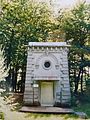
infrastructure building in Windisch in the canton of Aargau, Switzerland  | |||||
| Upload media | |||||
| Instance of |
| ||||
|---|---|---|---|---|---|
| Part of | |||||
| Location | Windisch, Brugg District, Aargau, Switzerland | ||||
| Street address |
| ||||
| Architectural style | |||||
| Heritage designation | |||||
| Inception |
| ||||
| Elevation above sea level |
| ||||
 | |||||
Media in category "Reservoir Chapf (Windisch)"
The following 3 files are in this category, out of 3 total.
-
 Reservoir Chapf Windisch.jpg 1,944 × 2,592; 1,012 KB
-
 Reservoir Chapf.jpg 4,140 × 5,520; 6.87 MB
-
 Reservoir Chapfstrasse.jpg 3,087 × 4,166; 3.11 MB

