Category:Republic of Ireland photographs taken on 2009-07-30
Jump to navigation
Jump to search
Countries of Europe: Andorra · Austria · Belarus · Belgium · Bulgaria · Croatia · Czech Republic · Denmark · Estonia · Finland · France‡ · Germany · Greece · Hungary · Republic of Ireland · Italy · Latvia · Lithuania · Monaco · Montenegro · Netherlands‡ · North Macedonia · Norway · Poland · Portugal‡ · Romania · Russia‡ · Serbia · Slovakia · Slovenia · Spain‡ · Sweden · Switzerland · Turkey‡ · Ukraine · United Kingdom
‡: partly located in Europe
‡: partly located in Europe
| ← | 30 July 2009 | → | ||
| ← | July 2009 | → | ||

Republic of Ireland photographs taken on 30 July 2009.
Image files should be categorized here automatically using {{taken on}} template. Direct categorisation is also possible, if automatic is impossible.
Media in category "Republic of Ireland photographs taken on 2009-07-30"
The following 153 files are in this category, out of 153 total.
-
 American House, Bundoran - geograph.org.uk - 1422189.jpg 640 × 479; 60 KB
-
 Angling on the Drowes - geograph.org.uk - 1422101.jpg 640 × 479; 114 KB
-
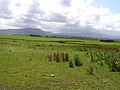
 Ardfarn Townland - geograph.org.uk - 1422133.jpg 640 × 479; 53 KB
-
 Ardfarn Townland - geograph.org.uk - 1422136.jpg 640 × 479; 58 KB
-
 Ardfarn Townland - geograph.org.uk - 1422142.jpg 640 × 479; 68 KB
-
 Ardfarn Townland - geograph.org.uk - 1422235.jpg 640 × 479; 62 KB
-
 Ardloughill Townland - geograph.org.uk - 1421972.jpg 640 × 479; 71 KB
-
 Ardloughill Townland - geograph.org.uk - 1421977.jpg 640 × 479; 73 KB
-
 Ascending Errigal - geograph.org.uk - 1502017.jpg 640 × 438; 230 KB
-
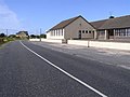
 Askill National School - geograph.org.uk - 1422005.jpg 640 × 479; 73 KB
-
 Askill Townland - geograph.org.uk - 1422017.jpg 640 × 479; 67 KB
-
 Askill Townland - geograph.org.uk - 1422026.jpg 640 × 479; 84 KB
-
 Askill Townland - geograph.org.uk - 1422029.jpg 640 × 479; 76 KB
-
 Ballymacaward Townland - geograph.org.uk - 1422371.jpg 640 × 479; 73 KB
-
 Ballymacaward Townland - geograph.org.uk - 1422601.jpg 640 × 479; 58 KB
-
 Ballymacaward Townland - geograph.org.uk - 1422773.jpg 640 × 479; 75 KB
-
 Ballymunterhiggin Townland - geograph.org.uk - 1421981.jpg 640 × 479; 81 KB
-
 Ballymunterhiggin Townland - geograph.org.uk - 1422294.jpg 640 × 479; 61 KB
-
 Ballymunterhiggin Townland - geograph.org.uk - 1422300.jpg 640 × 479; 50 KB
-
 Bayview Avenue, Bundoran - geograph.org.uk - 1422167.jpg 640 × 479; 47 KB
-
 Boyannagh Townland - geograph.org.uk - 1422240.jpg 640 × 479; 81 KB
-
 Boyannagh Townland - geograph.org.uk - 1422245.jpg 640 × 479; 77 KB
-
 Boyannagh Townland - geograph.org.uk - 1422247.jpg 640 × 479; 87 KB
-
 Boyannagh Townland - geograph.org.uk - 1422252.jpg 640 × 479; 91 KB
-
 Church of Ireland, Bundoran - geograph.org.uk - 1422176.jpg 640 × 479; 41 KB
-
 Church Road, Bundoran - geograph.org.uk - 1422158.jpg 640 × 479; 58 KB
-
 Clontyseer Townland - geograph.org.uk - 1421962.jpg 640 × 479; 54 KB
-
 Coach House, Ballymacaward - geograph.org.uk - 1422751.jpg 640 × 479; 67 KB
-
 Derryherk Townland - geograph.org.uk - 1422034.jpg 640 × 479; 66 KB
-
 Derryherk Townland - geograph.org.uk - 1422035.jpg 640 × 479; 73 KB
-
 Derryherk Townland - geograph.org.uk - 1422060.jpg 640 × 479; 52 KB
-
 Derryherk Townland - geograph.org.uk - 1422061.jpg 640 × 479; 72 KB
-
 Drowes River - geograph.org.uk - 1422098.jpg 640 × 479; 77 KB
-
 Drowes River, Rosfriar - geograph.org.uk - 1422097.jpg 640 × 479; 67 KB
-
 Drumnagroagh Townland - geograph.org.uk - 1421967.jpg 640 × 479; 53 KB
-
 Enjoying a round of golf, Bundoran - geograph.org.uk - 1422226.jpg 640 × 479; 47 KB
-
 Front entrance, Wardtown Castle - geograph.org.uk - 1422770.jpg 479 × 640; 153 KB
-
 Horses, Ballymacaward - geograph.org.uk - 1422373.jpg 640 × 479; 69 KB
-
 Horses, Ballymacaward - geograph.org.uk - 1422377.jpg 640 × 443; 60 KB
-
 Horses, Derryherk - geograph.org.uk - 1422038.jpg 640 × 479; 82 KB
-
 House, Cornaglah - geograph.org.uk - 1422255.jpg 640 × 441; 63 KB
-
 Interior, Wardtown Castle - geograph.org.uk - 1422771.jpg 479 × 640; 130 KB
-
 Lane, Edenvella - geograph.org.uk - 1422106.jpg 640 × 479; 46 KB
-
 Lareen Townland - geograph.org.uk - 1422065.jpg 640 × 479; 55 KB
-
 Lareen Townland - geograph.org.uk - 1422067.jpg 640 × 479; 59 KB
-
 Laughill Townland - geograph.org.uk - 1421907.jpg 640 × 479; 71 KB
-
 Legaloscran Townland - geograph.org.uk - 1421983.jpg 640 × 479; 71 KB
-
 Legaloscran Townland - geograph.org.uk - 1421987.jpg 640 × 479; 70 KB
-
 Lisacholly Townland - geograph.org.uk - 1421924.jpg 640 × 479; 78 KB
-
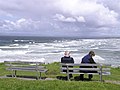 Looking at the breakers, Bundoran - geograph.org.uk - 1422198.jpg 640 × 479; 54 KB
-
 Lough Chamais - geograph.org.uk - 1435618.jpg 640 × 480; 95 KB
-
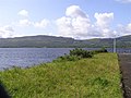 Lough Melvin - geograph.org.uk - 1422040.jpg 640 × 479; 57 KB
-
 Lough Melvin - geograph.org.uk - 1422049.jpg 640 × 479; 68 KB
-
 Magheracar Townland - geograph.org.uk - 1422146.jpg 640 × 479; 86 KB
-
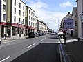
 Main Street, Bundoran - geograph.org.uk - 1422177.jpg 640 × 479; 58 KB
-
 Main Street, Bundoran - geograph.org.uk - 1422193.jpg 640 × 479; 58 KB
-
 Main Street, Bundoran - geograph.org.uk - 1422195.jpg 640 × 479; 64 KB
-
 Manger Townland - geograph.org.uk - 1422502.jpg 640 × 479; 60 KB
-
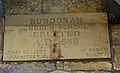
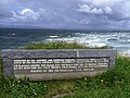 Memorial plaque, Bundoran - geograph.org.uk - 1422206.jpg 640 × 479; 75 KB
-
 Mullanaleck Townland - geograph.org.uk - 1422077.jpg 640 × 479; 79 KB
-
 Near Finner - geograph.org.uk - 1422338.jpg 640 × 479; 58 KB
-
 Near Tullan Strand, Bundoran - geograph.org.uk - 1422199.jpg 640 × 479; 74 KB
-
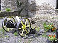
 Old machinery, Wardtown Castle (1) - geograph.org.uk - 1422754.jpg 640 × 479; 111 KB
-
 Old machinery, Wardtown Castle (2) - geograph.org.uk - 1422758.jpg 640 × 479; 111 KB
-
 Old machinery, Wardtown Castle (3) - geograph.org.uk - 1422762.jpg 640 × 479; 110 KB
-
 Old machinery, Wardtown Castle (4) - geograph.org.uk - 1422766.jpg 640 × 479; 103 KB
-

-
 Plaque, Askill National School - geograph.org.uk - 1422014.jpg 640 × 365; 71 KB
-
 Plaque, Bundoran Church School - geograph.org.uk - 1422171.jpg 640 × 390; 58 KB
-
 Plaque, Drones River - geograph.org.uk - 1422094.jpg 640 × 479; 65 KB
-
 Puffer, Bundoran - geograph.org.uk - 1422186.jpg 640 × 479; 40 KB
-
 R231 at Ballure - geograph.org.uk - 1422364.jpg 640 × 479; 54 KB
-
 Rathglass Townland - geograph.org.uk - 1422308.jpg 640 × 479; 69 KB
-
 Rathglass Townland - geograph.org.uk - 1422314.jpg 640 × 479; 83 KB
-
 Rathmore Townland - geograph.org.uk - 1422319.jpg 640 × 479; 80 KB
-
 Rathmore Townland - geograph.org.uk - 1422328.jpg 640 × 479; 70 KB
-
 Road and bridge at Edenvella - geograph.org.uk - 1422080.jpg 640 × 479; 75 KB
-
 Road at Ardfarn - geograph.org.uk - 1422131.jpg 640 × 479; 70 KB
-
 Road at Ardfarn - geograph.org.uk - 1422140.jpg 640 × 479; 75 KB
-
 Road at Ardfarn - geograph.org.uk - 1422234.jpg 640 × 479; 69 KB
-
 Road at Askill - geograph.org.uk - 1422032.jpg 640 × 479; 64 KB
-
 Road at Ballymunterhiggin - geograph.org.uk - 1421980.jpg 640 × 479; 66 KB
-
 Road at Ballymunterhiggin - geograph.org.uk - 1422299.jpg 640 × 479; 69 KB
-
 Road at Boyannagh - geograph.org.uk - 1422243.jpg 640 × 479; 67 KB
-
 Road at Clontyseer - geograph.org.uk - 1421944.jpg 640 × 479; 74 KB
-
 Road at Clontyseer - geograph.org.uk - 1421966.jpg 640 × 479; 75 KB
-
 Road at Cornaglah - geograph.org.uk - 1422287.jpg 640 × 479; 76 KB
-
 Road at Derryherk - geograph.org.uk - 1422052.jpg 640 × 479; 84 KB
-
 Road at Edenvella - geograph.org.uk - 1422107.jpg 640 × 479; 65 KB
-
 Road at Edenvella - geograph.org.uk - 1422123.jpg 640 × 479; 58 KB
-
 Road at Edenville - geograph.org.uk - 1422111.jpg 640 × 479; 60 KB
-
 Road at Finner - geograph.org.uk - 1422334.jpg 640 × 479; 50 KB
-
 Road at Gubacreeny - geograph.org.uk - 1422114.jpg 640 × 479; 72 KB
-
 Road at Gubacreeny - geograph.org.uk - 1422115.jpg 640 × 479; 62 KB
-
 Road at Gubnacreeny - geograph.org.uk - 1422511.jpg 640 × 479; 73 KB
-
 Road at Magheracar - geograph.org.uk - 1422150.jpg 640 × 479; 50 KB
-
 Road at Magheracar - geograph.org.uk - 1422153.jpg 640 × 479; 53 KB
-
 Road at Manger - geograph.org.uk - 1422503.jpg 640 × 479; 72 KB
-
 Road at Mullanaleck - geograph.org.uk - 1422074.jpg 640 × 479; 61 KB
-
 Road at Rathglass - geograph.org.uk - 1422303.jpg 640 × 479; 68 KB
-
 Road at Rathglass - geograph.org.uk - 1422309.jpg 640 × 479; 75 KB
-
 Road at Rathglass - geograph.org.uk - 1422311.jpg 640 × 479; 70 KB
-
 Road at Rathmore - geograph.org.uk - 1422322.jpg 640 × 479; 67 KB
-
 Road at Rosfriar - geograph.org.uk - 1422104.jpg 640 × 479; 81 KB
-
 Road at Rowantreehill - geograph.org.uk - 1421933.jpg 640 × 479; 77 KB
-
 Road at Sheegys - geograph.org.uk - 1422386.jpg 640 × 479; 54 KB
-
 Road at Sheegys - geograph.org.uk - 1422388.jpg 640 × 479; 57 KB
-
 Road at Tonregee - geograph.org.uk - 1422342.jpg 640 × 479; 102 KB
-
 Road at Tonregee - geograph.org.uk - 1422357.jpg 640 × 479; 74 KB
-
 Rock platform - geograph.org.uk - 1589507.jpg 640 × 480; 96 KB
-
 Rosfriar Townland - geograph.org.uk - 1422102.jpg 640 × 479; 64 KB
-
 Rougey Cliff Walk - geograph.org.uk - 1422216.jpg 640 × 479; 54 KB
-
 Rougey Cliff Walk, Bundoran - geograph.org.uk - 1422218.jpg 640 × 479; 49 KB
-
 Rougey Walk, Bundoran - geograph.org.uk - 1422209.jpg 640 × 479; 49 KB
-
 Rougey Walk, Bundoran - geograph.org.uk - 1422214.jpg 640 × 479; 50 KB
-
 Rougey, Bundoran - geograph.org.uk - 1422221.jpg 640 × 479; 79 KB
-
 Rowantreehill Townland - geograph.org.uk - 1421936.jpg 640 × 479; 77 KB
-
 Rowantreehill Townland - geograph.org.uk - 1421941.jpg 640 × 479; 57 KB
-
 Seafront, Bundoran - geograph.org.uk - 1422181.jpg 640 × 479; 43 KB
-
 Seafront, Bundoran - geograph.org.uk - 1422184.jpg 640 × 479; 42 KB
-
 Seedling forest - geograph.org.uk - 1589476.jpg 640 × 480; 87 KB
-
 Sheegys Townland - geograph.org.uk - 1422382.jpg 640 × 479; 60 KB
-
 Shelter, Bundoran - geograph.org.uk - 1422230.jpg 640 × 479; 50 KB
-
 Single Road, Bundoran - geograph.org.uk - 1422190.jpg 640 × 479; 53 KB
-
 Siopa, Derryherk - geograph.org.uk - 1422056.jpg 640 × 479; 70 KB
-
 Squeeze stile in wall, Askill School - geograph.org.uk - 1422011.jpg 640 × 479; 92 KB
-
 Strolling along Rougey - geograph.org.uk - 1422212.jpg 640 × 479; 53 KB
-
 The Fairy Bridges, Bundoran - geograph.org.uk - 1422208.jpg 640 × 479; 63 KB
-
 Tonregee Townland - geograph.org.uk - 1422352.jpg 640 × 479; 66 KB
-
 Tonregee Townland - geograph.org.uk - 1422355.jpg 640 × 479; 88 KB
-
 Track across the bog - geograph.org.uk - 1588768.jpg 640 × 480; 97 KB
-
 Tullan Strand, Bundoran - geograph.org.uk - 1422196.jpg 640 × 479; 63 KB
-
 Wardtown Castle - geograph.org.uk - 1422614.jpg 640 × 479; 46 KB
-
 Wardtown Castle - geograph.org.uk - 1422748.jpg 640 × 479; 61 KB
-
 Wild plant, Lareen - geograph.org.uk - 1422069.jpg 640 × 479; 87 KB
-
 Wild plants, Edenvella (1) - geograph.org.uk - 1422125.jpg 640 × 479; 119 KB
-
 Wild plants, Edenvella (2) - geograph.org.uk - 1422128.jpg 640 × 479; 86 KB
-
 Ballure Townland - geograph.org.uk - 1422367.jpg 640 × 479; 79 KB
-
 Bog and rocks - geograph.org.uk - 1435516.jpg 640 × 480; 91 KB
-
 Carrickboy Road - geograph.org.uk - 1421990.jpg 640 × 479; 63 KB
-
 Clontyseer Townland - geograph.org.uk - 1421951.jpg 640 × 479; 77 KB
-
 Clontyseer Townland - geograph.org.uk - 1421953.jpg 640 × 479; 64 KB
-
 Coastal scenery north of Tra-na-Rossan - geograph.org.uk - 1438884.jpg 640 × 475; 121 KB
-
 Cornaglah Townland - geograph.org.uk - 1422284.jpg 640 × 479; 53 KB
-
 Dunmuckrum Townland - geograph.org.uk - 1422329.jpg 640 × 479; 60 KB
-
 Dunmuckrum Townland - geograph.org.uk - 1422333.jpg 640 × 479; 69 KB
-
 Edenvella Townland - geograph.org.uk - 1422110.jpg 640 × 479; 66 KB
-
 Edenvella Townland - geograph.org.uk - 1422118.jpg 640 × 479; 92 KB
-
 Edenvella Townland - geograph.org.uk - 1422119.jpg 640 × 479; 77 KB
-
 Fassagh Road - geograph.org.uk - 1421913.jpg 640 × 479; 86 KB
-
 Fassagh Road - geograph.org.uk - 1421917.jpg 640 × 479; 79 KB
-
 Gubnacreeny Townland - geograph.org.uk - 1422508.jpg 640 × 479; 79 KB
-
 Gubnacreeny Townland - geograph.org.uk - 1422514.jpg 640 × 479; 73 KB


_-_geograph.org.uk_-_1422754.jpg)
_-_geograph.org.uk_-_1422758.jpg)
_-_geograph.org.uk_-_1422762.jpg)
_-_geograph.org.uk_-_1422766.jpg)


_-_geograph.org.uk_-_1422125.jpg)
_-_geograph.org.uk_-_1422128.jpg)


