Category:Republic of Ireland photographs taken on 2006-06-30
Jump to navigation
Jump to search

Media in category "Republic of Ireland photographs taken on 2006-06-30"
The following 50 files are in this category, out of 50 total.
-
 Athenry - panoramio.jpg 1,600 × 1,200; 511 KB
-
 Cashel, Saint Patrick's Cathedral - panoramio - fabiolah (1).jpg 1,024 × 768; 234 KB
-
 Cashel, Saint Patrick's Cathedral - panoramio - fabiolah.jpg 1,200 × 1,600; 516 KB
-
 Cashel, Saint Patrick's Cathedral - panoramio.jpg 1,200 × 1,600; 502 KB
-
 Colours of Croagh Patrick - panoramio.jpg 1,600 × 1,200; 528 KB
-
 Drisean - Drishane - geograph.org.uk - 273750.jpg 640 × 450; 78 KB
-
 Dublin Airport - geograph.org.uk - 897594.jpg 640 × 480; 56 KB
-
 Entrance alley of Monivea arboretum - panoramio.jpg 1,200 × 1,600; 513 KB
-
 Galway - panoramio - fabiolah (1).jpg 1,600 × 1,200; 518 KB
-
 Galway - panoramio - fabiolah.jpg 1,600 × 1,200; 517 KB
-
 Galway - panoramio.jpg 1,600 × 1,200; 513 KB
-
 Irish fiesta - panoramio.jpg 1,024 × 768; 239 KB
-
 Laharan - geograph.org.uk - 270898.jpg 640 × 480; 91 KB
-
 Monivea - panoramio.jpg 1,200 × 1,600; 518 KB
-
 Ruin, Tooreen - geograph.org.uk - 272099.jpg 640 × 480; 112 KB
-
 Sheep's Head Lighthouse - geograph.org.uk - 271962.jpg 640 × 480; 121 KB
-
 Ships in dock - panoramio.jpg 1,600 × 1,200; 514 KB
-
 Statue of Saint Patrick - panoramio.jpg 1,600 × 1,200; 519 KB
-
 Street of Cashel - panoramio.jpg 1,600 × 1,200; 516 KB
-
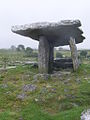 The Burren, Poulnabrone dolmen - panoramio.jpg 768 × 1,024; 231 KB
-
 Timoleague - panoramio.jpg 2,048 × 1,536; 756 KB
-
 A stripy hill - geograph.org.uk - 273723.jpg 640 × 480; 90 KB
-
 Alders, Mauladinna - geograph.org.uk - 273770.jpg 640 × 480; 173 KB
-
 Almost the tip of Sheep's Head Peninsula - geograph.org.uk - 271956.jpg 480 × 640; 102 KB
-
 Ardahill - geograph.org.uk - 270924.jpg 640 × 480; 123 KB
-
 Ardahill - geograph.org.uk - 270925.jpg 640 × 480; 120 KB
-
 Caher-mountain - geograph.org.uk - 271537.jpg 640 × 480; 98 KB
-
 Calves, Scrahanyleary - geograph.org.uk - 270913.jpg 640 × 480; 117 KB
-
 Caravilleen - geograph.org.uk - 271523.jpg 640 × 480; 105 KB
-
 Carriglea - geograph.org.uk - 270919.jpg 640 × 464; 56 KB
-
 Clash - geograph.org.uk - 271552.jpg 640 × 480; 92 KB
-
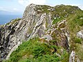 Crags, Sheep's Head - geograph.org.uk - 272065.jpg 640 × 480; 135 KB
-
 Derreennalomane - geograph.org.uk - 270904.jpg 640 × 480; 107 KB
-
 Derreennalomane - geograph.org.uk - 270905.jpg 640 × 480; 82 KB
-
 Dunbeacon Equestrian Centre - geograph.org.uk - 273772.jpg 640 × 480; 119 KB
-
 Farm buildings - geograph.org.uk - 270918.jpg 640 × 480; 85 KB
-
 Farm drive, Coolcoulaghta - geograph.org.uk - 270916.jpg 640 × 480; 101 KB
-
 Hairpins - geograph.org.uk - 271548.jpg 640 × 480; 80 KB
-
 Letter - geograph.org.uk - 271554.jpg 640 × 480; 102 KB
-
 Old fields, Sheep's Head - geograph.org.uk - 271951.jpg 640 × 480; 84 KB
-
 Plantation, Scrahanyleary - geograph.org.uk - 270915.jpg 640 × 480; 101 KB
-
 Rinn Mhuintir Bháire - Sheep's Head - geograph.org.uk - 271968.jpg 640 × 480; 112 KB
-
 Seefin - geograph.org.uk - 270935.jpg 640 × 480; 103 KB
-
 Seefin - geograph.org.uk - 270936.jpg 640 × 428; 60 KB
-
 Seefin - geograph.org.uk - 270939.jpg 640 × 480; 77 KB
-
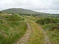
 Sheep's Head Way - geograph.org.uk - 272095.jpg 640 × 480; 85 KB
-
 Telegraph Office - geograph.org.uk - 270921.jpg 640 × 480; 87 KB
-
 The Goat's Path - geograph.org.uk - 270927.jpg 640 × 480; 86 KB
-
 View to Shantullig - geograph.org.uk - 273710.jpg 640 × 480; 92 KB
-
 Water and ground in their extremity - geograph.org.uk - 270928.jpg 640 × 480; 101 KB

.jpg)


.jpg)


