Category:Renishaw, Derbyshire
Jump to navigation
Jump to search
Cymraeg: Pentref a chymuned yn Lloegr ydy Renishaw, Swydd Derby; saif yn Nwyrain Canolbarth Lloegr. (→Renishaw, Swydd Derby)
Polski: Renishaw – wieś w Anglii, w hrabstwie Derbyshire, w dystrykcie North East Derbyshire. (→Renishaw (Derbyshire))

village in Derbyshire, United Kingdom  | |||||
| Upload media | |||||
| Instance of | |||||
|---|---|---|---|---|---|
| Location | Eckington, North East Derbyshire, Derbyshire, East Midlands, England | ||||
| official website | |||||
 | |||||
Subcategories
This category has the following 2 subcategories, out of 2 total.
M
R
Media in category "Renishaw, Derbyshire"
The following 62 files are in this category, out of 62 total.
-
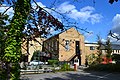 "The Sitwell Arms" - pub-hotel near Renishaw - geograph.org.uk - 3163225.jpg 4,339 × 2,893; 2.53 MB
-
 25085 Renishaw Golf Course.jpg 2,048 × 1,347; 798 KB
-
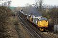
 31239 and 40132 Renishaw Park Colliery Sidings.jpg 2,048 × 1,305; 633 KB
-
 31289 Renishaw Golf Course.jpg 2,048 × 1,346; 532 KB
-
 47423 Renishaw Golf Course.jpg 1,199 × 803; 678 KB
-
 66423 Renishaw.jpg 3,000 × 2,000; 4.47 MB
-
 A folly at Renishaw - geograph.org.uk - 6103942.jpg 3,648 × 2,432; 2.98 MB
-
 A6135 Main Road, Renishaw - geograph.org.uk - 6066605.jpg 1,024 × 803; 157 KB
-
 Art at Renishaw - geograph.org.uk - 5036038.jpg 2,000 × 1,500; 791 KB
-
 Bend in the road nr Renishaw - geograph.org.uk - 3144424.jpg 427 × 640; 126 KB
-
 Carrwood Road, Renishaw - geograph.org.uk - 3163240.jpg 4,165 × 2,975; 2.61 MB
-
 Carrwood Road, Renishaw - geograph.org.uk - 4310349.jpg 640 × 480; 60 KB
-

-
 Cottage at Emmett Carr Lane, Renishaw - geograph.org.uk - 47287.jpg 640 × 480; 31 KB
-
 Cottage at Emmett Carr Lane, Renishaw - geograph.org.uk - 992365.jpg 640 × 480; 113 KB
-
 Fields and trees near Renishaw - geograph.org.uk - 3166520.jpg 768 × 1,024; 482 KB
-
 Floods on Renishaw Golf Course - geograph.org.uk - 2840865.jpg 604 × 640; 73 KB
-
 Footbridges under the A6135, Renishaw - geograph.org.uk - 2430517.jpg 950 × 704; 305 KB
-
 Forward thinking at Renishaw - geograph.org.uk - 2899322.jpg 3,072 × 2,304; 1.37 MB
-
 Hague Lane (B6419), Renishaw - geograph.org.uk - 4310351.jpg 640 × 480; 76 KB
-
 Industrial works at Renishaw - geograph.org.uk - 2430720.jpg 950 × 829; 352 KB
-
 Lily pond, Renishaw Hall - geograph.org.uk - 3583799.jpg 4,608 × 3,072; 6.44 MB
-
 Line of the canal appears safe at Renishaw - geograph.org.uk - 2899308.jpg 3,072 × 2,304; 1.36 MB
-
 Littlemoor towards Renishaw - geograph.org.uk - 4434182.jpg 640 × 432; 70 KB
-
 Main Road, Renishaw - geograph.org.uk - 2166120.jpg 1,280 × 856; 156 KB
-
 Renishaw (2995794845).jpg 2,047 × 1,356; 590 KB
-

-
 Renishaw - Industrial Estate - geograph.org.uk - 1025043.jpg 640 × 480; 66 KB
-
 Renishaw - Industrial Estate - geograph.org.uk - 1025074.jpg 640 × 480; 81 KB
-
 Renishaw - Lafarge Aggregates - geograph.org.uk - 1025049.jpg 640 × 480; 58 KB
-
 Renishaw - Main Road (A6135) - geograph.org.uk - 1145967.jpg 640 × 480; 91 KB
-
 Renishaw - Toll House.jpg 2,272 × 1,704; 770 KB
-
 Renishaw Central station site geograph-3450451-by-Ben-Brooksbank.jpg 1,966 × 1,591; 4.06 MB
-
 Renishaw Golf Course (3163063327).jpg 1,439 × 951; 784 KB
-
 Renishaw Golf Course, partly submerged - geograph.org.uk - 3033799.jpg 3,648 × 2,736; 4.65 MB
-
 Renishaw Lakes - geograph.org.uk - 2371627.jpg 640 × 480; 120 KB
-
 Renishaw Park Colliery Workshops. - geograph.org.uk - 288530.jpg 640 × 480; 70 KB
-
 Renishaw Park Golf Course - geograph.org.uk - 2825776.jpg 1,024 × 768; 177 KB
-
 Renishaw, new houses by the old canal - geograph.org.uk - 2430509.jpg 950 × 667; 303 KB
-
 Sodden fields by Renishaw Park - geograph.org.uk - 3279347.jpg 3,648 × 2,736; 4.4 MB
-
 The lake at Renishaw - geograph.org.uk - 6103946.jpg 3,648 × 2,432; 2.79 MB
-
 Tip near Renishaw - geograph.org.uk - 2713077.jpg 3,648 × 2,736; 5.62 MB
-

-
 TPT near Renishaw - geograph.org.uk - 4317144.jpg 1,024 × 768; 272 KB
-

-
 Track towards Renishaw - geograph.org.uk - 3166208.jpg 1,024 × 768; 486 KB
-
 Trans Pennine trail near Renishaw - geograph.org.uk - 4317149.jpg 1,024 × 768; 236 KB
-
 Trans Pennine Trail near Renishaw - geograph.org.uk - 4379580.jpg 640 × 480; 147 KB
-
 Trans Pennine Trail near Renishaw - geograph.org.uk - 5803215.jpg 1,600 × 1,065; 945 KB
-

-

-
 Transpennine Trail - bridge carrying the A6135 at Renishaw - geograph.org.uk - 3163232.jpg 4,068 × 2,906; 2.66 MB
-
 Chesterfield Canal, Renishaw - geograph.org.uk - 175259.jpg 640 × 427; 118 KB
-
 Flooding At Emmett Carr Lane - geograph.org.uk - 476743.jpg 640 × 480; 42 KB
-

-

-

-

-
 Renishaw - Main Road - geograph.org.uk - 321358.jpg 640 × 480; 85 KB
-
 Renishaw Village - geograph.org.uk - 47934.jpg 640 × 480; 40 KB
-
 Tip near Renishaw - geograph.org.uk - 172251.jpg 640 × 479; 74 KB
-
 Water Meadow, Renishaw - geograph.org.uk - 48705.jpg 640 × 480; 29 KB


,_Renishaw_-_geograph.org.uk_-_4310351.jpg)


.jpg)


_-_geograph.org.uk_-_1145967.jpg)

.jpg)


.jpg)


