Category:Remote views of Broad Law, Tweeddale
Jump to navigation
Jump to search
Media in category "Remote views of Broad Law, Tweeddale"
The following 34 files are in this category, out of 34 total.
-
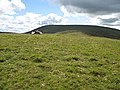
 Broad Law from Lamb Knowe - geograph.org.uk - 413220.jpg 640 × 483; 84 KB
-
 Broad Law from Syart Law - geograph.org.uk - 1108522.jpg 640 × 427; 201 KB
-
 Cor Water from Annanhead Hill - geograph.org.uk - 1737202.jpg 800 × 530; 172 KB
-
 Cramalt Craig cairn - geograph.org.uk - 320094.jpg 640 × 480; 70 KB
-
 Cramalt Craig view to Broad Law.jpg 640 × 394; 65 KB
-
 Dun Law - geograph.org.uk - 1522246.jpg 640 × 480; 92 KB
-
 Fanks, Hearthstane - geograph.org.uk - 510938.jpg 640 × 480; 106 KB
-
 Glenheurie Rig - geograph.org.uk - 510935.jpg 640 × 480; 80 KB
-
 Great Knock - geograph.org.uk - 510644.jpg 640 × 480; 99 KB
-
 Hill countryside at Megget Reservoir - geograph.org.uk - 1111460.jpg 640 × 427; 179 KB
-
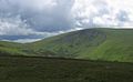
 Looking across Tweeddale - geograph.org.uk - 655929.jpg 640 × 480; 89 KB
-
 Nickies Knowe - geograph.org.uk - 559543.jpg 640 × 404; 57 KB
-
 Nickies Knowe, summit - geograph.org.uk - 467318.jpg 640 × 480; 66 KB
-
 On Hunt Law - geograph.org.uk - 16254.jpg 640 × 392; 36 KB
-
 On the northeast ridge of Craigdilly - geograph.org.uk - 1108793.jpg 640 × 418; 138 KB
-
 Ridge off Cramalt Craig - geograph.org.uk - 970703.jpg 640 × 359; 62 KB
-
 River Tweed at Hearthstane - geograph.org.uk - 38630.jpg 600 × 450; 153 KB
-

-
 Stottin Cleuch - geograph.org.uk - 1108482.jpg 640 × 427; 149 KB
-
 Summit of Dollar Law - geograph.org.uk - 16233.jpg 640 × 392; 39 KB
-
 Talla Cleuch Head - geograph.org.uk - 320111.jpg 640 × 480; 67 KB
-
 Talla East Side - geograph.org.uk - 559539.jpg 640 × 390; 44 KB
-

-
 The Tweed Valley from the summit of Wrae Hill - geograph.org.uk - 1755950.jpg 1,024 × 679; 281 KB
-
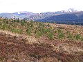
 Unplanted area, Peddrie Burn - geograph.org.uk - 932857.jpg 640 × 359; 59 KB
-
 View of Broad Law from Clyde Law - geograph.org.uk - 1446958.jpg 640 × 428; 64 KB
-
 Walking in the Southern Uplands - geograph.org.uk - 286272.jpg 640 × 480; 155 KB
-
 Alpine Tweeddale - geograph.org.uk - 246394.jpg 640 × 480; 42 KB
-
 Gool Knowe - geograph.org.uk - 354898.jpg 640 × 480; 188 KB
-
 Heartstane - geograph.org.uk - 246401.jpg 640 × 480; 47 KB
-
 Looking eastwards on the way to Broad Law - geograph.org.uk - 181833.jpg 640 × 480; 195 KB
-
 Summit, Cocklie Rig Head - geograph.org.uk - 52686.jpg 640 × 480; 276 KB
-
 Syart Farm. - geograph.org.uk - 354934.jpg 640 × 480; 69 KB
-
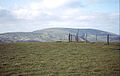
 Trig point, Pkyestone Hill - geograph.org.uk - 637373.jpg 640 × 480; 72 KB


