Category:Relief maps of subdivisions of Georgia
Jump to navigation
Jump to search
Media in category "Relief maps of subdivisions of Georgia"
The following 27 files are in this category, out of 27 total.
-
 Eredvi Municipality relief map.svg 511 × 640; 826 KB
-
 Georgia Abkhazia relief location map.svg 647 × 545; 7.64 MB
-
 Georgia Adjara location relief map.svg 512 × 321; 8.81 MB
-
 Georgia Guria relief location map.svg 512 × 290; 6.37 MB
-
 Georgia Imereti relief location map.svg 3,650 × 2,429; 9.6 MB
-
 Georgia Kakheti relief location map.svg 569 × 669; 4.86 MB
-
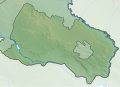
 Georgia Kvemo Kartli relief location map.svg 753 × 444; 8.96 MB
-
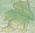
 Georgia Mtskheta-Mtianeti relief location map.svg 575 × 747; 9.62 MB
-
 Georgia Racha-Lechkhumi and Kvemo Svaneti relief location map.svg 757 × 407; 2.11 MB
-
 Georgia Samegrelo-Zemo Svaneti relief location map.svg 562 × 564; 8.96 MB
-
 Georgia Tbilisi relief location map.svg 750 × 556; 889 KB
-
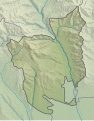
 Gori Municipality relief location map.svg 571 × 693; 998 KB
-
 Provisional Administrative-Territorial Unit of South Ossetia relief map.svg 1,087 × 1,013; 3.37 MB
-
 Relief map of Akhalgori municipality.svg 319 × 512; 1.12 MB
-
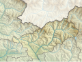
 Relief map of Akhmeta Municipality.svg 1,220 × 1,405; 6.49 MB
-
 Relief map of Dedoplistsqaro Municipality.svg 1,551 × 1,122; 2.66 MB
-
 Relief map of Dusheti Municipality.svg 1,000 × 1,245; 1.65 MB
-
 Relief map of Gali Municipality.svg 719 × 920; 1.17 MB
-
 Relief map of Java district.svg 508 × 379; 909 KB
-
 Relief map of Kareli Municipality.svg 1,000 × 1,239; 4.61 MB
-
 Relief map of Kaspi Municipality.svg 1,783 × 1,679; 2.71 MB
-
 Relief map of Kurta municipality.svg 400 × 512; 1.11 MB
-
 Relief map of Mtskheta Municipality.svg 800 × 558; 2.58 MB
-
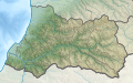
 Relief Map of Samtskhe-Javakheti.svg 906 × 748; 7.39 MB
-
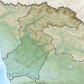
 Relief Map of Shida Kartli.svg 783 × 734; 8.21 MB
-
 Relief map of Signagi Municipality.svg 1,358 × 972; 2.31 MB
-
 Relief map of Tigva municipality.svg 524 × 512; 1.19 MB


