Category:Regions of Guyana
Jump to navigation
Jump to search
Territorial Organization of Guyana | |||||
| Upload media | |||||
| Subclass of | |||||
|---|---|---|---|---|---|
| Location |
| ||||
| |||||

Subcategories
This category has the following 13 subcategories, out of 13 total.
!
*
C
Pages in category "Regions of Guyana"
This category contains only the following page.
Media in category "Regions of Guyana"
The following 73 files are in this category, out of 73 total.
-
 Colored Map of Guyana (Neutral).png 6,120 × 7,920; 1.97 MB
-
 Detailed Map Guyana (Neutral).png 6,120 × 7,920; 2.02 MB
-
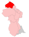
 Guyana - Region 1 Barima-Waini Map Neutral.png 6,120 × 7,920; 1.41 MB
-
 Guyana - Region 10 Upper Demerara-Berbice Map Neutral.png 6,120 × 7,920; 1.41 MB
-
 Guyana - Region 2 Pomeroon-Supenaam Map Neutral.png 6,120 × 7,920; 1.41 MB
-
 Guyana - Region 3 Essequibo Islands-West Demerara Map Neutral.png 6,120 × 7,920; 1.41 MB
-
 Guyana - Region 4 Demerara-Mahaica Map Neutral.png 6,120 × 7,920; 1.41 MB
-
 Guyana - Region 5 Mahaica-Berbice Map Neutral.png 6,120 × 7,920; 1.41 MB
-
 Guyana - Region 6 East Berbice-Corentyne Map Neutral.png 6,120 × 7,920; 1.41 MB
-
 Guyana - Region 7 Cuyuni-Mazaruni Map Neutral.png 6,120 × 7,920; 1.41 MB
-
 Guyana - Region 8 Potaro-Siparuni Map Neutral.png 6,120 × 7,920; 1.41 MB
-
 Guyana - Region 9 Upper Takutu-Upper Essequibo Map Neutral.png 6,120 × 7,920; 1.41 MB
-
 Guyana Administrative Regions Detailed.svg 595 × 842; 510 KB
-
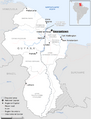 Guyana Basemap With disputed areas.png 566 × 742; 180 KB
-
 Guyana Location Map with Disputed Areas.png 1,965 × 2,400; 5.32 MB
-
 Guyana neighborhood councils.svg 593 × 777; 2.23 MB
-
 Guyana Physical Map with Disputed Areas.svg 851 × 1,252; 2.66 MB
-
 Guyana Region 1 - Barima-Waini.png 5,952 × 7,691; 731 KB
-
 Guyana Region 1 - Barima-Waini.svg 595 × 769; 212 KB
-
 Guyana Region 1 Barima-Waini.png 6,120 × 7,920; 1.03 MB
-
 Guyana Region 10 - Upper Demerara-Upper Berbice.png 5,952 × 7,691; 733 KB
-
 Guyana Region 10 - Upper Demerara-Upper Berbice.svg 595 × 769; 214 KB
-
 Guyana Region 10 Upper Demerara-Berbice.png 6,120 × 7,920; 1.03 MB
-
 Guyana Region 2 - Pomeroon-Supenaam.png 5,952 × 7,691; 731 KB
-
 Guyana Region 2 - Pomeroon-Supenaam.svg 595 × 769; 213 KB
-
 Guyana Region 2 Pomeroon-Supenaam.png 6,120 × 7,920; 1.03 MB
-
 Guyana Region 3 - Essequibo Islands - West Demerara.png 5,952 × 7,691; 731 KB
-
 Guyana Region 3 - Essequibo Islands - West Demerara.svg 595 × 769; 213 KB
-
 Guyana Region 3 Essequibo Islands-West Demerara.png 6,120 × 7,920; 1.03 MB
-
 Guyana Region 4 - Demerara-Mahaica.png 5,952 × 7,691; 731 KB
-
 Guyana Region 4 - Demerara-Mahaica.svg 595 × 769; 213 KB
-
 Guyana Region 4 Demerara-Mahaica.png 6,120 × 7,920; 1.03 MB
-
 Guyana Region 5 - Mahaica-Berbice.png 5,952 × 7,691; 731 KB
-
 Guyana Region 5 - Mahaica-Berbice.svg 595 × 769; 213 KB
-
 Guyana Region 5 Mahaica-Berbice.png 6,120 × 7,920; 1.03 MB
-
 Guyana Region 6 - East Berbice - Corentyne.png 5,952 × 7,691; 741 KB
-
 Guyana Region 6 - East Berbice - Corentyne.svg 595 × 769; 213 KB
-
 Guyana Region 6 East Berbice-Corentyne.png 6,120 × 7,920; 1.04 MB
-
 Guyana Region 7 - Cuyuni-Mazaruni.png 5,952 × 7,691; 734 KB
-
 Guyana Region 7 - Cuyuni-Mazaruni.svg 595 × 769; 213 KB
-
 Guyana Region 7 Cuyuni-Mazaruni.png 6,120 × 7,920; 1.03 MB
-
 Guyana Region 8 - Potaro-Siparuni.png 5,952 × 7,691; 732 KB
-
 Guyana Region 8 - Potaro-Siparuni.svg 595 × 769; 213 KB
-
 Guyana Region 8 Potaro-Siparuni.png 6,120 × 7,920; 1.03 MB
-
 Guyana Region 9 - Upper Takutu-Upper Essequibo.png 5,952 × 7,691; 730 KB
-
 Guyana Region 9 - Upper Takutu-Upper Essequibo.svg 595 × 769; 213 KB
-
 Guyana Region 9 Upper Takutu-Upper Essequibo.png 6,120 × 7,920; 1.03 MB
-
 Guyana Regions and Disputed Areas.png 5,950 × 8,420; 997 KB
-
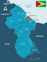
 Guyana Regions Information Map.png 6,120 × 7,920; 2.22 MB
-
 Guyana Regions Map Blank.png 5,952 × 7,691; 752 KB
-
 Guyana Regions Map With Names.png 5,952 × 7,691; 995 KB
-
 Guyana Regions Map.png 5,950 × 8,420; 1.14 MB
-
 Guyana regions Numbered.png 5,952 × 7,691; 820 KB
-
 High detailed map Guyana outline.png 5,699 × 8,420; 654 KB
-
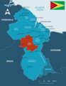
 Map of Guyana with Regions and places Neutral.png 6,120 × 7,920; 1.41 MB
-
 Neighborhoods of Guyana Grouped.png 5,950 × 8,420; 2.38 MB
-
 Neighborhoods of Guyana Outline.png 5,950 × 8,420; 1.35 MB
-
 Neighborhoods of Guyana Wikipedia Theme.png 5,950 × 8,420; 1.44 MB
-
 Regions of Guyana - Blank Outline Map with Label and Flag.png 5,950 × 8,420; 813 KB
-
 Regions of Guyana - Blank Outline Map.png 5,950 × 8,420; 760 KB
-
 Regions of Guyana - Outline Map with Region Names (Wiki Colors).png 5,950 × 8,420; 1.13 MB
-
 Regions of Guyana - Outline Map with Region Names Blue Theme 2.png 5,950 × 8,420; 1.13 MB
-
 Regions of Guyana - Outline Map with Region Names Blue Theme.png 5,950 × 8,420; 1.18 MB
-
 Regions of Guyana - Outline Map with Region Names Colored Pastel Theme.png 5,950 × 8,420; 1.16 MB
-
 Regions of Guyana - Outline Map with Region Names Colored.png 5,950 × 8,420; 1.15 MB
-
 Regions of Guyana - Outline Map with Region Names Colorful Theme.png 5,950 × 8,420; 1.11 MB
-
 Regions of Guyana - Outline Map with Region Names Darker colors.png 5,950 × 8,420; 1.15 MB
-
 Regions of Guyana - Outline Map with Region Names Light Blue Theme.png 5,950 × 8,420; 1.14 MB
-
 Regions of Guyana - Outline Map with Region Names Orange Theme.png 5,950 × 8,420; 1.16 MB
-
 Regions of Guyana - Outline Map with Region Names Pastel Theme.png 5,950 × 8,420; 1.18 MB
-
 Regions of Guyana - Outline Map with Region Names.png 5,950 × 8,420; 1 MB
-
 Regions of Guyana Including Capital.png 6,120 × 7,920; 1.03 MB
-
 Regions of Guyana with Region Names colored.png 5,950 × 8,420; 1.16 MB
.png)
.png)


.png)


