Category:Regierungsgebäude Kanton Thurgau
Jump to navigation
Jump to search
| Object location | | View all coordinates using: OpenStreetMap |
|---|
|
This is a category about a cultural property of regional significance in Switzerland with KGS number 5040
|
 | |||||
| Upload media | |||||
| Instance of | |||||
|---|---|---|---|---|---|
| Part of | |||||
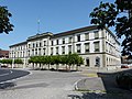
| Location | Frauenfeld, Frauenfeld District, Thurgau, Switzerland | ||||
| Street address |
| ||||
| Heritage designation |
| ||||
 | |||||
Subcategories
This category has only the following subcategory.
Media in category "Regierungsgebäude Kanton Thurgau"
This category contains only the following file.
-
 Zürcherstrasse 188 8500 Frauenfeld P1020197.jpg 4,000 × 3,000; 3.49 MB