Category:Regierungsgebäude (Freihof, Rathausstrasse 2, Liestal)
Jump to navigation
Jump to search
| Object location | | View all coordinates using: OpenStreetMap |
|---|
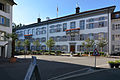
building in Liestal in the canton of Basel-Landschaft, Switzerland -Liestal-02.jpg) | |||||
| Upload media | |||||
| Instance of | |||||
|---|---|---|---|---|---|
| Part of | |||||
| Location | Liestal, Liestal District, Basel-Landschaft, Switzerland | ||||
| Street address |
| ||||
| Heritage designation | |||||
 | |||||
Media in category "Regierungsgebäude (Freihof, Rathausstrasse 2, Liestal)"
This category contains only the following file.
-
 Regierungsgebäude-(Freihof)-Liestal-02.jpg 6,000 × 4,000; 7.61 MB