Category:Regelbau M262A (Longues-sur-Mer)
Jump to navigation
Jump to search
| Object location | | View all coordinates using: OpenStreetMap |
|---|
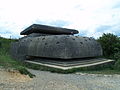
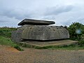
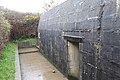
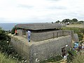
Français : Bunker de commandement située au Nord de la batterie de Longues-sur-Mer, faisant partie du mur de l'Atlantique (Calvados, Normandie, France).
English: Command bunker located north of the Longues-sur-Mer battery, part of the Atlantic Wall (Calvados, Normandy, France).
Deutsch: Kommandobunker nördlich der Batterie Longues-sur-Mer, Teil des Atlantikwalls (Calvados, Normandie, Frankreich).
Media in category "Regelbau M262A (Longues-sur-Mer)"
The following 46 files are in this category, out of 46 total.
-
 14400 Longues-sur-Mer, France - panoramio.jpg 3,072 × 2,304; 1.72 MB
-
 Batterie de Longues Observation post (6032288119).jpg 4,288 × 2,239; 5.88 MB
-
 Battery Longues-sur-Mer (14).JPG 3,264 × 2,448; 5.58 MB
-
 Battery Longues-sur-Mer (15).JPG 3,264 × 2,448; 4.39 MB
-
 Battery Longues-sur-Mer (16).JPG 3,264 × 2,448; 5.3 MB
-
 Battery Longues-sur-Mer (17).JPG 3,264 × 2,448; 5.12 MB
-
 Battery Longues-sur-Mer (18).JPG 3,264 × 2,448; 5.22 MB
-
 Battery Longues-sur-Mer.JPG 3,264 × 2,448; 4.9 MB
-
 Beobachtunsbunker Batterie Longues sur mer.JPG 3,648 × 2,736; 4.7 MB
-
 Bunker in Longues-sur-Mer (2).jpg 5,719 × 3,803; 2.56 MB
-
 Bunker Longues-sur-Mer.jpg 5,996 × 3,987; 2.73 MB
-
 Command post of Longues sur Mer battery back.jpg 1,600 × 1,200; 1.23 MB
-
 Command post of Longues sur Mer battery side.jpg 1,600 × 1,200; 919 KB
-
 Command post of Longues sur Mer battery top.jpg 1,600 × 1,200; 1.11 MB
-
 Feuerleitstand Batterie Longues sur mer.jpg 3,648 × 2,736; 4.04 MB
-
 France-000770 - Command Post - Seaward Side (15066560565).jpg 6,000 × 4,000; 22.9 MB
-
 France-000774 - Command Post (15066248162).jpg 6,000 × 4,000; 26.1 MB
-
 France-000776 - Command Post (15043613906).jpg 6,090 × 4,136; 23.29 MB
-
 Longues sur Mer DSC 2786 2.jpg 1,072 × 712; 603 KB
-
 Longues-German fire-control bunker.jpeg 1,600 × 1,200; 271 KB
-
 Longues-sur-Mer - Wn 48 (Bunker type M262A - intérieur) 01.jpg 4,272 × 2,848; 4.44 MB
-
 Longues-sur-Mer - Wn 48 (Bunker type M262A - intérieur) 02.jpg 4,272 × 2,848; 3.8 MB
-
 Longues-sur-Mer - Wn 48 (Bunker type M262A - intérieur) 03.jpg 4,272 × 2,848; 4.92 MB
-
 Longues-sur-Mer - Wn 48 (Bunker type M262A - intérieur) 04.jpg 4,272 × 2,848; 3.76 MB
-
 Longues-sur-Mer - Wn 48 (Bunker type M262A - intérieur) 05.jpg 4,096 × 3,072; 3.55 MB
-
 Longues-sur-Mer - Wn 48 (Bunker type M262A - intérieur) 06.jpg 4,272 × 2,848; 4.61 MB
-
 Longues-sur-Mer - Wn 48 (Bunker type M262A - intérieur) 07.jpg 4,096 × 3,072; 2.72 MB
-
 Longues-sur-Mer - Wn 48 (Bunker type M262A - intérieur) 08.jpg 4,096 × 3,072; 4.02 MB
-
 Longues-sur-Mer - Wn 48 (Bunker type M262A - intérieur) 09.jpg 4,096 × 3,072; 3.4 MB
-
 Longues-sur-Mer - Wn 48 (Bunker type M262A - intérieur) 10.jpg 4,096 × 3,072; 3.05 MB
-
 Longues-sur-Mer - Wn 48 (Bunker type M262A - intérieur) 11.jpg 3,264 × 2,448; 925 KB
-
 Longues-sur-Mer - Wn 48 (Bunker type M262A - intérieur) 12.jpg 4,272 × 2,848; 3.46 MB
-
 Longues-sur-Mer - Wn 48 (Bunker type M262A - intérieur) 13.jpg 4,096 × 3,072; 2.29 MB
-
 Longues-sur-Mer - Wn 48 (Bunker type M262A - intérieur) 14.jpg 4,096 × 3,072; 3.05 MB
-
 Longues-sur-Mer - Wn 48 (Bunker type M262A - intérieur) 15.jpg 4,272 × 2,848; 4.58 MB
-
 Longues-sur-Mer - Wn 48 (Bunker type M262A) 01.jpg 4,272 × 2,848; 5.2 MB
-
 Longues-sur-Mer - Wn 48 (Bunker type M262A) 02.jpg 4,272 × 2,848; 4.36 MB
-
 Longues-sur-Mer - Wn 48 (Bunker type M262A) 03.jpg 4,272 × 2,848; 5.88 MB
-
 Longues-sur-Mer - Wn 48 (Bunker type M262A) 04.jpg 4,272 × 2,848; 7.23 MB
-
 Longues-sur-Mer - Wn 48 (Bunker type M262A) 05.jpg 4,272 × 2,848; 6.03 MB
-
 Longues-sur-Mer - Wn 48 (Bunker type M262A) 06.jpg 4,272 × 2,848; 6.85 MB
-
 Longues-sur-Mer - Wn 48 (Bunker type M262A) 07.jpg 4,272 × 2,848; 6.67 MB
-
 Longues-sur-Mer - Wn 48 (Bunker type M262A) 08.jpg 4,272 × 2,848; 6.37 MB
-
 Ninho de metralhadoras - panoramio.jpg 800 × 600; 178 KB
-
 Observation Post Longues sur Mer (1764258537).jpg 1,280 × 960; 268 KB
-
 View from a bunker in Longues-sur-Mer.jpg 5,760 × 3,830; 1.55 MB

.jpg)
.JPG)
.JPG)
.JPG)
.JPG)
.JPG)


.jpg)


.jpg)
.jpg)
.jpg)


_01.jpg)
_02.jpg)
_03.jpg)
_04.jpg)
_05.jpg)
_06.jpg)
_07.jpg)
_08.jpg)
_09.jpg)
_10.jpg)
_11.jpg)
_12.jpg)
_13.jpg)
_14.jpg)
_15.jpg)
_01.jpg)
_02.jpg)
_03.jpg)
_04.jpg)
_05.jpg)
_06.jpg)
_07.jpg)
_08.jpg)

.jpg)
