Category:Reformierte Kirche Laupen
Jump to navigation
Jump to search
| Object location | | View all coordinates using: OpenStreetMap |
|---|
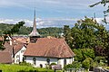
church building in Laupen in the canton of Bern, Switzerland .jpg) | |||||
| Upload media | |||||
| Instance of | |||||
|---|---|---|---|---|---|
| Part of | |||||
| Location | Laupen, Bern-Mittelland administrative district, Bernese Mittelland administrative region, Bern, Switzerland | ||||
| Street address |
| ||||
| Heritage designation |
| ||||
| Inception |
| ||||
 | |||||
Media in category "Reformierte Kirche Laupen"
The following 11 files are in this category, out of 11 total.
-
 Laupen BE - Reformierte Kirche (2019).jpg 4,500 × 3,000; 11.64 MB
-
 Laupen innerorts 15.jpg 4,896 × 3,672; 6.4 MB
-
 Laupen innerorts 21.jpg 4,896 × 3,672; 7.29 MB
-
 Laupen innerorts 24.jpg 3,672 × 4,896; 3.64 MB
-
 Laupen Kirche 2.jpg 4,668 × 3,671; 5.16 MB
-
 Laupen Kirche 3.jpg 3,551 × 4,735; 5.26 MB
-
 Laupen Kirche 4.jpg 3,672 × 4,896; 7.47 MB
-
 Laupen-Kirche.jpg 800 × 1,200; 1.35 MB
-
 Laupen-Laeubli.jpg 800 × 1,200; 1.18 MB
-
 Laupen.jpeg 380 × 590; 69 KB
-
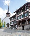 Läubeliplatz (12, 14 & 16) in Laupen.jpg 3,200 × 3,840; 6.79 MB


_in_Laupen.jpg)