Category:Reformed Church in Tornaľa
Jump to navigation
Jump to search
| Object location | | View all coordinates using: OpenStreetMap |
|---|
| This category shows the protected monument with the number 608-1021/1 (other) in the Slovak Republic. |
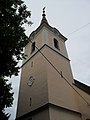
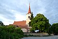
church of the Reformed Christian Church and a national cultural monument in the town of Tornaľa, Revúca district, Slovakia  | |||||
| Upload media | |||||
| Instance of | |||||
|---|---|---|---|---|---|
| Location | Tornaľa, Revúca District, Banská Bystrica Region, Slovakia | ||||
| Architectural style | |||||
| Heritage designation |
| ||||
| Inception |
| ||||
 | |||||
Subcategories
This category has only the following subcategory.
C
Media in category "Reformed Church in Tornaľa"
The following 10 files are in this category, out of 10 total.
-
 Tornalja066.JPG 1,944 × 2,592; 1.33 MB
-
 Tornalja067.JPG 1,944 × 2,592; 1.33 MB
-
 Tornalja074.JPG 2,592 × 1,944; 1.43 MB
-
 Tornalja075.JPG 1,944 × 2,592; 1.32 MB
-
 Tornaľa - Reformovaný kostol -a.jpg 4,608 × 3,072; 3.18 MB
-
 Tornaľa - Reformovaný kostol -b.jpg 4,182 × 2,881; 2.98 MB
-
 Tornaľa - Reformovaný kostol -c.jpg 4,608 × 3,072; 3.79 MB
-
 Tornaľa - Reformovaný kostol -d.jpg 2,948 × 4,458; 3.52 MB
-
 Tornaľa1.jpg 3,006 × 4,009; 1.86 MB
-
 Tornaľa2.jpg 4,608 × 3,456; 1.72 MB


