Category:Ref. Kirche Rebstein
Jump to navigation
Jump to search
| Object location | | View all coordinates using: OpenStreetMap |
|---|
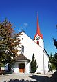
church building in Rebstein in the canton of St. Gallen, Switzerland  | |||||
| Upload media | |||||
| Instance of | |||||
|---|---|---|---|---|---|
| Part of | |||||
| Location | Rebstein, Rheintal Constituency, canton St. Gallen, Switzerland | ||||
| Street address |
| ||||
| Heritage designation | |||||
| Inception |
| ||||
 | |||||
Media in category "Ref. Kirche Rebstein"
The following 7 files are in this category, out of 7 total.
-
 ETH-BIB-Rebstein, Rheintal-LBS H1-021630.tif 6,275 × 4,455; 80.03 MB
-
 ETH-BIB-Rebstein-LBS H1-012656.tif 6,114 × 4,191; 73.45 MB
-
 ETH-BIB-Rebstein-LBS H1-021631.tif 6,244 × 4,426; 79.12 MB
-
 Evang. Kirche Rebstein - panoramio.jpg 2,048 × 1,536; 387 KB
-
 Rebstein - feldstrasse - panoramio.jpg 2,592 × 1,944; 1.21 MB
-
 Rebstein Dorf Kirchen.jpg 4,413 × 2,914; 6.11 MB
-
 Rebstein ref. Kirche.JPG 2,795 × 4,012; 3.65 MB


