Category:Reestraat 28, Amsterdam
Jump to navigation
Jump to search
| Object location | | View all coordinates using: OpenStreetMap |
|---|
 | |||||
| Upload media | |||||
| Instance of |
| ||||
|---|---|---|---|---|---|
| Location | Amsterdam, North Holland, Netherlands | ||||
| Street address |
| ||||
| Located on street | |||||
| Heritage designation |
| ||||
 | |||||
|
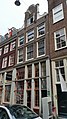
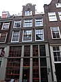
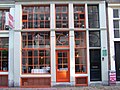
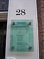
This is a category about rijksmonument number 4814
|
| Address |
|
Media in category "Reestraat 28, Amsterdam"
The following 9 files are in this category, out of 9 total.
-
 2020 Reestraat 28 (1).jpg 2,988 × 5,312; 2.81 MB
-
 2020 Reestraat 28 (2).jpg 2,988 × 5,312; 2.31 MB
-
 Amsterdam, Reestraat 28.jpg 2,736 × 3,648; 2.62 MB
-
 Cornelis Gerardus Leenheer, Afb 010118000013.jpg 2,015 × 2,603; 689 KB
-
 Gevels - Amsterdam - 20020387 - RCE.jpg 805 × 1,200; 159 KB
-
 Gevels - Amsterdam - 20020388 - RCE.jpg 806 × 1,200; 170 KB
-
 Reestraat 28 door.JPG 2,304 × 1,728; 755 KB
-
 Reestraat 28 plaque.JPG 1,728 × 2,304; 505 KB
-
 Reestraat 28 top.JPG 1,728 × 2,304; 937 KB
.jpg)
.jpg)


