Category:Redwick, Gloucestershire
Jump to navigation
Jump to search
village in South Gloucestershire, England _(geograph_3457507).jpg) | |||||
| Upload media | |||||
| Instance of | |||||
|---|---|---|---|---|---|
| Location | South Gloucestershire, Gloucestershire, South West England, England | ||||
 | |||||
English: Redwick is a village in South Gloucestershire, England. It is part of the parish of Pilning and Severn Beach. It is approximately enclosed by the River Severn to the north, The Chessell Pill Rhine to the east, the south meets the village of Pilning at the end of Redwick Road (by the Cross hands Public House) and the western edge finishes inline with mainlne of the railway prior to its entry to the Severn Tunnel. Very few people including locals describe themselves as coming from Redwick, usually they refer to themselves as being from Pilning or New Passage.
Media in category "Redwick, Gloucestershire"
The following 16 files are in this category, out of 16 total.
-
 Bridleway over the M4 - geograph.org.uk - 190692.jpg 640 × 480; 80 KB
-

-
 Deane House, Redwick, South Gloucestershire - geograph.org.uk - 2398496.jpg 3,523 × 2,759; 3.41 MB
-
 End of the road - geograph.org.uk - 118663.jpg 480 × 640; 151 KB
-
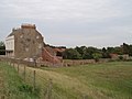
 Imposing house and barns at Redwick - geograph.org.uk - 1848615.jpg 4,288 × 2,848; 2.84 MB
-
 Imposing house at Redwick - geograph.org.uk - 1848574.jpg 4,288 × 2,848; 3.37 MB
-

-
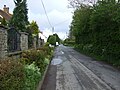 New Passage Road (B4064) (geograph 3457507).jpg 640 × 480; 89 KB
-
 Old barns at Redwick - geograph.org.uk - 1848598.jpg 4,288 × 2,848; 3 MB
-
 Redwick Road, Redwick - geograph.org.uk - 2723945.jpg 800 × 600; 256 KB
-
 Driftwood, at Severn Beach - geograph.org.uk - 444440.jpg 640 × 480; 97 KB
-

-
 Old road, new road - geograph.org.uk - 192123.jpg 640 × 480; 84 KB
-
 Road by Brook Farm - geograph.org.uk - 118665.jpg 640 × 480; 140 KB
-
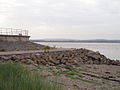 Sea defences at New Passage - geograph.org.uk - 190697.jpg 640 × 480; 79 KB
-
 Severn Lodge Farm - geograph.org.uk - 192141.jpg 640 × 480; 71 KB


