Category:Red Wharf Bay
Jump to navigation
Jump to search
Media in category "Red Wharf Bay"
The following 64 files are in this category, out of 64 total.
-
 A line of posts in Red Wharf Bay - geograph.org.uk - 948183.jpg 640 × 480; 131 KB
-

-
 A plastic bag in Red Wharf Bay - geograph.org.uk - 947883.jpg 480 × 640; 190 KB
-
 Approaching the junction with the A 5025 - geograph.org.uk - 908051.jpg 640 × 480; 108 KB
-

-
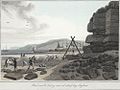 Black marble quarry, near Red Wharf Bay, Anglesea (1131967).jpg 1,000 × 752; 185 KB
-
 Bridge at Red Wharf Bay.jpg 3,456 × 2,304; 3.52 MB
-
 Bungalows at Red Wharf Bay - geograph.org.uk - 1228353.jpg 640 × 480; 50 KB
-
 Bungalows at Red Wharf Bay - geograph.org.uk - 906724.jpg 640 × 480; 45 KB
-
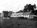
 Cottage in Sandy Lane, Red Wharf Bay.jpg 3,456 × 2,304; 4.63 MB
-
 Croesfryn farmhouse - geograph.org.uk - 908103.jpg 640 × 480; 89 KB
-
 Early evening at Red Wharf Bay - geograph.org.uk - 2551491.jpg 3,264 × 2,162; 2.42 MB
-
 East end of Red Wharf Bay - geograph.org.uk - 1533335.jpg 640 × 480; 223 KB
-

-
 High and dry^ - geograph.org.uk - 73060.jpg 640 × 480; 66 KB
-
 House and store at Red Wharf Bay - geograph.org.uk - 907636.jpg 640 × 480; 41 KB
-
 Houses at Red Wharf Bay - geograph.org.uk - 930172.jpg 640 × 480; 51 KB
-
 Incoming tide at Red Wharf Bay - geograph.org.uk - 2962919.jpg 640 × 473; 49 KB
-
 Incoming tide at Red Wharf Bay - geograph.org.uk - 565669.jpg 640 × 480; 62 KB
-
 Line of wooden posts on Red Wharf Bay - geograph.org.uk - 947831.jpg 640 × 480; 174 KB
-
 Low tide at Red Wharf Bay - geograph.org.uk - 948175.jpg 640 × 480; 47 KB
-
 Low tide in Red Wharf Bay - geograph.org.uk - 948039.jpg 640 × 480; 101 KB
-

-
 Mud and sand - geograph.org.uk - 1293493.jpg 640 × 480; 58 KB
-
 Multiple Choice Near Red Wharf Bay - geograph.org.uk - 1436364.jpg 640 × 480; 165 KB
-

-

-
 Ploughed land west of the A5025 - geograph.org.uk - 1244857.jpg 640 × 480; 36 KB
-
 Red Wharf Bay - Flickr - Terry Kearney.jpg 4,038 × 2,691; 1.38 MB
-
 Red Wharf Bay - geograph.org.uk - 1533349.jpg 640 × 480; 226 KB
-
 Red Wharf Bay - geograph.org.uk - 2529760.jpg 2,494 × 1,922; 1.33 MB
-
 Red Wharf Bay - geograph.org.uk - 565657.jpg 640 × 480; 60 KB
-
 Red Wharf Bay and Shipwreck - geograph.org.uk - 322383.jpg 640 × 480; 129 KB
-
 Red Wharf Bay at high tide - geograph.org.uk - 1533341.jpg 640 × 480; 251 KB
-
 Red Wharf Bay at low tide - geograph.org.uk - 87884.jpg 640 × 429; 291 KB
-
 Red Wharf Bay at low tide - geograph.org.uk - 943235.jpg 640 × 480; 221 KB
-
 Red Wharf Bay at low tide ^2 - geograph.org.uk - 943250.jpg 640 × 480; 190 KB
-
 Red Wharf Bay towards Moelfre - geograph.org.uk - 948168.jpg 640 × 480; 140 KB
-
 Red Wharf Bay, Anglesey - geograph.org.uk - 1316823.jpg 640 × 484; 68 KB
-
 Red Wharf Bay, Anglesey - geograph.org.uk - 133042.jpg 640 × 406; 65 KB
-
 Red Wharf Bay, Anglesey - geograph.org.uk - 851480.jpg 640 × 406; 92 KB
-
 Red Wharf Limestone Formation, Red Wharf Bay, Anglesey, North Wales, UK.jpg 3,264 × 2,448; 3.41 MB
-

-

-

-
 Sea Defences at Red Wharf Bay - geograph.org.uk - 906741.jpg 640 × 480; 60 KB
-
 Sunset over Red Wharf Bay - geograph.org.uk - 2529397.jpg 2,658 × 2,444; 3.04 MB
-

-
 The beach at Red Wharf Bay - geograph.org.uk - 907624.jpg 640 × 480; 51 KB
-

-

-

-
 The head of Red Wharf Bay at low tide - geograph.org.uk - 906719.jpg 640 × 480; 73 KB
-

-
 The seaward end of Lon Cei-Quay Lane - geograph.org.uk - 906729.jpg 640 × 480; 98 KB
-
 The Ship Inn.jpg 6,000 × 4,000; 12.18 MB
-
 Tide line in Red Wharf Bay - geograph.org.uk - 947797.jpg 640 × 480; 160 KB
-

-

-

-
 View across Red Wharf Bay - geograph.org.uk - 944146.jpg 640 × 480; 62 KB
-
 View across Red Wharf Bay - geograph.org.uk - 947909.jpg 640 × 480; 237 KB
-
 View out to sea across Red Wharf Bay - geograph.org.uk - 944084.jpg 640 × 480; 99 KB
-
 Walking on the beach at Red Wharf Bay - geograph.org.uk - 943264.jpg 640 × 457; 44 KB


.jpg)


