Category:Red Torii (Enoshima Shrine)
Jump to navigation
Jump to search
| Object location | | View all coordinates using: OpenStreetMap |
|---|
|
Red Torii (Enoshima Shrine) has an entry on OpenStreetMap (show). |
Media in category "Red Torii (Enoshima Shrine)"
The following 10 files are in this category, out of 10 total.
-
 1 Chome Enoshima, Fujisawa-shi, Kanagawa-ken 251-0036, Japan - panoramio.jpg 1,936 × 1,296; 1,019 KB
-
 Enoshima-5.jpg 2,027 × 1,504; 609 KB
-
 Enoshimajinja -05.jpg 2,592 × 1,944; 1.14 MB
-
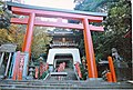 EnoshimaTorii.jpg 640 × 432; 67 KB
-
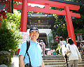 James Zumwalt 2009 2.jpg 240 × 189; 40 KB
-
 Kamakura 2011-04 (5712269968).jpg 5,184 × 3,456; 4.42 MB
-
 Lion 1 of 2 - Enoshima, Japan - DSC07623.jpg 3,648 × 5,472; 15.67 MB
-
 Lion 2 of 2 - Enoshima, Japan - DSC07625.jpg 3,648 × 5,472; 11.89 MB
-
 Shrine - panoramio - Babiesan.jpg 1,771 × 1,176; 1.28 MB
-
 江島神社 (49305248632).jpg 6,000 × 4,000; 22.15 MB

.jpg)

.jpg)