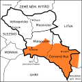
Category:Red Ruthenia
Jump to navigation
Jump to search
historic term used since the Middle Ages for southeastern Poland and Western Ukraine | |||||
| Upload media | |||||
| Instance of | |||||
|---|---|---|---|---|---|
| Location |
| ||||
| Capital | |||||
| Different from | |||||
 | |||||
- Беларуская: Чырвоная Русь
- Deutsch: Rothreußen
- English: Red Ruthenia is the name used since the Rus' culture's medieval times to refer to the area known as Eastern Galicia, in present day Ukraine and Subcarpathian Voivodeship, Poland.
- Français : Ruthénie rouge
- Magyar: Vörösoroszország
- Polski: Ruś Czerwona
- Русский: Червонная Русь
- Українська: Червона Русь
Subcategories
This category has the following 14 subcategories, out of 14 total.
Media in category "Red Ruthenia"
The following 39 files are in this category, out of 39 total.
-
1550 Map of Poland - Book Museum - National Library - Minsk - Belarus (27448006382).jpg 3,648 × 2,736; 3.32 MB
-
1700 Nicolás de Fer (París).jpg 1,500 × 2,304; 1.69 MB
-
1750 Homann Heirs Map of Poland - Geographicus - Poloniae-homannheirs-1750.jpg 4,000 × 3,552; 3.07 MB
-
1856 р. Луї-Етьєн Дюсьє Фрагмент.png 1,110 × 608; 1.14 MB
-
CHODZKO(1861) CARTE DES ÉTATS DE LA REPUBLIQUE DE POLOGNE AUX XVI ET XVII SIECLES.jpg 3,167 × 3,953; 3.85 MB
-
Alex K Halych-Volynia.svg 234 × 283; 56 KB
-
Carte des Estats de Suede, de Dannemarq, et de Pologne; sur la Mer Baltique.jpg 2,882 × 3,576; 5.12 MB
-
Caspar Vopel.jpg 2,369 × 1,763; 1.6 MB
-
Eastern Europe - Antonio Zatta (1781).jpg 1,024 × 742; 211 KB
-
Eastern Europe by Antonio Zatta.jpg 1,500 × 1,171; 1.57 MB
-
English map of Poland XVIII century.png 928 × 796; 1.7 MB
-
Kart425(0239).jpg 4,000 × 2,929; 1.72 MB
-
Kyivstar vkraina 1560-2.jpg 2,500 × 1,945; 2.38 MB
-
Litvania map 1570.png 764 × 593; 1.02 MB
-
Lubomeriae et Galliciae Regni tabula geographica ; F.L.G.jpg 3,768 × 2,912; 3.78 MB
-
Magni Ducatus Lithuaniae.jpg 2,274 × 1,600; 1.43 MB
-
MERCATOR G HONDIUS J Lithuania Amsterdam 1634.JPG 571 × 415; 51 KB
-
Monety opolczyka.jpg 450 × 121; 32 KB
-
Poland - claims of the partitioners.jpg 897 × 754; 176 KB
-
Poland1739old.jpg 1,668 × 1,457; 1.46 MB
-
Polen in den Grenzen vor 1660.jpg 731 × 561; 409 KB
-
Polsko 1400, Halič.svg 300 × 300; 27 KB
-
Red ruthenia history.png 1,703 × 5,156; 542 KB
-
Review of reviews and world's work (1890) (14793347573).jpg 2,714 × 3,980; 1.47 MB
-
Rossia Blanca.jpg 1,324 × 1,050; 1.34 MB
-
Rossia Fra Mauro.png 1,548 × 1,007; 4.59 MB
-
Rus Czerwona.png 1,703 × 5,156; 583 KB
-
Ruskie bełskie (II RP).png 2,110 × 2,364; 679 KB
-
Ruskie bełskie.png 3,155 × 2,831; 581 KB
-
Russia Mercator 1595.jpg 1,883 × 1,400; 3.58 MB
-
The map of Russia, late 16 c., Holland.jpg 1,742 × 1,053; 632 KB
-
Typus Generalis Ukraina 1649.jpg 2,608 × 2,040; 1.38 MB
-
Władysław Opolczyk seal 1378.PNG 1,292 × 1,129; 1.86 MB
-
Червонная Русь, Подолье, Волынь и Украина.png 1,358 × 722; 1.83 MB


