Category:Recreational and Cultural Interest Area destination guide signs in the United States
Jump to navigation
Jump to search
Media in category "Recreational and Cultural Interest Area destination guide signs in the United States"
The following 173 files are in this category, out of 173 total.
-
 "Ice Fishing Access" sign (9160115537).jpg 6,016 × 4,000; 5.57 MB
-
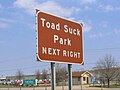
 040i ar toadsuck.jpg 1,656 × 1,242; 577 KB
-

-

-

-

-

-

-

-
-

-

-

-

-

-

-

-

-

-

-

-

-
 27 miles (2241218679).jpg 3,008 × 2,000; 5.29 MB
-
 AL68eRoad-US11nsSigns (35060805841).jpg 2,400 × 1,600; 1.9 MB
-
 AL68eRoad-US11sSigns (34804694760).jpg 2,400 × 1,600; 1.76 MB
-
 Alapaha River Water Trail Pafford's Landing sign.jpg 5,184 × 3,456; 9.73 MB
-
 Alapaha River Water Trail, Nashville Landing Berrien County GA135 NB.jpg 5,184 × 3,456; 5.26 MB
-
 Alapaha River Water Trail, Willacoochee Landing Atkinson County GA135 NB.jpg 5,184 × 3,456; 4.91 MB
-
 Appleton Art Museum-Silver Springs Park I-75 sign from 37th Avenue; Ocala.jpg 3,648 × 2,736; 2 MB
-
 Approaching Colonial Parkway, U.S. 17, Yorktown, Virginia (14486065125).jpg 4,000 × 3,000; 3.3 MB
-
 Aptos shore 813 - panoramio.jpg 3,456 × 3,456; 3.06 MB
-
 Baltimore-Washington Pkwy near MD 450.jpg 2,288 × 1,712; 810 KB
-
 Belt Mill Basin Bridge 20.jpg 5,152 × 3,864; 7.44 MB
-
 Blue Ridge Parkway - North Carolina (14584543498).jpg 3,072 × 2,304; 954 KB
-
 Blue Ridge Parkway - North Carolina (14584635708).jpg 3,072 × 2,304; 890 KB
-
 Blue Ridge Parkway - North Carolina (14748100046).jpg 3,072 × 2,304; 869 KB
-
 Blue Ridge Parkway - North Carolina (14768018051).jpg 3,072 × 2,304; 641 KB
-
 Blue Ridge Parkway - North Carolina (14790976203).jpg 3,072 × 2,304; 973 KB
-
 Brown Belmont Lake State Park sign on EB SSP.JPG 4,000 × 3,000; 2.67 MB
-
 BuffaloHerdOverlookSign.JPG 640 × 458; 39 KB
-
 Bull Gap-2011.jpg 4,288 × 2,848; 2.92 MB
-
 Catoctin Mountain Park VC MD1.jpg 5,184 × 3,462; 17.42 MB
-
 Colonial Parkway En Route to Yorktown, Virginia (14424539332).jpg 4,000 × 3,000; 4.63 MB
-
 Craven Gap-2011.jpg 4,288 × 2,848; 2.98 MB
-
 CS&IR Trolley Museum road sign and street sign.jpg 331 × 797; 103 KB
-
 CS&IR, Streetcar Railway Museum road sign.jpg 3,264 × 1,836; 1.49 MB
-
 Davidson Co I-85N Rest Area-02.jpg 4,912 × 7,360; 8.89 MB
-
 Dolly Sods road sign DSCF0033.jpg 1,024 × 768; 129 KB
-
 Douglas County Fairgrounds - I-5 Douglas County (11274241103).jpg 2,560 × 1,920; 896 KB
-
 EAP-NHS-Sign.jpg 2,048 × 1,536; 617 KB
-
 EB FL 100; Starke Downtown HD; One-and-a-Half Miles.jpg 3,648 × 2,736; 1.91 MB
-
 EB FL 40; Lake George WMA; Dexter-Mary Farms Unit.jpg 3,648 × 2,736; 2.04 MB
-
 EB Sumter CR 673 from I-75.jpg 5,152 × 3,864; 7.15 MB
-
 EverPkwyNearMuseum.JPG 640 × 480; 58 KB
-
 FireIslandWilderness.jpg 2,000 × 1,500; 632 KB
-
 Florida I10eb Entering Osceola National Forest.jpg 5,184 × 3,456; 4.55 MB
-
 Florida I10eb Exit 203 Maclay Gardens.jpg 5,184 × 3,456; 4.98 MB
-
 Florida I10eb Leaving Osceola National Forest.jpg 5,184 × 3,456; 4.44 MB
-
 Florida I10wb Exit 181 Lake Talquin State Forest.jpg 5,184 × 3,456; 5.25 MB
-
 Florida I75sb Exit 374 Paynes Prairie.jpg 5,184 × 3,456; 4.49 MB
-
 Florida I95 SB Exit 323 World Golf Hall of Fame.jpg 5,184 × 3,456; 5.88 MB
-
 Forest Capital Museum entrance.JPG 4,608 × 3,456; 5.51 MB
-
 Frostburg, Maryland (5855256148).jpg 2,324 × 1,556; 1.27 MB
-
 GA135 SB Nashville Landing Berrien County.jpg 5,184 × 3,456; 5.01 MB
-
 GA135 SB Willacoochee Landing Atkinson County.jpg 5,184 × 3,456; 5.37 MB
-
 GA94 EB, Clinch County, direction distance road sign Stephen C. Foster State Park.jpg 5,184 × 3,456; 4.27 MB
-
 GA94 EB, Echols County, Stephen C. Foster State Park direction sign.jpg 5,184 × 3,456; 4.63 MB
-

-
 GA94 EB, Fargo, direction road sign Stephen C. Foster State Park.jpg 5,184 × 3,456; 5.21 MB
-
 GA94WB, Clinch County, Stephen C. Foster State Park Distance and Directional sign.jpg 5,184 × 3,456; 4.84 MB
-
 Gateway National Recreation Area - Jacob Riis Park (8189875759).jpg 1,920 × 1,080; 856 KB
-
 George Washington Memorial Parkway GEME8256.jpg 3,072 × 2,048; 3.7 MB
-
 George Washington Memorial Parkway GEME8257.jpg 3,072 × 2,048; 3.15 MB
-
 George Washington Memorial Parkway GEME8262.jpg 3,072 × 2,048; 3.88 MB
-
 George Washington Parkway - Virginia (5512057700).jpg 2,048 × 1,536; 1.06 MB
-
 Georgia I285nb Clarkston city limit.jpg 5,184 × 3,456; 4.75 MB
-
 Georgia I75nb Exit 101 Georgia Veterans State Park.jpg 5,184 × 3,456; 4.24 MB
-
 Georgia I75nb Exit 101 Jimmy Carter National Historical Park.jpg 5,184 × 3,456; 4.27 MB
-
 Georgia I75nb Exit 109 Georgia State Cotton Museum.jpg 5,184 × 3,456; 4.4 MB
-
 Georgia I75nb Exit 188 Indian Spring State Park.jpg 5,184 × 3,456; 4.73 MB
-
 Georgia I75nb Exit 198 High Falls State Park.jpg 5,184 × 3,456; 4.73 MB
-
 Georgia I75nb Exit 39 Reed Bingham.jpg 5,184 × 3,456; 5.01 MB
-
 Georgia I75nb Exit 78 Jefferson Davis State.jpg 5,184 × 3,456; 4.2 MB
-
 Georgia I75sb Exit 39 Reed Bingham State Park.jpg 5,184 × 3,456; 4.4 MB
-
 Georgia I75sb Exit 63B Georgia Museum of Agriculture.jpg 5,184 × 3,456; 4.06 MB
-
 Gfp-minnesota-voyaguers-national-park-sign.jpg 2,500 × 1,706; 604 KB
-
 Heckscher State Park Entrance.jpg 4,000 × 3,000; 2.73 MB
-
 I 81 Interstate 81 - Virginia (6322177020).jpg 2,816 × 2,112; 288 KB
-
 I 81 Interstate 81 - Virginia (8598471333).jpg 3,072 × 2,304; 1.33 MB
-
 I 81 Interstate 81 - Virginia (8598475549).jpg 3,072 × 2,304; 486 KB
-
 I 81 STA60427 (3844496575).jpg 1,600 × 1,200; 483 KB
-
 I 81 STA60438 (3844497789).jpg 1,600 × 1,200; 484 KB
-
 I-10 West - Exit 166 - Lake Torreya SP (44033664992).jpg 2,400 × 1,600; 1.79 MB
-
 I-10 West - MM 159 - Three Rivers State Park (44033669762).jpg 2,400 × 1,600; 1.67 MB
-
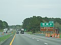
 I-40 Conway, Arkansas Toad Suck Park.jpg 1,073 × 804; 108 KB
-
 I-85 South-US 158 West in Vance County (October 2023) 02.jpg 6,000 × 4,000; 9.49 MB
-
 I-95-FL 105 EB Off-Ramp; Jax Zoo 1; Timucuan-Kingsley 18.jpg 1,306 × 732; 148 KB
-
 I95 PICT0348 (4531200090).jpg 1,600 × 1,200; 337 KB
-
 Int64wRoadWV-NationalRadioAstroObserve (33832258596).jpg 2,400 × 1,600; 2.07 MB
-
 Interstate 95 - Florida - 6876434722.jpg 2,816 × 2,112; 430 KB
-
 Interstate 95 - Florida - 8561061373.jpg 3,072 × 2,304; 781 KB
-
 Interstate 95 - Virginia (8112213457).jpg 3,072 × 2,304; 548 KB
-
 Interstate 95 - Virginia (8112222396).jpg 3,072 × 2,304; 604 KB
-
 Interstate 95 - Virginia (8112222592).jpg 3,072 × 2,304; 606 KB
-
 Interstate 95 - Virginia (8112231983).jpg 3,072 × 2,304; 511 KB
-
 Interstate 95 in North Carolina (27503489728).jpg 4,608 × 3,456; 7.44 MB
-
 Interstate 95 in North Carolina (40660591414).jpg 4,608 × 3,456; 7.77 MB
-
 Lake Welch Parkway approaching Lake Welch Beach.jpg 640 × 469; 49 KB
-
 Lime Kiln Canyon Road Arizona BLM (29922096425).jpg 3,846 × 2,505; 5.95 MB
-
 Little River Water Trail, GA37 Cook County.jpg 5,184 × 3,456; 4.1 MB
-
 Little Switzerland Tunnel.jpg 502 × 376; 142 KB
-
 Main St Horace Harding td 12 - LIE.jpg 5,472 × 3,648; 4.75 MB
-
 Meadowbrook State Parkway at toll barrier.jpg 1,024 × 768; 142 KB
-
 MS8 East MS25 North US45 South - Future Lock and Dam Sign (41644713032).jpg 2,400 × 1,600; 2.37 MB
-
 NB FL 19 at Rodman Campground-Kirkpatrick Dam.jpg 3,648 × 2,736; 2.03 MB
-
 NB I-75 Sumter Co, FL; Florida Nat'l Cemetery; Exit 309.jpg 1,485 × 756; 623 KB
-
 NB I-95 in NC; Exit 168; Historic Site.jpg 3,648 × 2,736; 1.88 MB
-
 NB I-95 on Trout River Bridge; Jacksonville Zoo and Other Parks sign.jpg 1,304 × 731; 122 KB
-
 NB I-95; Flagler College & Anastasia State Park; Exit 311.jpg 3,648 × 2,736; 2.06 MB
-
 NB I-95; Santee State Park Sign.jpg 5,152 × 3,864; 7.33 MB
-
 NB I-95; SC 34 @ Exit 190; Up-Right Arrow.jpg 3,648 × 2,736; 2.07 MB
-
 NB Marion CR 315; Orange Springs; Park vs Boat Ramp Sign.jpg 3,648 × 2,736; 2.1 MB
-
 NB US 15-301; 1st Santee NWR Visitor's Center Sign.jpg 3,648 × 2,736; 2.11 MB
-
 NB US 15-301; 2nd Santee NWR Visitor's Center Sign.jpg 3,648 × 2,736; 2.1 MB
-
 NB US 17; Dunns Creek State Park; Next Right.jpg 3,648 × 2,736; 2.06 MB
-
 NB US 17; Dunns Creek State Park; One Mile.jpg 3,648 × 2,736; 2.08 MB
-
 NB US 19-ALT 27-98; Andrews WMA Sign.jpg 3,648 × 2,736; 2.08 MB
-
 NB US 301 @ US 17 Port Royal, VA; Pettigrew WMA Sign.jpg 3,648 × 2,736; 2.07 MB
-
 NB US 41-441; O'Leno State Park; 5 Miles Sign.jpg 3,648 × 2,736; 2.08 MB
-
 NEB FL-200-A1A; Park Signs @ US 17.jpg 3,648 × 2,736; 2.06 MB
-
 Ninety Six National Historic Site Road Sign.jpg 3,128 × 2,346; 2.57 MB
-
 Northbound I-95; Lewis Ginter Botanical Garden at Exit 80.jpg 1,600 × 1,200; 471 KB
-
 Northbound I-95; Richmond Nat'l Battlefield at Exit 64 in Virginia (3844519965).jpg 1,600 × 1,200; 479 KB
-
 Northbound Interstate 95 in Virginia (Exit 98); Two Miles from Kings Dominion.jpg 1,600 × 1,200; 476 KB
-
 Northbound Interstate 95 in Virginia; Kings Dominion at Exit 98.jpg 1,600 × 1,200; 473 KB
-
 Npas sign.jpg 415 × 277; 14 KB
-
 NY 27 MPSP; Hither Hills West Overlook.jpg 5,152 × 3,864; 7.37 MB
-
 NY 27 MSPS; West Overlook 1000 Ft East.jpg 5,152 × 3,864; 7.5 MB
-
 NY 27 MSPS; West Overlook 1000 Ft West.jpg 3,648 × 2,736; 2.03 MB
-
 Ocmulgee River Water Trail, Mobley Bluff Landing Ben Hill County, US441N.jpg 5,184 × 3,456; 5.05 MB
-
 Old Chief Joseph Gravesite and Cemetery.jpg 4,287 × 2,858; 1.53 MB
-
 Pescadero beach.JPG 720 × 480; 76 KB
-
 Pictograph Caves State Park - Montana - 2013-07-07.jpg 1,630 × 2,000; 1.94 MB
-
 Pomponio beach.JPG 720 × 480; 79 KB
-
 Prairie Dog Town State Park - Montana - 2013-07-07.jpg 1,866 × 2,000; 3.64 MB
-
 Ridge Route northside info signs.jpg 1,818 × 1,228; 1.04 MB
-
 Rock Creek Park NPS sign.jpg 2,385 × 1,593; 1.56 MB
-
 Roxborough State Park, Waterton Canyon Recreation Area sign, SH-121.jpg 2,848 × 2,136; 1.81 MB
-
 SB FL 15A @ FL 44.jpg 3,648 × 2,736; 2.06 MB
-
 SB I-75; Hillsborough River SP Sign @ Exit 279.jpg 3,648 × 2,736; 2.11 MB
-
 Seven Lakes Drive in Harriman State Park.JPG 2,816 × 2,112; 3.59 MB
-
 Sign P9111071.jpg 2,048 × 1,536; 538 KB
-
 Ski Area Echo Mtn road sign, SB C-103.jpg 3,264 × 1,836; 1.19 MB
-
 Snow in the Santa Monica Mountains.jpg 1,024 × 768; 435 KB
-
 St. Vrain State Park.JPG 5,666 × 3,394; 15.17 MB
-
 Stephen F Austin State Park EXIT 723.jpeg 3,024 × 4,032; 2.32 MB
-
 Sunken Meadow Parkway - Long Island, New York - 5351673577.jpg 2,048 × 1,536; 729 KB
-
 U.S. Route 17 EB Sullivans Island .25 mile.jpg 5,184 × 3,456; 4.77 MB
-
 US 12 Dunes Highway Tremont area.JPG 1,984 × 1,488; 630 KB
-
 US 41 Dunnellon; Rainbow Springs and Trailers Park Sign.JPG 4,000 × 3,000; 2.59 MB
-
 US Highway 1 - Florida - 8561133025.jpg 3,072 × 2,304; 500 KB
-
 US Highway 1 - Florida - 8562227064.jpg 3,072 × 2,304; 511 KB
-
 US Highway 1 - Florida - 8562229718.jpg 3,072 × 2,304; 799 KB
-
 US Route 301 - Maryland (4133044561).jpg 1,600 × 1,200; 314 KB
-
 US Route 301 - Maryland (8135445944).jpg 3,072 × 2,304; 617 KB
-
 US Route 6 - New York - 11696675916.jpg 3,072 × 2,304; 735 KB
-
 US1nRoad-FL312ewOverheadSigns (31869220293).jpg 2,400 × 1,600; 1.68 MB
-
 US319 SB Mobley Bluff Landing.jpg 5,184 × 3,456; 5.56 MB
-
 US82EB, Albany, Exit 5 Parks at Chehaw.jpg 5,184 × 3,456; 4.41 MB
-
 Utica Illinois Mill St bridge at IL route 178.jpg 800 × 600; 62 KB
-
 Valley Stream State Park sign on Southern State Pkwy.JPG 4,000 × 3,000; 2.89 MB
-
 WB FL 320; Manatee Springs SP; 6 Miles.jpg 3,648 × 2,736; 2.07 MB
-
 WB FL 44; Fort Cooper State Park Sign.jpg 5,152 × 3,864; 8.29 MB
.jpg)


_near_Exit_247_(Interstate_20)_in_Atlanta,_Georgia.jpg)
_in_western_Page_County,_Virginia.jpg)

_in_Montebello,_Nelson_County,_Virginia.jpg)


_just_south_of_New_Jersey_State_Route_37_in_Island_Heights,_Ocean_County,_New_Jersey.jpg)
_just_east_of_Exit_54_in_Irvington_Township,_Essex_County,_New_Jersey.jpg)

.jpg)
.jpg)
.jpg)


.jpg)


.jpg)
.jpg)
.jpg)
.jpg)
.jpg)


.jpg)


.jpg)


.jpg)


.jpg)


.jpg)


.jpg)
.jpg)
.jpg)
.jpg)
.jpg)
.jpg)
.jpg)

_02.jpg)

.jpg)
.jpg)


.jpg)
.jpg)
.jpg)
.jpg)
.jpg)
.jpg)

.jpg)


.jpg)


.jpg)
;_Two_Miles_from_Kings_Dominion.jpg)


.jpg)
.jpg)

.jpg)


