Category:Ravensdale Park
Jump to navigation
Jump to search
English: Ravensdale Park is a village and civil parish in the Derbyshire Dales district of Derbyshire roughly 2.5 miles north of Belper, Derbyshire England.
civil parish in Amber Valley District, Derbyshire, England | |||||
| Upload media | |||||
| Instance of | |||||
|---|---|---|---|---|---|
| Location | Amber Valley, Derbyshire, East Midlands, England | ||||
| Population |
| ||||
 | |||||
Media in category "Ravensdale Park"
The following 14 files are in this category, out of 14 total.
-
 Brook Farm, below Ling Hill - geograph.org.uk - 3320977.jpg 4,000 × 3,000; 5.04 MB
-
 Derbyshire UK parish map highlighting Ravensdale Park.svg 888 × 1,308; 2.34 MB
-
 Gorse, buzzard and high-flying plane - geograph.org.uk - 2300195.jpg 3,648 × 2,736; 5.35 MB
-
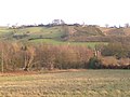
 Hill north of Hill Top Farm - geograph.org.uk - 3039668.jpg 1,600 × 1,200; 439 KB
-
 Hill Top Farm - geograph.org.uk - 3039659.jpg 1,600 × 1,200; 496 KB
-
 Hill Top Farm, Mercaston - geograph.org.uk - 3320981.jpg 4,000 × 3,000; 5.02 MB
-
 Old Covert - geograph.org.uk - 3039404.jpg 4,320 × 3,240; 2.99 MB
-
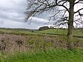
 Park Dale - geograph.org.uk - 289798.jpg 640 × 480; 121 KB
-
 Park Pale - geograph.org.uk - 3039628.jpg 4,320 × 3,240; 2.95 MB
-
 Park pale, Ravensdale.jpg 4,000 × 3,000; 5.04 MB
-
 Road to Hill Top Farm - geograph.org.uk - 2348347.jpg 490 × 640; 104 KB
-
 Sand Pit. - geograph.org.uk - 289796.jpg 640 × 480; 119 KB
-
 Sheep grazing on a hillside - geograph.org.uk - 2300186.jpg 3,464 × 2,246; 1.93 MB
-
 Site of deer course in Ravensdale Park.jpg 4,000 × 3,000; 4.68 MB


