Category:Rathaus Lehrte
Jump to navigation
Jump to search
| Object location | | View all coordinates using: OpenStreetMap |
|---|
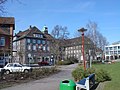
building in Lehrte near Hannover, Germany .jpg) | |||||
| Upload media | |||||
| Instance of | |||||
|---|---|---|---|---|---|
| Location | Lehrte, Hanover region, Lower Saxony, Germany | ||||
| Street address |
| ||||
| Heritage designation | |||||
 | |||||
Media in category "Rathaus Lehrte"
The following 8 files are in this category, out of 8 total.
-
 Lehrte - Rathausplatz 1 - Rathaus - 2013-03-16 17.16.08.jpg 2,581 × 1,251; 2.23 MB
-
 Lehrte - Rathausplatz 1 - Rathaus - 2014-02-22 08.20.01.jpg 2,675 × 1,331; 2.86 MB
-
 Lehrte - Rathausplatz 1 - Rathaus - 2014-02-22 08.24.01.jpg 2,718 × 1,781; 4.65 MB
-
 Lehrte city hall.jpg 6,000 × 4,000; 17.15 MB
-
 Lehrte, Rathausplatz 1, Erinnerungstafel Rathaus, 2014-02-22 08.36.47.jpg 1,695 × 1,817; 836 KB
-
 Rathaus in Lehrte.JPG 1,024 × 768; 366 KB
-
 Rathaus Lehrte (01).jpg 5,752 × 3,236; 18.07 MB
-
 Rathaus Lehrte (02).jpg 3,844 × 5,125; 17.74 MB


.jpg)