Category:Ratcliffe on Soar
Jump to navigation
Jump to search
English: Ratcliffe on Soar is a village and civil parish in Nottinghamshire on the River Soar. It is part of the Rushcliffe district, and is the site of Ratcliffe-on-Soar Power Station. Nearby places are Kingston on Soar and Trentlock. With a population of around 100, the parish is too small to have a parish council and so has a parish meeting. Although the village does not contain any shops, it has a church and a marina which is often affected by severe flooding as it built on designated flood-plain,just before the notorious soar-valley joins the river Trent at Trent-lock.
village and civil parish in Nottinghamshire, UK  | |||||
| Upload media | |||||
| Instance of | |||||
|---|---|---|---|---|---|
| Location | Rushcliffe, Nottinghamshire, East Midlands, England | ||||
| Population |
| ||||
 | |||||
Subcategories
This category has the following 4 subcategories, out of 4 total.
Media in category "Ratcliffe on Soar"
The following 200 files are in this category, out of 212 total.
(previous page) (next page)-
 1-2 Old Park Close - geograph.org.uk - 6549522.jpg 3,648 × 2,432; 3.57 MB
-
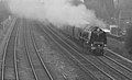 6233 Duchess of Sutherland Ratcliffe-on-Soar.jpg 2,331 × 1,418; 709 KB
-

-
 A pile of alabaster - geograph.org.uk - 3838634.jpg 1,280 × 950; 289 KB
-
 A pile of trees - geograph.org.uk - 3344123.jpg 1,280 × 853; 394 KB
-
 A quick peek at Redhill Farm - geograph.org.uk - 2952293.jpg 640 × 480; 93 KB
-

-

-
 A453 - River Soar bridge - geograph.org.uk - 2952258.jpg 640 × 480; 105 KB
-
 A453 approaching roundabout - geograph.org.uk - 4037287.jpg 640 × 480; 70 KB
-
 A453 approaching the railway bridge - geograph.org.uk - 2952263.jpg 640 × 480; 114 KB
-

-
 A453 at the turning for Thrumpton - geograph.org.uk - 2952345.jpg 640 × 480; 41 KB
-
 A453 crossing the Soar - geograph.org.uk - 739558.jpg 640 × 480; 71 KB
-

-

-
 A453 new bridge over the railway - geograph.org.uk - 4860781.jpg 1,280 × 960; 342 KB
-
 A453 new bridge over the River Soar - geograph.org.uk - 4860792.jpg 1,280 × 960; 422 KB
-
 A453 Widening, Ratcliffe on Soar - geograph.org.uk - 4229512.jpg 640 × 480; 279 KB
-
 Ash fields wheel wash - geograph.org.uk - 4860838.jpg 1,280 × 960; 283 KB
-
 Barren field north of New Kingston - geograph.org.uk - 6541627.jpg 1,024 × 768; 134 KB
-
 Blackthorn hedge in flower - geograph.org.uk - 4901760.jpg 1,280 × 960; 690 KB
-
 Boats and caravans along the River Soar - geograph.org.uk - 6180898.jpg 1,600 × 1,200; 269 KB
-
 Bridge over Red Hill Lock - geograph.org.uk - 1886159.jpg 1,024 × 683; 417 KB
-
 Bulldozer on the coal heap - geograph.org.uk - 4901756.jpg 1,280 × 960; 485 KB
-
 Crop field and power lines - geograph.org.uk - 4037290.jpg 640 × 480; 83 KB
-
 Dark steam - geograph.org.uk - 5128805.jpg 853 × 1,280; 106 KB
-

-
 Decision time heading upstream on the River Soar - geograph.org.uk - 6180981.jpg 1,703 × 1,277; 646 KB
-

-
 East Midlands Parkway - geograph.org.uk - 3654603.jpg 640 × 383; 99 KB
-
 East Midlands Parkway - geograph.org.uk - 3987498.jpg 1,600 × 1,046; 462 KB
-

-

-

-
 Entrance to Winking Hill Farm - geograph.org.uk - 6594952.jpg 1,600 × 1,065; 712 KB
-
 Farmland, Ratcliffe on Soar - geograph.org.uk - 2964936.jpg 640 × 472; 80 KB
-
 Farmland, Ratcliffe on Soar - geograph.org.uk - 4766688.jpg 640 × 426; 42 KB
-
 Farmland, Red Hill - geograph.org.uk - 2964922.jpg 800 × 569; 73 KB
-
 Felled trees - geograph.org.uk - 3344124.jpg 1,280 × 853; 391 KB
-
 Flat landscape - geograph.org.uk - 1170621.jpg 631 × 469; 68 KB
-
 Flooded canal lock.jpg 2,560 × 1,440; 1.09 MB
-
 Foot and cycle path beside the A453 - geograph.org.uk - 5366199.jpg 1,280 × 1,280; 372 KB
-

-
 Footbridge over the River Soar - geograph.org.uk - 1886189.jpg 1,024 × 683; 420 KB
-
 Footpath beside the power station fence - geograph.org.uk - 4800230.jpg 1,600 × 1,200; 1.14 MB
-
 Footpath through the pylons - geograph.org.uk - 4860822.jpg 1,280 × 960; 420 KB
-
 Footpath through the woods east of Ratcliffe - geograph.org.uk - 3353009.jpg 2,048 × 1,536; 523 KB
-
 Footpath to Thrumpton - geograph.org.uk - 5366243.jpg 1,280 × 1,280; 558 KB
-
 Ford on the Soar at Ratcliffe on Soar (geograph 2980140).jpg 3,872 × 2,592; 2.38 MB
-
 Gateway to the marina, Redhill Farm - geograph.org.uk - 2952297.jpg 640 × 480; 59 KB
-
 Grand Union Canal at Red Hill Marina - geograph.org.uk - 556821.jpg 640 × 409; 98 KB
-
 Green for go at Redhill flood lock, on the River Soar - geograph.org.uk - 6180973.jpg 1,600 × 1,200; 272 KB
-
 Holy Trinity Church, Ratcliffe on Soar - geograph.org.uk - 5336833.jpg 480 × 640; 584 KB
-
 Houseboats at Red Hill - geograph.org.uk - 6180926.jpg 1,946 × 1,460; 1.07 MB
-
 Houses at Ratcliffe on Soar - geograph.org.uk - 9652.jpg 640 × 389; 112 KB
-
 Houses at Ratcliffe on Soar - geograph.org.uk - 9653.jpg 640 × 451; 177 KB
-
 Houses at Red Hill, by the River Soar - geograph.org.uk - 6180956.jpg 1,600 × 1,200; 310 KB
-
 Improved road junction - geograph.org.uk - 1170663.jpg 640 × 479; 173 KB
-

-
 Ivy Cottage - geograph.org.uk - 6549520.jpg 3,648 × 2,432; 6.68 MB
-
 Kegworth Road - geograph.org.uk - 3606508.jpg 640 × 480; 85 KB
-
 Kegworth Road - geograph.org.uk - 6549521.jpg 3,648 × 2,432; 4.57 MB
-
 Main building, East Midlands Parkway station - geograph.org.uk - 4795152.jpg 1,024 × 768; 135 KB
-
 Millennium Stone at Ratcliffe on Soar - geograph.org.uk - 9654.jpg 640 × 552; 183 KB
-
 Modern infrastructure at Ratcliffe - geograph.org.uk - 2952303.jpg 640 × 480; 62 KB
-

-
 New and old accesses to Redhill Farm - geograph.org.uk - 2952299.jpg 640 × 480; 42 KB
-
 New bridge - geograph.org.uk - 1170666.jpg 640 × 479; 137 KB
-
 New road - geograph.org.uk - 1170627.jpg 640 × 479; 217 KB
-
 New roundabout - geograph.org.uk - 1170647.jpg 640 × 479; 165 KB
-
 New Roundabout at West Leake Junction - geograph.org.uk - 4229488.jpg 640 × 480; 274 KB
-
 No train services to Nottingham - geograph.org.uk - 3624965.jpg 1,200 × 915; 1.01 MB
-
 North Bridge Cottage - geograph.org.uk - 1170633.jpg 640 × 479; 161 KB
-
 North from East Midlands Parkway - geograph.org.uk - 3624943.jpg 1,200 × 853; 1.12 MB
-
 North West Leicestershire , Countryside Scenery - geograph.org.uk - 5979044.jpg 6,000 × 4,000; 6.88 MB
-
 Old railings and River Soar - geograph.org.uk - 6248666.jpg 715 × 800; 224 KB
-
 Old railway spur - geograph.org.uk - 4860774.jpg 1,280 × 960; 469 KB
-

-

-

-
 Packhorse Bridge Redhill Lock.jpg 3,904 × 2,928; 3.29 MB
-
 Parkway Station junction - geograph.org.uk - 3344118.jpg 1,280 × 853; 178 KB
-
 Path through woodland east of Ratcliffe on Soar - geograph.org.uk - 6538897.jpg 1,024 × 768; 286 KB
-

-

-
 Platforms 1 and 2, East Midlands Parkway station - geograph.org.uk - 4795149.jpg 1,024 × 768; 154 KB
-

-
 Power lines - geograph.org.uk - 6549525.jpg 3,648 × 2,432; 5.72 MB
-
 Public footpath east of Ratcliffe on Soar - geograph.org.uk - 6538901.jpg 1,024 × 768; 111 KB
-
 Public footpath under railway, Ratcliffe on Soar - geograph.org.uk - 6538892.jpg 1,024 × 768; 196 KB
-
 Public footpath waymarker, west bank of the River Soar - geograph.org.uk - 6180990.jpg 1,600 × 1,200; 347 KB
-
 Pylon in the Soar Valley - geograph.org.uk - 4766691.jpg 458 × 640; 49 KB
-
 Pylon in the Soar Valley - geograph.org.uk - 4766693.jpg 387 × 640; 48 KB
-
 Pylon near Ratcliffe Power Station - geograph.org.uk - 3725495.jpg 2,644 × 3,522; 2 MB
-
 Pylons - geograph.org.uk - 2285374.jpg 800 × 533; 66 KB
-
 Pylons and cooling towers - geograph.org.uk - 3937489.jpg 640 × 640; 584 KB
-
 Pylons east of Ratcliffe on Soar (2) - geograph.org.uk - 6538883.jpg 1,024 × 768; 136 KB
-
 Pylons east of Ratcliffe on Soar (3) - geograph.org.uk - 6538887.jpg 1,024 × 768; 103 KB
-
 Pylons east of Ratcliffe on Soar (4) - geograph.org.uk - 6538895.jpg 1,024 × 768; 128 KB
-
 Pylons east of Ratcliffe on Soar (5) - geograph.org.uk - 6538898.jpg 1,024 × 768; 143 KB
-
 Pylons in the Soar Valley - geograph.org.uk - 4766690.jpg 640 × 426; 43 KB
-
 Pylons north of New Kingston - geograph.org.uk - 6541581.jpg 1,024 × 768; 171 KB
-
 Radcliffe Power Station - geograph.org.uk - 6594959.jpg 1,600 × 1,065; 546 KB
-
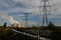 Railway and Power Lines - geograph.org.uk - 570723.jpg 640 × 427; 69 KB
-
 Railway bridge over footpath - geograph.org.uk - 3606507.jpg 640 × 480; 108 KB
-
 Railway Bridges at Red Hill - geograph.org.uk - 1090570.jpg 640 × 480; 152 KB
-
 Railway platform at East Midlands Parkway - geograph.org.uk - 5894022.jpg 1,600 × 1,200; 466 KB
-
 Ratcliffe hairpin cycle path - geograph.org.uk - 4860810.jpg 1,280 × 960; 407 KB
-
 Ratcliffe Junction - geograph.org.uk - 1146278.jpg 640 × 461; 100 KB
-
 Ratcliffe Lock - geograph.org.uk - 556677.jpg 640 × 417; 100 KB
-
 Ratcliffe Lock - the modern chamber - geograph.org.uk - 687427.jpg 640 × 480; 75 KB
-
 Ratcliffe Lock - the old chamber - geograph.org.uk - 687433.jpg 640 × 480; 88 KB
-
 Ratcliffe near sunset - geograph.org.uk - 1929092.jpg 683 × 1,024; 110 KB
-
 Ratcliffe on Soar - geograph.org.uk - 1293211.jpg 640 × 480; 144 KB
-
 Ratcliffe on Soar - geograph.org.uk - 1293424.jpg 640 × 480; 170 KB
-
 Ratcliffe on Soar power station - geograph.org.uk - 4037285.jpg 640 × 498; 40 KB
-
 Ratcliffe on Soar Power Station - geograph.org.uk - 4040384.jpg 851 × 1,280; 145 KB
-
 Ratcliffe on Soar power station - geograph.org.uk - 4454238.jpg 4,280 × 3,186; 4.02 MB
-
 Ratcliffe on Soar power station - geograph.org.uk - 5357823.jpg 2,000 × 1,333; 1.5 MB
-
 Ratcliffe on Soar power station - geograph.org.uk - 5366258.jpg 1,280 × 719; 299 KB
-
 Ratcliffe on Soar Power Station - geograph.org.uk - 5846037.jpg 1,280 × 960; 336 KB
-
 Ratcliffe on Soar Power Station from here - geograph.org.uk - 3039960.jpg 4,320 × 3,240; 2.94 MB
-

-
 Ratcliffe on Soar wood - geograph.org.uk - 1293429.jpg 640 × 480; 211 KB
-
 Ratcliffe on Soar woods - geograph.org.uk - 1293442.jpg 640 × 480; 201 KB
-
 Ratcliffe on Soar, Nottinghamshire - geograph.org.uk - 556616.jpg 640 × 522; 132 KB
-

-
 Ratcliffe-on-Soar Power Station from afar - geograph.org.uk - 5531906.jpg 1,024 × 768; 797 KB
-
 Ratcliffe-on-Soar village - geograph.org.uk - 685896.jpg 640 × 480; 95 KB
-
 Ratcliffe-on-Soar village - geograph.org.uk - 685916.jpg 640 × 480; 100 KB
-
 Red Hill Lock - geograph.org.uk - 1901652.jpg 683 × 1,024; 374 KB
-
 Red Hill lock - geograph.org.uk - 687342.jpg 640 × 480; 86 KB
-
 Red Hill lock - geograph.org.uk - 687343.jpg 640 × 480; 92 KB
-
 Red Hill lock - geograph.org.uk - 687346.jpg 640 × 454; 73 KB
-
 Red Hill lock - geograph.org.uk - 687348.jpg 640 × 480; 86 KB
-
 Red Hill lock - geograph.org.uk - 687354.jpg 640 × 480; 82 KB
-
 Red Hill Marina in Nottinghamshire - geograph.org.uk - 556823.jpg 640 × 416; 87 KB
-
 Redhill Farm - geograph.org.uk - 4755255.jpg 640 × 426; 41 KB
-
 Redhill Flood Lock 59 - geograph.org.uk - 2355947.jpg 640 × 480; 92 KB
-
 Redhill Lock (no 59) and Redhill Lock Bridge (no 47) - geograph.org.uk - 6180918.jpg 1,600 × 1,200; 261 KB
-
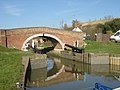
 Redhill Lock and Bridge - geograph.org.uk - 3357011.jpg 2,048 × 1,536; 545 KB
-

-

-

-

-

-
 River moorings north-west of Ratcliffe on Soar - geograph.org.uk - 5998819.jpg 1,440 × 960; 1.51 MB
-
 River north-west of Ratcliffe on Soar - geograph.org.uk - 5998698.jpg 1,600 × 900; 1.74 MB
-

-

-
 River Soar at Ratcliffe - geograph.org.uk - 9648.jpg 640 × 439; 127 KB
-
 River Soar at Ratcliffe - geograph.org.uk - 9650.jpg 640 × 438; 132 KB
-
 River Soar below Ratcliffe - geograph.org.uk - 687450.jpg 640 × 480; 94 KB
-
 River Soar moorings by Red Hill in Nottinghamshire - geograph.org.uk - 5999491.jpg 1,440 × 960; 1.63 MB
-
 River Soar moorings by Red Hill in Nottinghamshire - geograph.org.uk - 5999496.jpg 1,024 × 1,280; 1.52 MB
-
 River Soar near Ratcliffe on Soar - geograph.org.uk - 556637.jpg 640 × 502; 155 KB
-
 River Soar near Red Hill - geograph.org.uk - 687405.jpg 640 × 480; 72 KB
-
 River Soar west of Red Hill in Nottinghamshire - geograph.org.uk - 5999529.jpg 1,440 × 960; 1.76 MB
-

-
 Riverside dwellings at Redhill - geograph.org.uk - 1048188.jpg 640 × 421; 72 KB
-
 Riverside Farm - geograph.org.uk - 6549516.jpg 3,648 × 2,432; 4.58 MB
-
 Riverside pasture near Red Hill in Nottinghamshire - geograph.org.uk - 5999534.jpg 1,280 × 960; 1.54 MB
-
 Riverside pasture near Red Hill in Nottinghamshire - geograph.org.uk - 5999540.jpg 1,024 × 1,024; 1.2 MB
-
 Riverside pasture near Red Hill in Nottinghamshire - geograph.org.uk - 5999567.jpg 960 × 1,280; 1.64 MB
-

-

-
 Road in Winking Hill Disposal Site - geograph.org.uk - 6541566.jpg 1,024 × 768; 194 KB
-
 Road junction in Winking Hill Disposal Site - geograph.org.uk - 6541547.jpg 1,024 × 768; 232 KB
-

-

-

-
 Rock exposure at Red Hill, Nottinghamshire - geograph.org.uk - 5999497.jpg 1,440 × 960; 1.73 MB
-
 Rock exposure at Red Hill, Nottinghamshire - geograph.org.uk - 5999500.jpg 1,280 × 960; 1.55 MB
-
 Scrap wheels and cooling towers - geograph.org.uk - 5366174.jpg 1,280 × 1,228; 363 KB
-
 Sheep and lambs near Manor Farm - geograph.org.uk - 6180818.jpg 1,600 × 1,200; 460 KB
-
 Sky full of Steam 2 - geograph.org.uk - 587806.jpg 640 × 426; 15 KB
-
 Solstice sunset - geograph.org.uk - 1929205.jpg 683 × 1,024; 97 KB
-

-
 Strata at Red Hill - geograph.org.uk - 6180963.jpg 1,600 × 1,200; 487 KB
-
 Tasty hawthorn, west bank of the River Soar - geograph.org.uk - 6180978.jpg 1,402 × 1,052; 428 KB
-
 The approach to East Midlands Parkway Station - geograph.org.uk - 3624958.jpg 1,024 × 1,024; 966 KB
-
 The bellmouth of Barton Lane - geograph.org.uk - 6488549.jpg 1,280 × 853; 266 KB
-
 The end of the line - geograph.org.uk - 737730.jpg 640 × 446; 91 KB
-
 The Old School House - geograph.org.uk - 6549519.jpg 3,648 × 2,432; 5.44 MB
-
 To Soil Storage Area - geograph.org.uk - 3353237.jpg 2,048 × 1,336; 473 KB
-
 Track alongside power station, Ratcliffe on Soar - geograph.org.uk - 4672921.jpg 1,024 × 768; 215 KB
-
 Track to the marina - geograph.org.uk - 2952289.jpg 640 × 480; 36 KB
-
 Train approaching East Midlands Parkway - geograph.org.uk - 5048620.jpg 640 × 480; 480 KB
-
 Train at Ratcliffe on Soar - (1) - geograph.org.uk - 3045466.jpg 1,024 × 701; 794 KB
-
 Train at Ratcliffe on Soar - (2) - geograph.org.uk - 3045471.jpg 1,024 × 643; 734 KB
-
 Turn Left For Thrumpton - geograph.org.uk - 3183798.jpg 640 × 385; 29 KB
-
 Two ways on the River Soar at Red Hill - geograph.org.uk - 6180967.jpg 1,237 × 928; 283 KB
-
 Underpass on the A453 - geograph.org.uk - 6594966.jpg 1,600 × 1,077; 563 KB
-
 Walkers Lake - geograph.org.uk - 4860826.jpg 1,280 × 960; 470 KB
-
 Weighbridge at the Ratcliffe on Soar power station - geograph.org.uk - 3353274.jpg 2,048 × 1,536; 426 KB
-
 Weighbridge, Winking Hill Disposal Site - geograph.org.uk - 6541571.jpg 1,024 × 768; 175 KB
-
 West Leake junction - 1 - geograph.org.uk - 3344131.jpg 1,280 × 960; 287 KB
-
 West Leake junction - 2 - geograph.org.uk - 3344132.jpg 1,280 × 960; 304 KB
-
 West Leake junction - 3 - geograph.org.uk - 3344133.jpg 1,280 × 953; 470 KB


.jpg)


_-_geograph.org.uk_-_4672914.jpg)
_-_geograph.org.uk_-_4672918.jpg)


_-_geograph.org.uk_-_6538883.jpg)
_-_geograph.org.uk_-_6538887.jpg)
_-_geograph.org.uk_-_6538895.jpg)
_-_geograph.org.uk_-_6538898.jpg)


_and_Redhill_Lock_Bridge_(no_47)_-_geograph.org.uk_-_6180918.jpg)


_-_geograph.org.uk_-_3045466.jpg)
_-_geograph.org.uk_-_3045471.jpg)


