Category:Rapeseed fields in Australia
Jump to navigation
Jump to search
Countries of Oceania: Australia
Media in category "Rapeseed fields in Australia"
The following 43 files are in this category, out of 43 total.
-
 Aerial view of farmland in Dhulura (1).jpg 5,464 × 3,640; 17.18 MB
-
 Aerial view of farmland in Dhulura.jpg 5,464 × 3,640; 14.7 MB
-
 Belalie North. Spring crop of canola in flower. (31043024448).jpg 4,896 × 3,672; 5.74 MB
-
 Berrigan Canola September 2017 001.JPG 4,032 × 3,024; 1.15 MB
-
 Berrigan Canola September 2017 002.JPG 4,032 × 3,024; 3.06 MB
-
 BerriganCanolaField.JPG 2,272 × 1,704; 1.06 MB
-
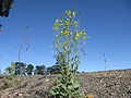
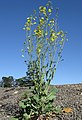
 Brassica napus plant1 (14391753223).jpg 4,000 × 3,000; 7.11 MB
-
 Brassica napus plant10 (14494288548).jpg 4,000 × 3,000; 7.22 MB
-
 Brassica napus plant11 (14494772209).jpg 4,000 × 3,000; 8.38 MB
-
 Brassica napus plant12 (14681122592).jpg 4,000 × 3,000; 8.66 MB
-
 Brassica napus plant13 (14681427655).jpg 4,000 × 3,000; 7.52 MB
-
 Brassica napus plant14 (14494785098).jpg 4,000 × 3,000; 6.49 MB
-
 Brassica napus plant2 (14391738253).jpg 4,000 × 3,000; 6.35 MB
-
 Brassica napus plant3 (14184930668).jpg 4,000 × 3,000; 5.89 MB
-
 Brassica napus plant4 (14348436596).jpg 2,058 × 3,000; 2.8 MB
-
 Brassica napus plant5 (14371510205).jpg 4,000 × 3,000; 5.52 MB
-
 Brassica napus plant5 (14657991266).jpg 4,000 × 3,000; 6.79 MB
-
 Brassica napus plant6 (14680976095).jpg 4,000 × 3,000; 6.67 MB
-
 Brassica napus plant7 (14680663592).jpg 4,000 × 3,000; 7.4 MB
-
 Brassica napus plant8 (14680953515).jpg 4,000 × 3,000; 6.66 MB
-
 Brassica napus plant9 (14680943335).jpg 4,000 × 3,000; 6.59 MB
-
 Canola (21717913876).jpg 4,896 × 3,264; 8.87 MB
-
 Canola (21732432892).jpg 4,896 × 3,264; 10.92 MB
-
 Canola (23276580672).jpg 4,896 × 3,264; 10.62 MB
-
 Canola crop near Kojonup.jpg 1,600 × 1,200; 384 KB
-
 Canola field temora nsw.jpg 1,600 × 1,200; 621 KB
-
 Canola flowering - Flickr - jeans Photos.jpg 3,847 × 2,164; 2.77 MB
-
 Country Farm Nsw Australia (105136797).jpeg 2,048 × 1,153; 1.06 MB
-
 CSIRO ScienceImage 1511 Mt Barker WA Canola.jpg 1,772 × 1,416; 2.27 MB
-
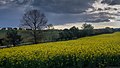
 Farmland from Gundry's Hill lookout, Kapunda.JPG 640 × 481; 187 KB
-
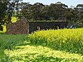 Fords Rd ruins, Kapunda.JPG 640 × 480; 182 KB
-
 Hansborough bridge on River Light.jpg 640 × 481; 153 KB
-
 Hansborough Rd ford on Light River, Hansborough, South Australia.JPG 640 × 481; 182 KB
-
 Light River headwaters at Waterloo.JPG 640 × 480; 167 KB
-
 Light River valley near Waterloo.JPG 640 × 482; 202 KB
-
 PleasantHillsEntrySign.JPG 2,272 × 1,704; 1.46 MB
-
 Railway bridge over Light River at Hansborough, South Australia.JPG 640 × 480; 165 KB
-
 Tothill Creek from Quin Gap.JPG 640 × 480; 193 KB
-
 Windrowed canola at Dhulura (1).jpg 4,032 × 3,024; 5.42 MB
-
 Windrowed canola at Dhulura (2).jpg 4,032 × 3,024; 8.52 MB
-
 Windrowed canola at Dhulura (3).jpg 4,032 × 3,024; 7.8 MB
-
 Windrowed canola at Dhulura.jpg 4,032 × 3,024; 7.37 MB
-
 オーストラリアのどこまでも続く菜の花畑 - panoramio.jpg 640 × 480; 57 KB
.jpg)

.jpg)


.jpg)
.jpg)
.jpg)
.jpg)
.jpg)
.jpg)
.jpg)
.jpg)
.jpg)
.jpg)
.jpg)
.jpg)
.jpg)
.jpg)
.jpg)
.jpg)
.jpg)
.jpg)


.jpeg)


.jpg)
.jpg)
.jpg)

